
| Memorials | : | 0 |
| Location | : | Bristol Unitary Authority, England |
| Coordinate | : | 51.3990278, -2.5506809 |
frequently asked questions (FAQ):
-
Where is Whitchurch Cemetery?
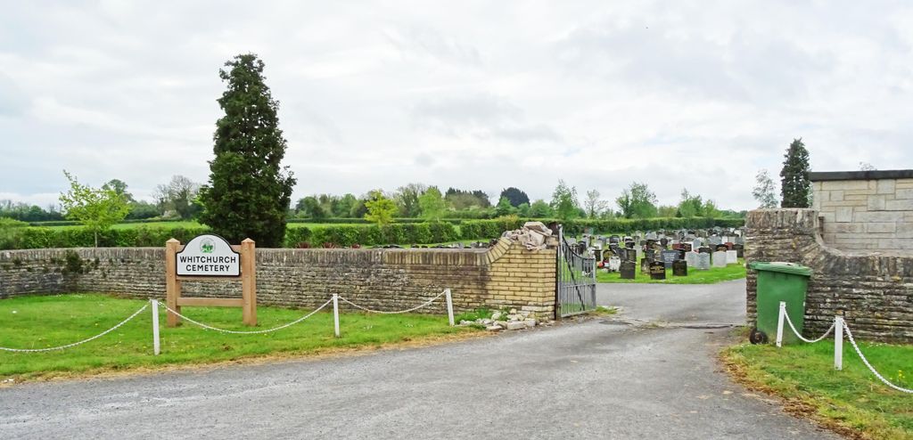
Whitchurch Cemetery is located at Woollard Lane Bristol Unitary Authority ,Bristol , BS39 4HTEngland.
-
Whitchurch Cemetery cemetery's updated grave count on graveviews.com?
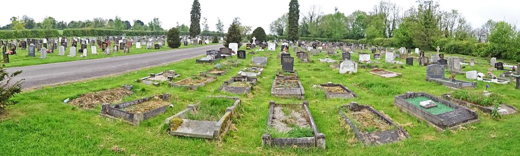
0 memorials
-
Where are the coordinates of the Whitchurch Cemetery?
Latitude: 51.3990278
Longitude: -2.5506809
Nearby Cemetories:
1. Saint Margaret Churchyard
Compton Dando, Bath and North East Somerset Unitary Authority, England
Coordinate: 51.4009330, -2.5272136
2. Queen Charlton St. Margaret Churchyard
Compton Dando, Bath and North East Somerset Unitary Authority, England
Coordinate: 51.4009300, -2.5271800
3. Holy Trinity Churchyard
Norton Malreward, Bath and North East Somerset Unitary Authority, England
Coordinate: 51.3831750, -2.5711360
4. Christ Church Churchyard
Bristol, Bristol Unitary Authority, England
Coordinate: 51.4213270, -2.5632460
5. All Saints Churchyard
Publow, Bath and North East Somerset Unitary Authority, England
Coordinate: 51.3751100, -2.5423600
6. Pensford Methodist Churchyard
Pensford, Bath and North East Somerset Unitary Authority, England
Coordinate: 51.3731030, -2.5506730
7. Saint Thomas Churchyard
Pensford, Bath and North East Somerset Unitary Authority, England
Coordinate: 51.3710450, -2.5495820
8. Blessed Virgin Mary Churchyard
Compton Dando, Bath and North East Somerset Unitary Authority, England
Coordinate: 51.3796870, -2.5100920
9. Keynsham Cemetery
Keynsham, Bath and North East Somerset Unitary Authority, England
Coordinate: 51.4212975, -2.5116095
10. Brislington Cemetery
Brislington, Bristol Unitary Authority, England
Coordinate: 51.4355480, -2.5438020
11. Ebenezer Baptist Church
Keynsham, Bath and North East Somerset Unitary Authority, England
Coordinate: 51.4160710, -2.4983170
12. St. John the Baptist Churchyard
Keynsham, Bath and North East Somerset Unitary Authority, England
Coordinate: 51.4174570, -2.4987140
13. St Mary the Virgin Churchyard
Stanton Drew, Bath and North East Somerset Unitary Authority, England
Coordinate: 51.3657390, -2.5788440
14. Keynsham Abbey
Keynsham, Bath and North East Somerset Unitary Authority, England
Coordinate: 51.4172000, -2.4961000
15. Saint Michael Churchyard
Keynsham, Bath and North East Somerset Unitary Authority, England
Coordinate: 51.3865690, -2.4830350
16. Holy Souls Catholic Cemetery
Arnos Vale, Bristol Unitary Authority, England
Coordinate: 51.4422800, -2.5639300
17. Arnos Vale Cemetery and Crematorium
Arnos Vale, Bristol Unitary Authority, England
Coordinate: 51.4423740, -2.5648680
18. St. Mary Redcliffe Cemetery
Arnos Vale, Bristol Unitary Authority, England
Coordinate: 51.4428370, -2.5646220
19. St. Peter's Churchyard
Bishopsworth, Bristol Unitary Authority, England
Coordinate: 51.4154334, -2.6191740
20. Saint Leonard Churchyard
Chelwood, Bath and North East Somerset Unitary Authority, England
Coordinate: 51.3546300, -2.5246880
21. St. Andrew's Churchyard
Chew Magna, Bath and North East Somerset Unitary Authority, England
Coordinate: 51.3664560, -2.6089140
22. Chew Magna Baptist Churchyard
Chew Magna, Bath and North East Somerset Unitary Authority, England
Coordinate: 51.3648736, -2.6094282
23. St John the Baptist Church Demolished
Bedminster, Bristol Unitary Authority, England
Coordinate: 51.4400110, -2.5982980
24. South Bristol Cemetery and Crematorium
Bedminster, Bristol Unitary Authority, England
Coordinate: 51.4240940, -2.6236390