| Memorials | : | 0 |
| Location | : | Egham, Runnymede Borough, England |
| Coordinate | : | 51.4327120, -0.5443380 |
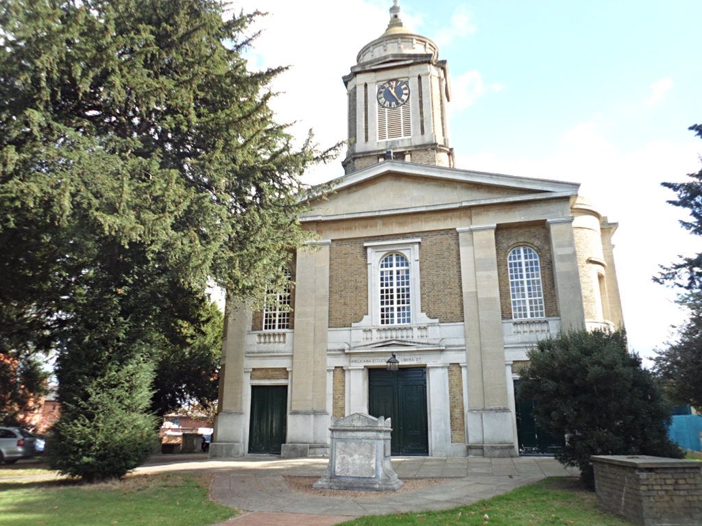
| Description | : | St. John's is on Church Road, opposite the end of the High Street. It's the church behind the trees. Because the church building fronts on Manor Farm Road, that is considered to be the street address. |
frequently asked questions (FAQ):
-
Where is St. John the Baptist Churchyard?
St. John the Baptist Churchyard is located at Church Road Egham, Runnymede Borough ,Surrey , TW20 9HLEngland.
-
St. John the Baptist Churchyard cemetery's updated grave count on graveviews.com?
0 memorials
-
Where are the coordinates of the St. John the Baptist Churchyard?
Latitude: 51.4327120
Longitude: -0.5443380
Nearby Cemetories:
1. Runnymede Memorial
Englefield Green, Runnymede Borough, England
Coordinate: 51.4378433, -0.5649990
2. St. Mary's Churchyard
Staines, Spelthorne Borough, England
Coordinate: 51.4365400, -0.5191540
3. Englefield Green Cemetery
Englefield Green, Runnymede Borough, England
Coordinate: 51.4273640, -0.5730490
4. Saint Andrew's Churchyard
Wraysbury, Windsor and Maidenhead Royal Borough, England
Coordinate: 51.4558200, -0.5600900
5. St Marys Churchyard
Thorpe, Runnymede Borough, England
Coordinate: 51.4075720, -0.5293820
6. Christ Church Churchyard
Virginia Water, Runnymede Borough, England
Coordinate: 51.4073160, -0.5796440
7. St. Peter and St. Andrew Churchyard
Old Windsor, Windsor and Maidenhead Royal Borough, England
Coordinate: 51.4621120, -0.5727310
8. London Road Cemetery
Staines, Spelthorne Borough, England
Coordinate: 51.4380000, -0.4889100
9. Church Road Cemetery
Old Windsor, Windsor and Maidenhead Royal Borough, England
Coordinate: 51.4622500, -0.5805900
10. St Michael's Churchyard
Horton, Aylesbury Vale District, England
Coordinate: 51.4725400, -0.5402620
11. St Michael Churchyard
Horton, Windsor and Maidenhead Royal Borough, England
Coordinate: 51.4728500, -0.5403800
12. All Saints Churchyard
Laleham, Spelthorne Borough, England
Coordinate: 51.4091880, -0.4898680
13. Stanwell Cemetery
Stanwell, Spelthorne Borough, England
Coordinate: 51.4523640, -0.4840770
14. Chertsey Abbey (Defunct)
Chertsey, Runnymede Borough, England
Coordinate: 51.3950000, -0.5031000
15. St Mary the Virgin
Stanwell, Spelthorne Borough, England
Coordinate: 51.4564840, -0.4799090
16. St. Peter's Churchyard
Chertsey, Runnymede Borough, England
Coordinate: 51.3924010, -0.5036640
17. Ashford Burial Ground
Staines, Spelthorne Borough, England
Coordinate: 51.4465100, -0.4677360
18. Datchet Parish Council Cemetery
Datchet, Windsor and Maidenhead Royal Borough, England
Coordinate: 51.4836530, -0.5657230
19. Saint Matthew's Churchyard
Ashford, Spelthorne Borough, England
Coordinate: 51.4321830, -0.4588780
20. Royal Burial Ground
Windsor, Windsor and Maidenhead Royal Borough, England
Coordinate: 51.4740562, -0.5986640
21. Saint Thomas Churchyard
Colnbrook, Slough Borough, England
Coordinate: 51.4845890, -0.5219910
22. Adelaide Cottage
Windsor, Windsor and Maidenhead Royal Borough, England
Coordinate: 51.4790700, -0.5903400
23. Chertsey Cemetery
Chertsey, Runnymede Borough, England
Coordinate: 51.3849600, -0.5009760
24. St. Mary the Virgin Churchyard
Datchet, Windsor and Maidenhead Royal Borough, England
Coordinate: 51.4843260, -0.5782760

