
| Memorials | : | 0 |
| Location | : | Dorchester, West Dorset District, England |
| Coordinate | : | 50.7050192, -2.3872764 |
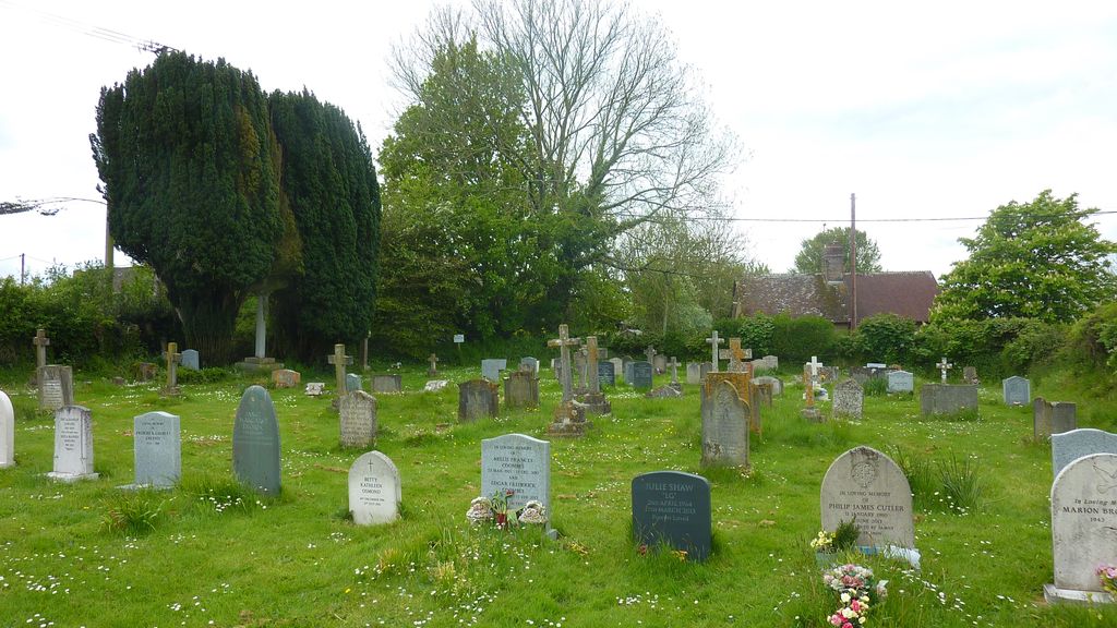
| Description | : | West Stafford is a village and civil parish in southwest Dorset, England, situated in the Frome valley 2 miles east of Dorchester. The new burial ground is REALLY not easy to find as there are no sign posts to it or even a sign on the entrance. It is also behind a hedge so is not visible from the road. Keep on the main road through the village passing St Andrew's church on your left. The next left is Manor Drive and The Wise Man Inn. Do not turn into it. Keep on the main road and go past this turning and you... Read More |
frequently asked questions (FAQ):
-
Where is West Stafford New Burial Ground?
West Stafford New Burial Ground is located at Dorchester, West Dorset District ,Dorset ,England.
-
West Stafford New Burial Ground cemetery's updated grave count on graveviews.com?
0 memorials
-
Where are the coordinates of the West Stafford New Burial Ground?
Latitude: 50.7050192
Longitude: -2.3872764
Nearby Cemetories:
1. Fordington Cemetery
Dorchester, West Dorset District, England
Coordinate: 50.7131110, -2.4263720
2. St. Martin's Churchyard
Broadmayne, West Dorset District, England
Coordinate: 50.6787530, -2.3856840
3. St George's Churchyard
Fordington, West Dorset District, England
Coordinate: 50.7136510, -2.4286550
4. Dorchester Gallows Hill Cemetery
Dorchester, West Dorset District, England
Coordinate: 50.7127930, -2.4315480
5. All Saints Churchyard
Dorchester, West Dorset District, England
Coordinate: 50.7153670, -2.4355750
6. Dorchester Gaol Cemetery
Dorchester, West Dorset District, England
Coordinate: 50.7153670, -2.4355750
7. Greyfriars Churchyard
Dorchester, West Dorset District, England
Coordinate: 50.7172150, -2.4354070
8. St. Peter's Church
Dorchester, West Dorset District, England
Coordinate: 50.7155740, -2.4369030
9. Holy Trinity Church
Dorchester, West Dorset District, England
Coordinate: 50.7154890, -2.4379470
10. Maumbury Rings Cemetery
Dorchester, West Dorset District, England
Coordinate: 50.7079000, -2.4403900
11. Dorchester Cemetery
Dorchester, West Dorset District, England
Coordinate: 50.7062110, -2.4422800
12. Poundbury Cemetery
Dorchester, West Dorset District, England
Coordinate: 50.7181090, -2.4544830
13. St John the Evangelist Churchyard
Poxwell, West Dorset District, England
Coordinate: 50.6555000, -2.3663000
14. St. Mary the Virgin Churchyard
Puddletown, West Dorset District, England
Coordinate: 50.7484670, -2.3434700
15. St Mary the Virgin Churchyard
Charminster, West Dorset District, England
Coordinate: 50.7330600, -2.4557900
16. St. Michael's Church
Owermoigne, West Dorset District, England
Coordinate: 50.6671120, -2.3284310
17. Charminster Cemetery
Charminster, Bournemouth Unitary Authority, England
Coordinate: 50.7341430, -2.4627060
18. Holy Trinity
Bincombe, West Dorset District, England
Coordinate: 50.6598000, -2.4449000
19. St Osmund's Churchyard
Osmington, West Dorset District, England
Coordinate: 50.6459250, -2.3909880
20. St. Andrew's Churchyard
Preston, West Dorset District, England
Coordinate: 50.6456500, -2.4173900
21. Moreton Cemetery
Moreton, Purbeck District, England
Coordinate: 50.7024300, -2.2790900
22. St Nicholas Churchyard
Moreton, Purbeck District, England
Coordinate: 50.7023040, -2.2786470
23. St Mary the Virgin Churchyard
Piddlehinton, West Dorset District, England
Coordinate: 50.7732980, -2.4045680
24. St. Mary's Churchyard
Bradford Peverell, West Dorset District, England
Coordinate: 50.7356600, -2.4857900