| Memorials | : | 0 |
| Location | : | Middleton, City of Lancaster, England |
| Phone | : | 0161 643 2693 |
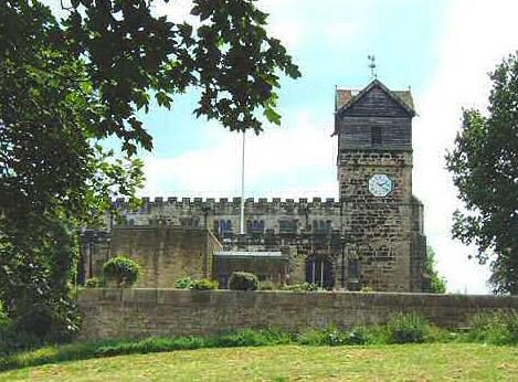
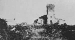
| Description | : | The parish church of St. Leonard stands on elevated ground on the east side of Middleton. A church is documented here in the early thirteenth century and possibly by c1180. Incorporated in the present building are architectural fragments of the early Norman Period. The church was rebuilt in 1412 by Cardinal Thomas Langley Bishop of Durham and Chancellor of England, who was born in Middleton. In 1524 Langley's church seems to have been in turn rebuilt by Richard Asshton except for the tower and possibly the porch. There were later additions in the 17th, 18th and 19th centuries. [from the... Read More |
frequently asked questions (FAQ):
-
Where is St. Leonard?
St. Leonard is located at No GPS information available Add GPSNew Lane, Middleton, Lancashire, England Middleton, City of Lancaster ,Lancashire , M24 6JDEngland.
-
St. Leonard cemetery's updated grave count on graveviews.com?
0 memorials
Nearby Cemetories:
1. St John The Baptist Churchyard
Arkholme, City of Lancaster, England
Coordinate: 54.0486900, -2.7987900
2. Christ Church of Glasson Churchyard
Glasson, City of Lancaster, England
Coordinate: 53.9839250, -2.6861150
3. Cathedral Cemetery of Lancaster
Lancaster, City of Lancaster, England
Coordinate: 54.0868185, -2.7969423
4. Friends Meeting House Burial Ground
Lancaster, City of Lancaster, England
5. John Ecroyd's Orchard
Lancaster, City of Lancaster, England
Coordinate: 54.1022960, -2.6081510
6. Lancaster Castle Cemetery
Lancaster, City of Lancaster, England
Coordinate: 53.9910820, -2.6912370
7. Lancaster Cemetery
Lancaster, City of Lancaster, England
Coordinate: 53.9602092, -2.8204877
8. Lancaster Priory
Lancaster, City of Lancaster, England
Coordinate: 54.0474180, -2.9019260
9. Lancaster and Morecambe Crematorium
Lancaster, City of Lancaster, England
Coordinate: 54.0520500, -2.8833940
10. Mount Street Congregational Chapel
Lancaster, City of Lancaster, England
Coordinate: 54.0744769, -2.8569331
11. Skerton Cemetery
Lancaster, City of Lancaster, England
Coordinate: 54.0759090, -2.8572610
12. St. John the Evangelist Churchyard
Lancaster, City of Lancaster, England
Coordinate: 54.0638980, -2.8409800
13. St. Nicholas Street Chapel Churchyard
Lancaster, City of Lancaster, England
Coordinate: 54.0486900, -2.7987900
14. Christ Church Churchyard
Over Wyresdale, City of Lancaster, England
Coordinate: 53.9839250, -2.6861150
15. Slyne Cemetery
Slyne, City of Lancaster, England
Coordinate: 54.0868185, -2.7969423
16. St. Luke's Curch
Slyne, City of Lancaster, England
17. Holy Trinity Churchyard
Wray, City of Lancaster, England
Coordinate: 54.1022960, -2.6081510
18. Quaker Burial Ground
Abbeystead, City of Lancaster, England
Coordinate: 53.9910820, -2.6912370
19. Saint Michael's and All Angels Church Cemetery
Cockerham, City of Lancaster, England
Coordinate: 53.9602092, -2.8204877
20. St. Peter Churchyard
Heysham, City of Lancaster, England
Coordinate: 54.0474180, -2.9019260
21. Hale Carr Lane Cemetery
Morecambe, City of Lancaster, England
Coordinate: 54.0520500, -2.8833940
22. Holy Trinity Church Poulton-le-Sands
Morecambe, City of Lancaster, England
Coordinate: 54.0744769, -2.8569331
23. Morecambe Cemetery
Morecambe, City of Lancaster, England
Coordinate: 54.0759090, -2.8572610
24. Torrisholme Cemetery
Morecambe, City of Lancaster, England
Coordinate: 54.0638980, -2.8409800


