
| Memorials | : | 1587 |
| Location | : | Westminster, City of Westminster, England |
| Coordinate | : | 51.5087624, -0.1269620 |
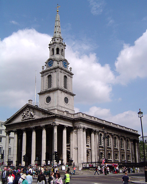
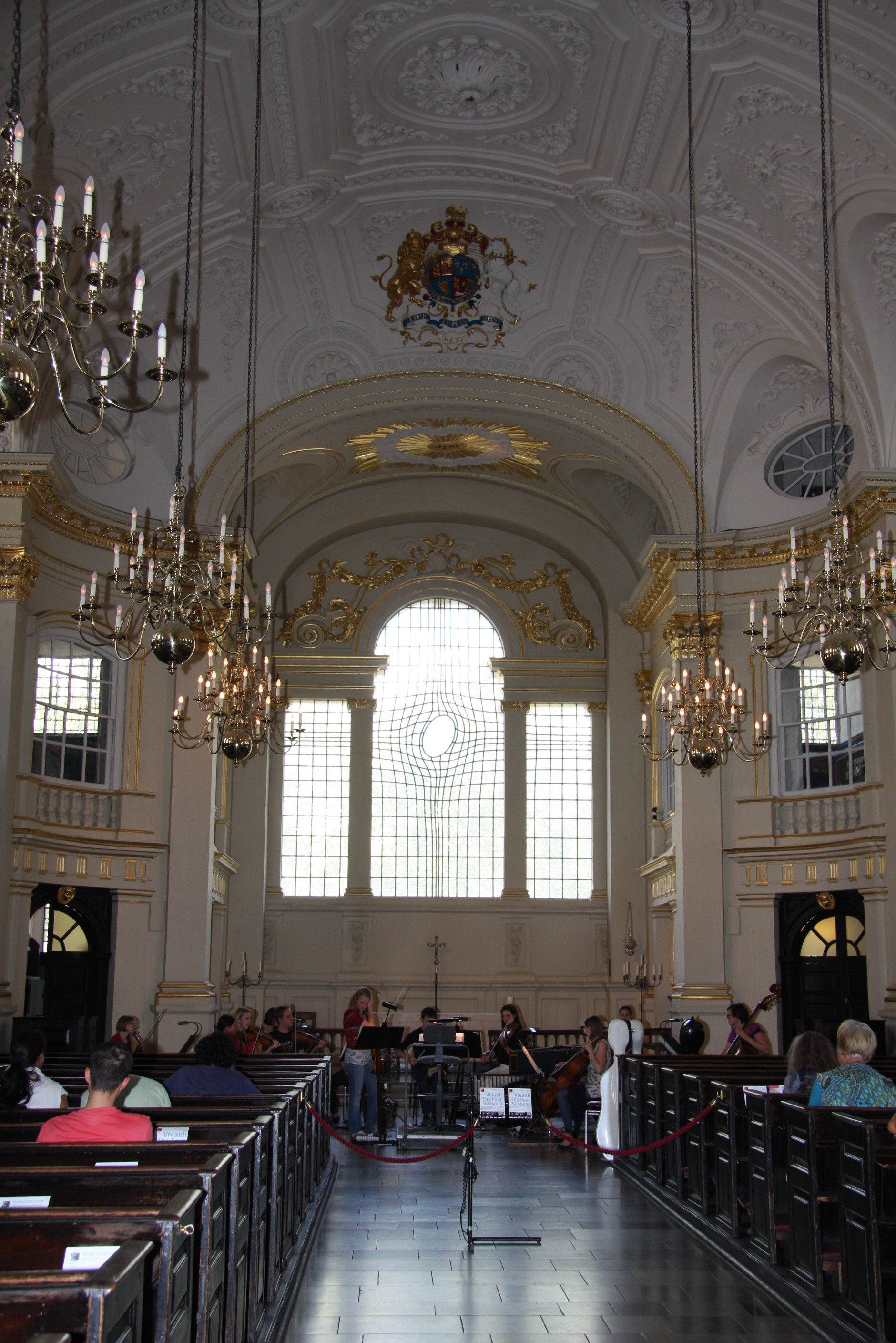
| Description | : | St Martin-in-the-Fields is an English Anglican church at the N.E. corner of Trafalgar Square in the City of Westminster, London. It is dedicated to Saint Martin of Tour. There has been a church on the site since at least 1222. It was at that time located ‘in the fields’ beyond the London wall, when it was awarded to Westminster Abbey for oversight. It became a principal parish church west of the old City in the early modern period as Westminster's population grew. The present church was designed by James Gibbs and completed in 1726. The area around church is now... Read More |
frequently asked questions (FAQ):
-
Where is St. Martin-in-the-Fields Churchyard?
St. Martin-in-the-Fields Churchyard is located at Trafalgar Square Westminster, City of Westminster ,Greater London ,England.
-
St. Martin-in-the-Fields Churchyard cemetery's updated grave count on graveviews.com?
1587 memorials
-
Where are the coordinates of the St. Martin-in-the-Fields Churchyard?
Latitude: 51.5087624
Longitude: -0.1269620
Nearby Cemetories:
1. St. Paul's Churchyard
Covent Garden, London Borough of Camden, England
Coordinate: 51.5114594, -0.1239310
2. St. Bartholomew-by-the-Exchange
London, City of London, England
Coordinate: 51.5082830, -0.1333593
3. Savoy Chapel Churchyard
Strand, City of Westminster, England
Coordinate: 51.5105360, -0.1199210
4. St. Anne's Church
London, City of London, England
Coordinate: 51.5124321, -0.1318976
5. St Anne Churchyard
Soho, City of Westminster, England
Coordinate: 51.5123910, -0.1322610
6. Whitehall
Westminster, City of Westminster, England
Coordinate: 51.5035300, -0.1262190
7. St. James Churchyard
Piccadilly, City of Westminster, England
Coordinate: 51.5085907, -0.1367360
8. St Giles in the Fields Churchyard
Holborn, London Borough of Camden, England
Coordinate: 51.5153070, -0.1285300
9. Marlborough House
City of Westminster, England
Coordinate: 51.5049710, -0.1363050
10. St Mary le Strand Church
Strand, City of Westminster, England
Coordinate: 51.5121540, -0.1169360
11. Portugal Street Burial Ground (Defunct)
London, City of London, England
Coordinate: 51.5142280, -0.1162410
12. St. Margaret's Churchyard
Westminster, City of Westminster, England
Coordinate: 51.4998560, -0.1268100
13. St. George's Churchyard
Bloomsbury, City of Westminster, England
Coordinate: 51.5177160, -0.1248090
14. St Clement Danes Churchyard
City of Westminster, England
Coordinate: 51.5131070, -0.1138980
15. Westminster Abbey
Westminster, City of Westminster, England
Coordinate: 51.4992790, -0.1274370
16. Royal College of Surgeons of England
City of Westminster, England
Coordinate: 51.5152780, -0.1158330
17. St John the Evangelist Churchyard
Waterloo, London Borough of Lambeth, England
Coordinate: 51.5044620, -0.1123090
18. Sir John Soane's Museum
Holborn, London Borough of Camden, England
Coordinate: 51.5170370, -0.1174070
19. London Palladium
Soho, City of Westminster, England
Coordinate: 51.5146000, -0.1404500
20. Florence Nightingale Museum
Royal Borough of Kensington and Chelsea, England
Coordinate: 51.5003650, -0.1175810
21. British Museum
London, City of London, England
Coordinate: 51.5190500, -0.1271778
22. St. George Churchyard
Mayfair, City of Westminster, England
Coordinate: 51.5125140, -0.1429070
23. Lincoln's Inn
Holborn, London Borough of Camden, England
Coordinate: 51.5161310, -0.1136610
24. Lincoln's Inn Chapel
Holborn, London Borough of Camden, England
Coordinate: 51.5164400, -0.1132400