
| Memorials | : | 6 |
| Location | : | Waterloo, London Borough of Lambeth, England |
| Coordinate | : | 51.5044620, -0.1123090 |
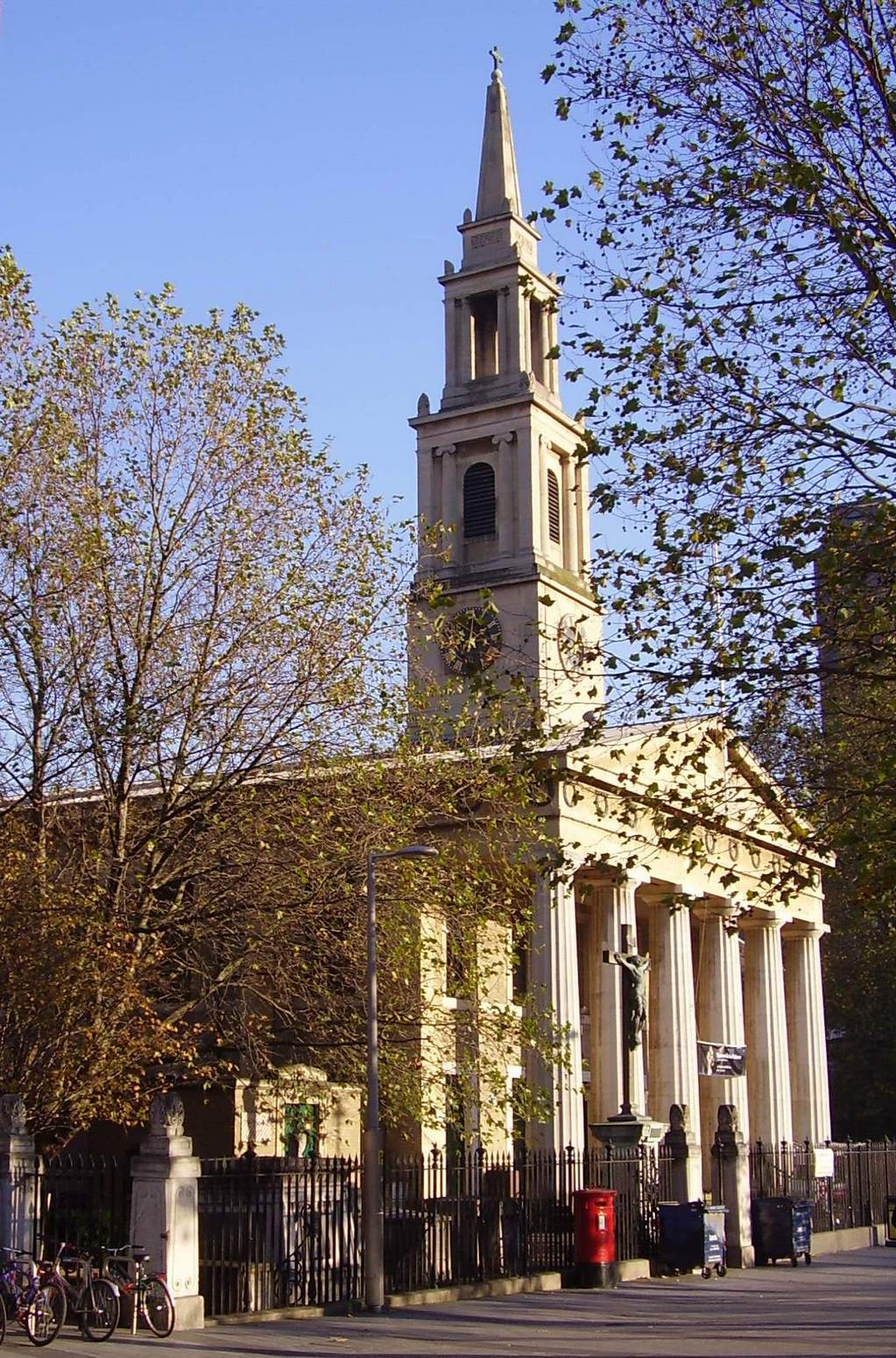
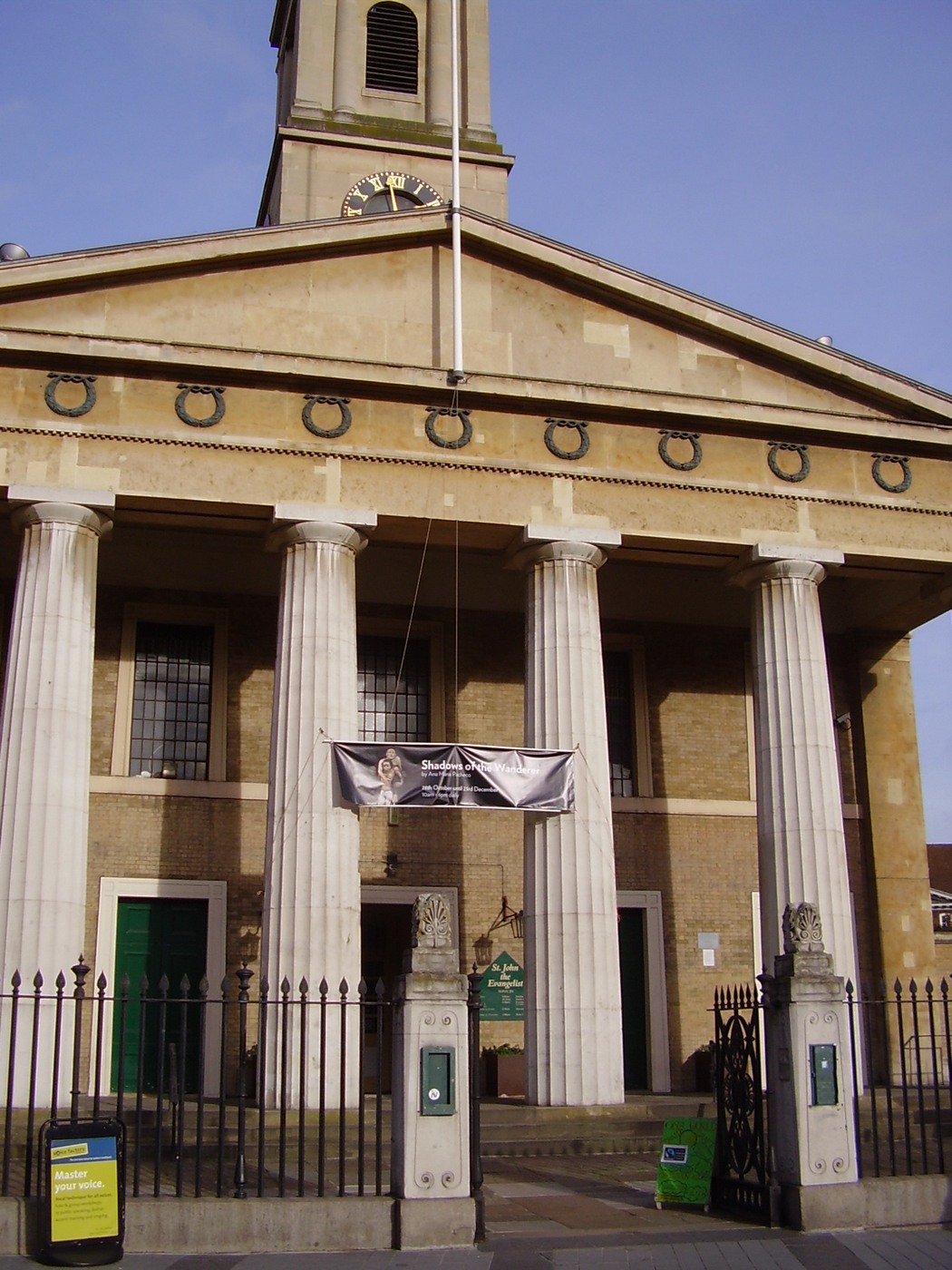
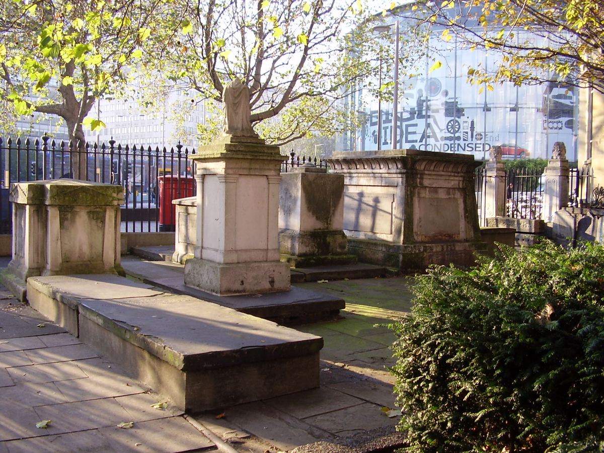
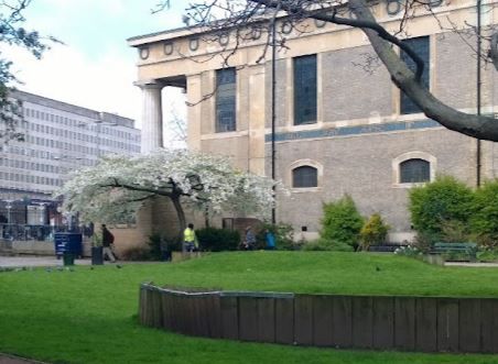
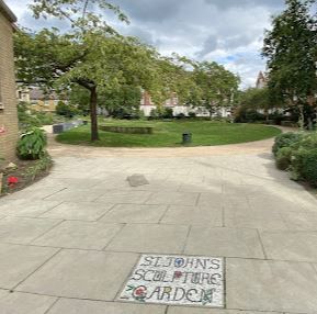
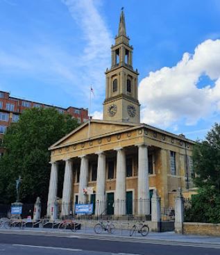
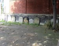
| Description | : | St John's Church was consecrated on 3 Nov 1824. It was largely destroyed by bombing in 1940 and rebuilt in 1950. The churchyard was made into a public garden in 1878. Several large tombs remain on the north side of the church, and there are some gravestones scattered amongst the shrubbery around the garden. |
frequently asked questions (FAQ):
-
Where is St John the Evangelist Churchyard?
St John the Evangelist Churchyard is located at Waterloo Road Waterloo, London Borough of Lambeth ,Greater London , SE1 8UDEngland.
-
St John the Evangelist Churchyard cemetery's updated grave count on graveviews.com?
6 memorials
-
Where are the coordinates of the St John the Evangelist Churchyard?
Latitude: 51.5044620
Longitude: -0.1123090
Nearby Cemetories:
1. Christ Church Churchyard
Southwark, London Borough of Southwark, England
Coordinate: 51.5061200, -0.1053500
2. Florence Nightingale Museum
Royal Borough of Kensington and Chelsea, England
Coordinate: 51.5003650, -0.1175810
3. St George's Cathedral
Southwark, London Borough of Southwark, England
Coordinate: 51.4976900, -0.1076110
4. Savoy Chapel Churchyard
Strand, City of Westminster, England
Coordinate: 51.5105360, -0.1199210
5. St Mary le Strand Church
Strand, City of Westminster, England
Coordinate: 51.5121540, -0.1169360
6. Ewer Street Burial Ground
Southwark, London Borough of Southwark, England
Coordinate: 51.5045560, -0.0990240
7. St Clement Danes Churchyard
City of Westminster, England
Coordinate: 51.5131070, -0.1138980
8. Whitehall
Westminster, City of Westminster, England
Coordinate: 51.5035300, -0.1262190
9. Baptist Chapel Burial Ground
Southwark, London Borough of Southwark, England
Coordinate: 51.5027900, -0.0978580
10. St Dunstan in the West Burial Ground
Fleet Street, City of London, England
Coordinate: 51.5142540, -0.1102480
11. St. Paul's Churchyard
Covent Garden, London Borough of Camden, England
Coordinate: 51.5114594, -0.1239310
12. Portugal Street Burial Ground (Defunct)
London, City of London, England
Coordinate: 51.5142280, -0.1162410
13. St. Martin-in-the-Fields Churchyard
Westminster, City of Westminster, England
Coordinate: 51.5087624, -0.1269620
14. St. Margaret's Churchyard
Westminster, City of Westminster, England
Coordinate: 51.4998560, -0.1268100
15. St Bride Churchyard
Fleet Street, City of London, England
Coordinate: 51.5137970, -0.1057060
16. St Andrew-by-the-Wardrobe
London, City of London, England
Coordinate: 51.5123850, -0.1012230
17. St. Ann Blackfriars
London, City of London, England
Coordinate: 51.5129180, -0.1021170
18. Lambeth Chapel
Lambeth, London Borough of Lambeth, England
Coordinate: 51.4950340, -0.1201320
19. Blackfriars Priory
Blackfriars, City of London, England
Coordinate: 51.5129730, -0.1021110
20. St. Mary's Churchyard
Lambeth, London Borough of Lambeth, England
Coordinate: 51.4949700, -0.1201770
21. Westminster Abbey
Westminster, City of Westminster, England
Coordinate: 51.4992790, -0.1274370
22. St. Benet's Churchyard
Queenhithe, City of London, England
Coordinate: 51.5117110, -0.0993280
23. Gough Square
London, City of London, England
Coordinate: 51.5150590, -0.1077440
24. Royal College of Surgeons of England
City of Westminster, England
Coordinate: 51.5152780, -0.1158330