| Memorials | : | 0 |
| Location | : | Tarrant Rushton, North Dorset District, England |
| Coordinate | : | 50.8541050, -2.0899870 |
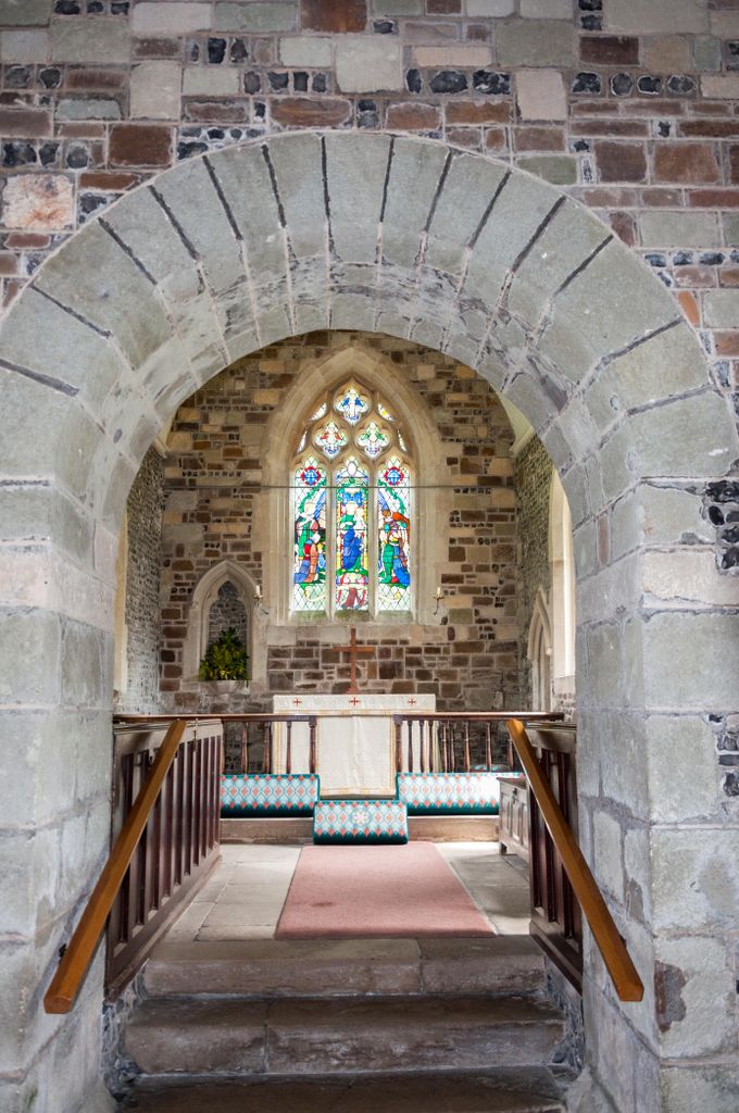
| Description | : | Early 12th century church built of flint and stone and consecrated in 1150. Adaptions were added in the 13th, 14th, 15th and 19th centuries, with new pews and furniture added in the early 1960's The north side of the church features a leper's squint, with deeply ridged finger marks in the soft sandstone of the window surround. It is now largely hidden from the road by surrounding buildings, but very pretty and peaceful. |
frequently asked questions (FAQ):
-
Where is St. Mary's Churchyard?
St. Mary's Churchyard is located at Dellsmead Tarrant Rushton, North Dorset District ,Dorset , DT11 8SDEngland.
-
St. Mary's Churchyard cemetery's updated grave count on graveviews.com?
0 memorials
-
Where are the coordinates of the St. Mary's Churchyard?
Latitude: 50.8541050
Longitude: -2.0899870
Nearby Cemetories:
1. St Laurence Churchyard
Farnham, North Dorset District, England
Coordinate: 50.8475730, -2.1093750
2. All Saints Churchyard
Tarrant Keyneston, North Dorset District, England
Coordinate: 50.8359850, -2.1074200
3. All Saints Churchyard
Tarrant Monkton, North Dorset District, England
Coordinate: 50.8789530, -2.0810240
4. St Mary The Virgin Churchyard
Tarrant Crawford, North Dorset District, England
Coordinate: 50.8307290, -2.1107000
5. All Saints Churchyard
Langton Long Blandford, North Dorset District, England
Coordinate: 50.8526530, -2.1459390
6. St Mary the Virgin Churchyard
Charlton Marshall, North Dorset District, England
Coordinate: 50.8360900, -2.1427800
7. St John the Baptist Churchyard
Spetisbury, North Dorset District, England
Coordinate: 50.8258000, -2.1300000
8. Shapwick Parish Churchyard
Shapwick, East Dorset District, England
Coordinate: 50.8147360, -2.0914850
9. St. Mary Churchyard
Blandford St Mary, North Dorset District, England
Coordinate: 50.8466680, -2.1551470
10. St Peters Churchyard
Pimperne, North Dorset District, England
Coordinate: 50.8841710, -2.1378980
11. Witchampton Methodist Churchyard
Witchampton, East Dorset District, England
Coordinate: 50.8574990, -2.0205250
12. Blandford Cemetery
Blandford Forum, North Dorset District, England
Coordinate: 50.8631910, -2.1590920
13. All Saints Churchyard
Witchampton, East Dorset District, England
Coordinate: 50.8574650, -2.0178710
14. St. Mary's Churchyard
Tarrant Hinton, North Dorset District, England
Coordinate: 50.8998000, -2.0919000
15. St Peter and St Paul Churchyard
Blandford Forum, North Dorset District, England
Coordinate: 50.8561880, -2.1639230
16. St Mary's Churchyard - Long Crichel
Tarrant Hinton, North Dorset District, England
Coordinate: 50.8927141, -2.0355435
17. St. Mary's Churchyard
Sturminster Marshall, East Dorset District, England
Coordinate: 50.8031270, -2.0709410
18. St. Mary's Churchyard
Cranborne, East Dorset District, England
Coordinate: 50.8741910, -2.0083630
19. Crichel House and Garden
Witchampton, East Dorset District, England
Coordinate: 50.8755820, -2.0072820
20. St Martin Churchyard
Bryanston, North Dorset District, England
Coordinate: 50.8620910, -2.1792480
21. St Mary's Church
Tarrant Gunville, North Dorset District, England
Coordinate: 50.9147358, -2.1051552
22. St. Kenelm Churchyard
Hinton Parva, East Dorset District, England
Coordinate: 50.8336300, -1.9949200
23. Gussage St Michael
Gussage St Michael, East Dorset District, England
Coordinate: 50.9016920, -2.0214940
24. St Mary Churchyard
Chettle, North Dorset District, England
Coordinate: 50.9191230, -2.0700510


