| Memorials | : | 0 |
| Location | : | Cranborne, East Dorset District, England |
| Coordinate | : | 50.8741910, -2.0083630 |
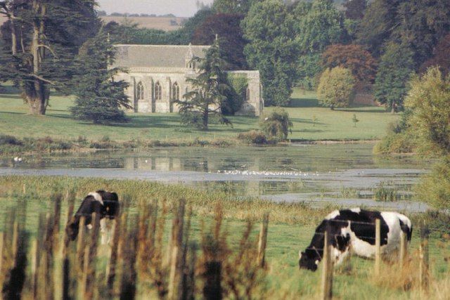
| Description | : | Moor Crichel is a village and civil parish in East Dorset, England situated on Cranborne Chase five miles east of Blandford Forum. Unusually the parish church of St. Mary is in the grounds of Crichel House and not accessible to the public. |
frequently asked questions (FAQ):
-
Where is St. Mary's Churchyard?
St. Mary's Churchyard is located at Moor Crichel Cranborne, East Dorset District ,Dorset ,England.
-
St. Mary's Churchyard cemetery's updated grave count on graveviews.com?
0 memorials
-
Where are the coordinates of the St. Mary's Churchyard?
Latitude: 50.8741910
Longitude: -2.0083630
Nearby Cemetories:
1. Crichel House and Garden
Witchampton, East Dorset District, England
Coordinate: 50.8755820, -2.0072820
2. All Saints Churchyard
Witchampton, East Dorset District, England
Coordinate: 50.8574650, -2.0178710
3. Witchampton Methodist Churchyard
Witchampton, East Dorset District, England
Coordinate: 50.8574990, -2.0205250
4. Gussage All Saints Churchyard
Gussage All Saints, East Dorset District, England
Coordinate: 50.8966570, -2.0031990
5. All Saints Churchyard
Chalbury, East Dorset District, England
Coordinate: 50.8610620, -1.9750690
6. St Mary's Churchyard - Long Crichel
Tarrant Hinton, North Dorset District, England
Coordinate: 50.8927141, -2.0355435
7. St. John The Evangelist Church
Hinton Martell, East Dorset District, England
Coordinate: 50.8551000, -1.9814000
8. Gussage St Michael
Gussage St Michael, East Dorset District, England
Coordinate: 50.9016920, -2.0214940
9. St. Wolfrida's Churchyard
Horton, East Dorset District, England
Coordinate: 50.8665000, -1.9585000
10. St. Kenelm Churchyard
Hinton Parva, East Dorset District, England
Coordinate: 50.8336300, -1.9949200
11. All Hallows Old Cemetery
Wimborne St Giles, North Dorset District, England
Coordinate: 50.9123200, -1.9673800
12. All Saints Churchyard
Tarrant Monkton, North Dorset District, England
Coordinate: 50.8789530, -2.0810240
13. Wimborne St Giles Churchyard
Wimborne St Giles, North Dorset District, England
Coordinate: 50.9071030, -1.9560130
14. The Church of the Ascension Churchyard
Woodlands, East Dorset District, England
Coordinate: 50.8806164, -1.9291594
15. St. James' Churchyard
Holt, East Dorset District, England
Coordinate: 50.8347020, -1.9585820
16. St. Mary's Churchyard
Tarrant Rushton, North Dorset District, England
Coordinate: 50.8541050, -2.0899870
17. St. Mary's Churchyard
Tarrant Hinton, North Dorset District, England
Coordinate: 50.8998000, -2.0919000
18. St Mary Churchyard
Chettle, North Dorset District, England
Coordinate: 50.9191230, -2.0700510
19. St Nicholas
Edmondsham, East Dorset District, England
Coordinate: 50.9032700, -1.9143680
20. Poole and Wimborne Woodland Burial Ground
Wimborne, East Dorset District, England
Coordinate: 50.8097500, -1.9745150
21. Woodland Burial Ground
Colehill, East Dorset District, England
Coordinate: 50.8088100, -1.9737900
22. St Michael and All Angels Churchyard
Colehill, East Dorset District, England
Coordinate: 50.8104720, -1.9661400
23. St Laurence Churchyard
Farnham, North Dorset District, England
Coordinate: 50.8475730, -2.1093750
24. Ss Mary & Bartholomew Churchyard
Cranborne, East Dorset District, England
Coordinate: 50.9187790, -1.9237020

