
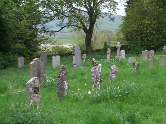
| Memorials | : | 14 |
| Location | : | Conistone, Craven District, England |
| Coordinate | : | 54.1042630, -2.0304750 |
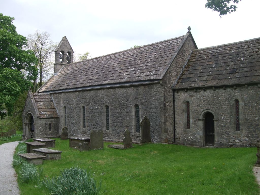
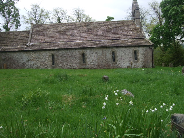
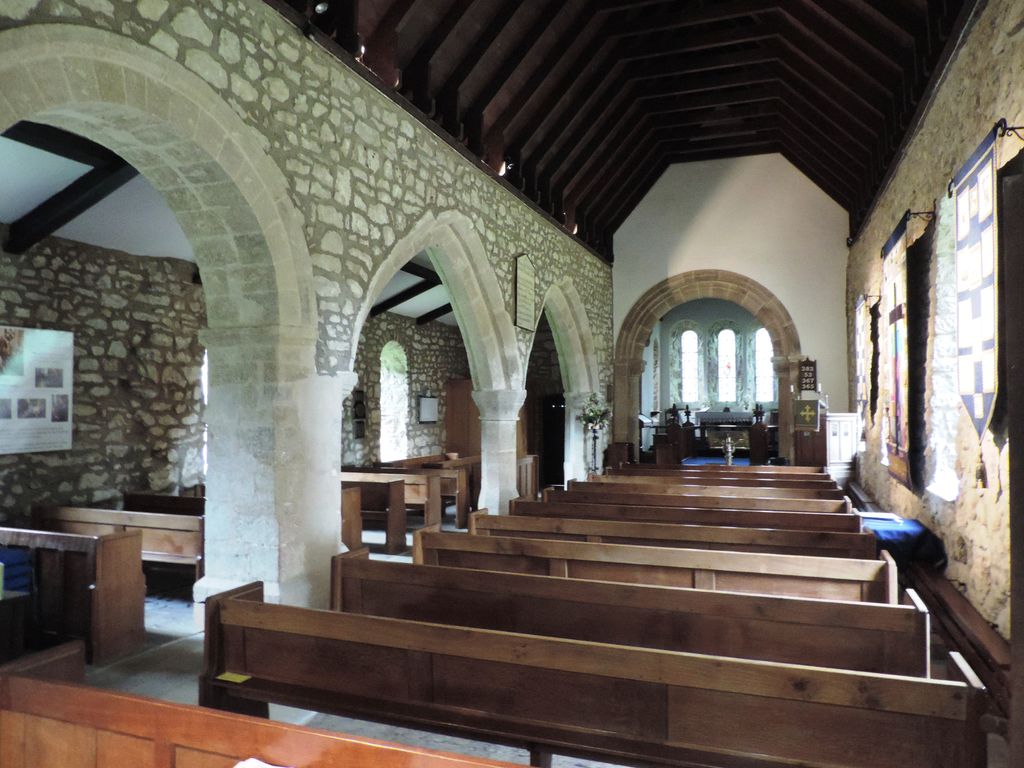
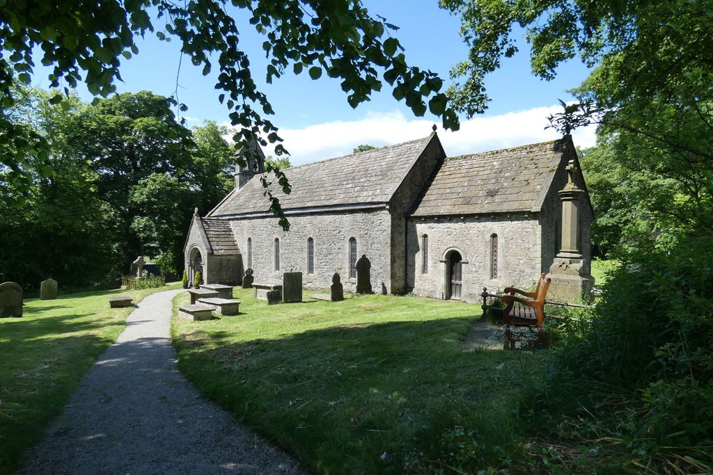
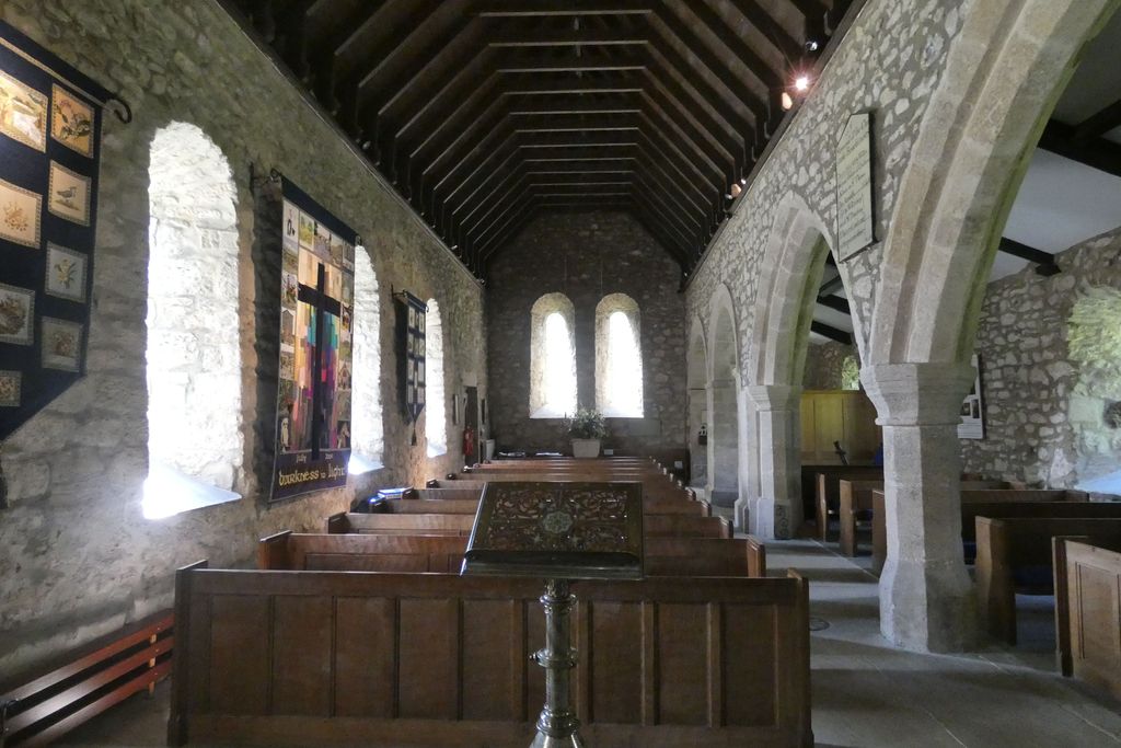
| Description | : | St Mary's Church was built in the 11th or 12th century, and is possibly the oldest building in the district. In 1846 it was rebuilt under the supervision of the Lancaster architects Sharpe and Paley, who maintained its original Norman style of architecture. St Mary's is constructed in limestone rubble, with gritstone dressings and a stone slate roof. Its plan consists of a five-bay nave with a north aisle and a south porch, and a three-bay chancel with a north vestry. On the west gable of the nave is a double bellcote. The east window has three... Read More |
frequently asked questions (FAQ):
-
Where is St. Mary's Churchyard?
St. Mary's Churchyard is located at Kettlewell Road Conistone, Craven District ,North Yorkshire , BD23 5HSEngland.
-
St. Mary's Churchyard cemetery's updated grave count on graveviews.com?
14 memorials
-
Where are the coordinates of the St. Mary's Churchyard?
Latitude: 54.1042630
Longitude: -2.0304750
Nearby Cemetories:
1. Grassington Congregational Churchyard
Grassington, Craven District, England
Coordinate: 54.0723570, -1.9963100
2. St Mary Churchyard
Kettlewell, Craven District, England
Coordinate: 54.1459650, -2.0454120
3. St. Michael and All Angels Churchyard
Linton, Craven District, England
Coordinate: 54.0647950, -1.9933070
4. St Peter Churchyard
Hebden, Craven District, England
Coordinate: 54.0626500, -1.9618960
5. St Oswald Churchyard
Arncliffe, Craven District, England
Coordinate: 54.1434970, -2.1038940
6. St Wilfrid Churchyard
Burnsall, Craven District, England
Coordinate: 54.0495000, -1.9520690
7. St Peter Churchyard
Rylstone, Craven District, England
Coordinate: 54.0253360, -2.0445780
8. St Michael the Archangel Churchyard
Kirkby Malham, Craven District, England
Coordinate: 54.0448480, -2.1628540
9. St. Michael and All Angels Churchyard
Hubberholme, Craven District, England
Coordinate: 54.2001100, -2.1147330
10. St Chad Churchyard
Middlesmoor, Harrogate Borough, England
Coordinate: 54.1630080, -1.8597240
11. St Mary Churchyard
Greenhow Hill, Harrogate Borough, England
Coordinate: 54.0734500, -1.8298000
12. St Mary Churchyard
Embsay, Craven District, England
Coordinate: 53.9829390, -1.9834030
13. St. Mary the Virgin Churchyard
Ramsgill, Harrogate Borough, England
Coordinate: 54.1340320, -1.8189890
14. Tarn Moor Memorial Woodland Burial Ground
Skipton, Craven District, England
Coordinate: 53.9759590, -2.0254260
15. St. Peter's Churchyard
Coniston Cold, Craven District, England
Coordinate: 53.9944380, -2.1493870
16. St Andrew Churchyard
Gargrave, Craven District, England
Coordinate: 53.9811830, -2.1054420
17. St Botolph Churchyard
Horsehouse, Richmondshire District, England
Coordinate: 54.2269100, -1.9292300
18. Raikes Road Burial Ground
Skipton, Craven District, England
Coordinate: 53.9643822, -2.0196819
19. Holy Trinity Churchyard
Skipton, Craven District, England
Coordinate: 53.9633250, -2.0161180
20. St Stephen Roman Catholic Churchyard
Skipton, Craven District, England
Coordinate: 53.9631760, -2.0210240
21. Skipton War Memorial
Skipton, Craven District, England
Coordinate: 53.9627100, -2.0161680
22. St. Andrew's Churchyard
Skipton, Craven District, England
Coordinate: 53.9609959, -2.0140994
23. St John the Evangelist Churchyard
Langcliffe, Craven District, England
Coordinate: 54.0807400, -2.2721000
24. St Peter Churchyard
Stainforth, Craven District, England
Coordinate: 54.1019280, -2.2754890