
| Memorials | : | 0 |
| Location | : | Tatenhill, East Staffordshire Borough, England |
| Coordinate | : | 52.7809957, -1.7236464 |
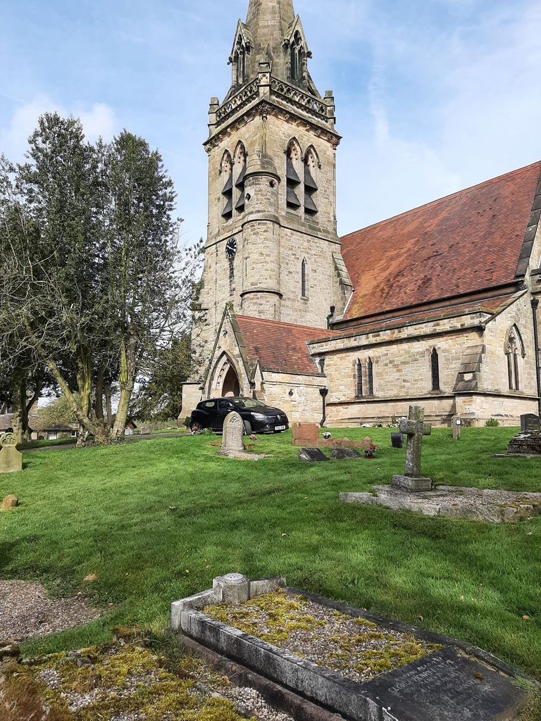
| Description | : | The parish church of Dunstall, St Mary's, was built to serve the Dunstall Hall estate by the Arkwright family. After their move to Cromford, the new owner of the estate, John Hardy, completed the church in 1853.[14] The Arkwright family pledged £12,000 in total to help build the church, school (which in now the church hall) and a parsonage as Charles had always wanted to have a church in this community, however he died before any stones were laid, leaving the Hardy family to complete his wishes.[15] To show the community's appreciation to John Hardy and his wife Isobel, a... Read More |
frequently asked questions (FAQ):
-
Where is St. Mary's Churchyard, Dunstall?
St. Mary's Churchyard, Dunstall is located at Tatenhill, East Staffordshire Borough ,Staffordshire ,England.
-
St. Mary's Churchyard, Dunstall cemetery's updated grave count on graveviews.com?
0 memorials
-
Where are the coordinates of the St. Mary's Churchyard, Dunstall?
Latitude: 52.7809957
Longitude: -1.7236464

Nearby Cemetories:
1. St. James' Churchyard
Barton-under-Needwood, East Staffordshire Borough, England
Coordinate: 52.7641321, -1.7228176
2. St. Michael and All Angels Churchyard
Tatenhill, East Staffordshire Borough, England
Coordinate: 52.7958170, -1.6968150
3. All Saints Churchyard
Rangemore, East Staffordshire Borough, England
Coordinate: 52.8040800, -1.7337000
4. St Laurence Churchyard
Walton-on-Trent, South Derbyshire District, England
Coordinate: 52.7613386, -1.6819775
5. Saint Saviour's Cemetery
Burton upon Trent, East Staffordshire Borough, England
Coordinate: 52.7892907, -1.6668628
6. St Leonard's Church
Wychnor, East Staffordshire Borough, England
Coordinate: 52.7420071, -1.7394617
7. Catholic Church of Saint Francis of Sales
Yoxall, East Staffordshire Borough, England
Coordinate: 52.7844140, -1.7909000
8. Holy Trinity Churchyard
Anslow, East Staffordshire Borough, England
Coordinate: 52.8216926, -1.7079807
9. St. Peter's Churchyard
Yoxall, East Staffordshire Borough, England
Coordinate: 52.7687960, -1.7915250
10. Newchurch, Christchurch-in-Needwood
Hoar Cross, East Staffordshire Borough, England
Coordinate: 52.8083859, -1.7811304
11. All Saints Churchyard
Alrewas, Lichfield District, England
Coordinate: 52.7347941, -1.7530332
12. National Memorial Arboretum
Alrewas, Lichfield District, England
Coordinate: 52.7274040, -1.7324890
13. St Modwen Churchyard
Burton upon Trent, East Staffordshire Borough, England
Coordinate: 52.8013990, -1.6291340
14. The Holy Angels Churchyard
Hoar Cross, East Staffordshire Borough, England
Coordinate: 52.8047974, -1.8161691
15. Garden of Remembrance
Burton upon Trent, East Staffordshire Borough, England
Coordinate: 52.8023045, -1.6283625
16. Croxall, St John the Baptist Churchyard
Edingale, Lichfield District, England
Coordinate: 52.7200210, -1.7091480
17. St. Peter's Parish Churchyard
Stapenhill, East Staffordshire Borough, England
Coordinate: 52.7960899, -1.6230323
18. All Saints Churchyard
Newborough, East Staffordshire Borough, England
Coordinate: 52.8259013, -1.8003185
19. Saint John the Divine Churchyard
Horninglow, East Staffordshire Borough, England
Coordinate: 52.8237520, -1.6426170
20. Stapenhill Cemetery
Burton upon Trent, East Staffordshire Borough, England
Coordinate: 52.8026310, -1.6208900
21. RAF Fauld
Hanbury, East Staffordshire Borough, England
Coordinate: 52.8474200, -1.7303500
22. St Mary Churchyard
Coton in the Elms, South Derbyshire District, England
Coordinate: 52.7358240, -1.6400740
23. Saint Stephen Churchyard
Fradley, Lichfield District, England
Coordinate: 52.7183456, -1.7686180
24. St Werburgh's Church
Hanbury, East Staffordshire Borough, England
Coordinate: 52.8485000, -1.7478000