| Memorials | : | 6 |
| Location | : | Hanbury, East Staffordshire Borough, England |
| Coordinate | : | 52.8485000, -1.7478000 |
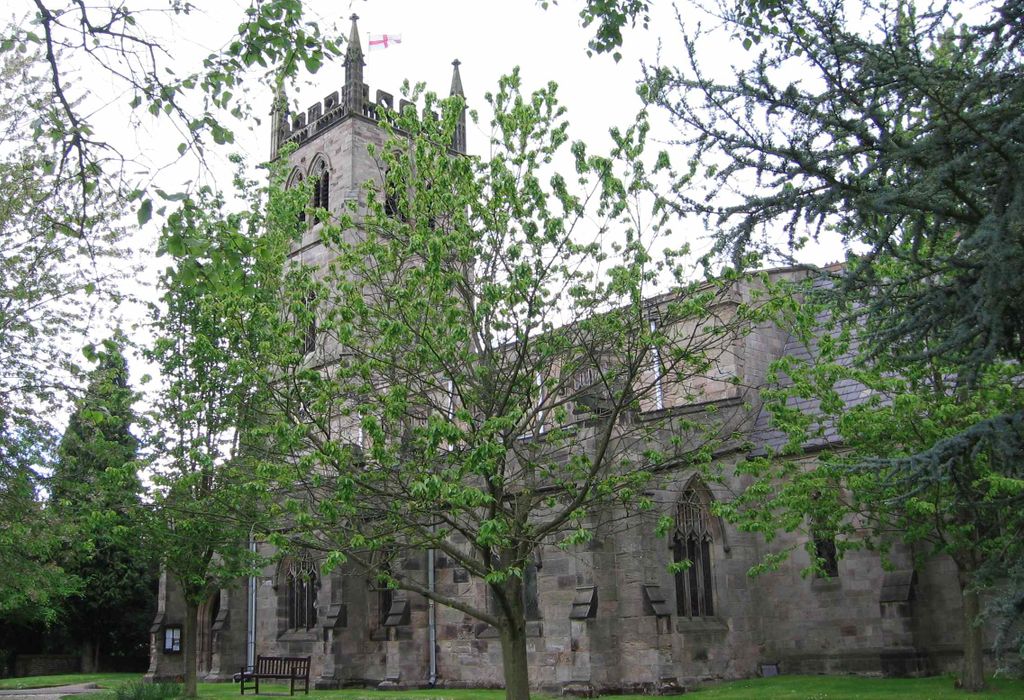
| Description | : | In the year 680, the Saxon princess, St Werburgh, became abbess of a nunnery founded at Hanbury by her brother Ethelred, King of Mercia. St Werburgh died in 706 AD and was originally buried at Hanbury in Staffordshire. The church at Hanbury became a place of pilgimage. However, in the early 900s the Vikings were attacking, so the relics were brought to Chester in 875 in order to protect them from the marauding Danes. The parish church, St Werburgh, was a rectory attached to the nunnery. In the early 14th Century the church was largely rebuilt with the celestorys being... Read More |
frequently asked questions (FAQ):
-
Where is St Werburgh's Church?
St Werburgh's Church is located at Hanbury, East Staffordshire Borough ,Staffordshire ,England.
-
St Werburgh's Church cemetery's updated grave count on graveviews.com?
5 memorials
-
Where are the coordinates of the St Werburgh's Church?
Latitude: 52.8485000
Longitude: -1.7478000
Nearby Cemetories:
1. RAF Fauld
Hanbury, East Staffordshire Borough, England
Coordinate: 52.8474200, -1.7303500
2. St. Paul's Churchyard Extension
Scropton, South Derbyshire District, England
Coordinate: 52.8687230, -1.7133750
3. Holy Trinity Churchyard
Anslow, East Staffordshire Borough, England
Coordinate: 52.8216926, -1.7079807
4. Priory Church of St. Mary the Virgin
Tutbury, East Staffordshire Borough, England
Coordinate: 52.8590900, -1.6877900
5. St Peter's Churchyard
Marchington, East Staffordshire Borough, England
Coordinate: 52.8738278, -1.7967917
6. All Saints Churchyard
Newborough, East Staffordshire Borough, England
Coordinate: 52.8259013, -1.8003185
7. All Saints Churchyard
Sudbury, Derbyshire Dales District, England
Coordinate: 52.8867660, -1.7667510
8. Newchurch, Christchurch-in-Needwood
Hoar Cross, East Staffordshire Borough, England
Coordinate: 52.8083859, -1.7811304
9. All Saints Churchyard
Rangemore, East Staffordshire Borough, England
Coordinate: 52.8040800, -1.7337000
10. Rolleston Cemetery
Rolleston-on-Dove, East Staffordshire Borough, England
Coordinate: 52.8483757, -1.6643849
11. St. Mary's Churchyard
Rolleston-on-Dove, East Staffordshire Borough, England
Coordinate: 52.8465144, -1.6519844
12. Marston-on-Dove Cemetery
Marston-on-Dove, South Derbyshire District, England
Coordinate: 52.8640550, -1.6552780
13. St Mary's
Marston-on-Dove, South Derbyshire District, England
Coordinate: 52.8633910, -1.6547730
14. The Holy Angels Churchyard
Hoar Cross, East Staffordshire Borough, England
Coordinate: 52.8047974, -1.8161691
15. St Michael and All Angels Churchyard
Church Broughton, South Derbyshire District, England
Coordinate: 52.9009460, -1.6962610
16. St. Michael and All Angels Churchyard
Tatenhill, East Staffordshire Borough, England
Coordinate: 52.7958170, -1.6968150
17. Dove Evangelical Free Church, Somersal Herbert
Doveridge, Derbyshire Dales District, England
Coordinate: 52.9109200, -1.7905560
18. Saint John the Divine Churchyard
Horninglow, East Staffordshire Borough, England
Coordinate: 52.8237520, -1.6426170
19. St. Mary's Churchyard, Dunstall
Tatenhill, East Staffordshire Borough, England
Coordinate: 52.7809957, -1.7236464
20. Catholic Church of Saint Francis of Sales
Yoxall, East Staffordshire Borough, England
Coordinate: 52.7844140, -1.7909000
21. St. John the Baptist Churchyard
Boylestone, Derbyshire Dales District, England
Coordinate: 52.9195410, -1.7313190
22. St. Cuthbert's Churchyard
Doveridge, Derbyshire Dales District, England
Coordinate: 52.9042368, -1.8317361
23. St Mary's Churchyard
Stretton, South Staffordshire Borough, England
Coordinate: 52.8336500, -1.6253400
24. St Mary's Church
Stretton, East Staffordshire Borough, England
Coordinate: 52.8341478, -1.6247215

