
| Memorials | : | 531 |
| Location | : | Bowdon, Metropolitan Borough of Trafford, England |
| Coordinate | : | 53.3778850, -2.3643390 |
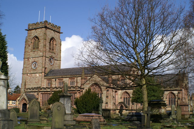
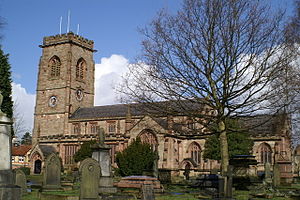
| Description | : | St Mary's Church has a long history and the records go back nearly as far as any in the country. Most of the statutory records have been copied to computer and selections are often requested by people tracing their family trees. The computer records include all the legible inscriptions in the graveyard and the Church. We continue to get enquiries from people tracing their family trees at the rate of about one a week. These can come from anywhere in the world and the simple ones can be answered by an email reply. Others... Read More |
frequently asked questions (FAQ):
-
Where is St Mary the Virgin Churchyard?
St Mary the Virgin Churchyard is located at Stamford Road Bowdon, Metropolitan Borough of Trafford ,Greater Manchester , WA14 2TREngland.
-
St Mary the Virgin Churchyard cemetery's updated grave count on graveviews.com?
531 memorials
-
Where are the coordinates of the St Mary the Virgin Churchyard?
Latitude: 53.3778850
Longitude: -2.3643390

Nearby Cemetories:
1. St Peter Churchyard
Hale, Metropolitan Borough of Trafford, England
Coordinate: 53.3753110, -2.3417960
2. St George's Churchyard
Altrincham, Metropolitan Borough of Trafford, England
Coordinate: 53.3900000, -2.3511000
3. Bowdon and Hale Cemetery
Altrincham, Metropolitan Borough of Trafford, England
Coordinate: 53.3787830, -2.3330000
4. Holy Trinity Churchyard
Little Bollington, Cheshire East Unitary Authority, England
Coordinate: 53.3744640, -2.4121950
5. Christ Churchyard
Timperley, Metropolitan Borough of Trafford, England
Coordinate: 53.3901500, -2.3159770
6. Dunham Lawn Cemetery
Dunham Massey, Metropolitan Borough of Trafford, England
Coordinate: 53.4036500, -2.3953800
7. St. Mary's Churchyard
Rostherne, Cheshire East Unitary Authority, England
Coordinate: 53.3494630, -2.3880170
8. Altrincham Crematorium
Dunham Massey, Metropolitan Borough of Trafford, England
Coordinate: 53.4041600, -2.3943760
9. Sale Brooklands Cemetery
Sale, Metropolitan Borough of Trafford, England
Coordinate: 53.4180020, -2.3279330
10. Ringway St. Mary and All Saints Churchyard
Altrincham, Metropolitan Borough of Trafford, England
Coordinate: 53.3587900, -2.2885800
11. Friends Cemetery
Ashton upon Mersey, Metropolitan Borough of Trafford, England
Coordinate: 53.4272490, -2.3281035
12. St. Martin's Churchyard
Ashton upon Mersey, Metropolitan Borough of Trafford, England
Coordinate: 53.4332650, -2.3444220
13. St. Peter's Parish Churchyard
Lymm, Warrington Unitary Authority, England
Coordinate: 53.3802800, -2.4610000
14. Saint George Churchyard
Carrington, Metropolitan Borough of Trafford, England
Coordinate: 53.4300760, -2.4109550
15. Saint Werburgh's Churchyard
Warburton, Metropolitan Borough of Trafford, England
Coordinate: 53.4021610, -2.4572830
16. Urmston Cemetery
Urmston, Metropolitan Borough of Trafford, England
Coordinate: 53.4419290, -2.3533890
17. Lymm Baptist Churchyard
Lymm, Warrington Unitary Authority, England
Coordinate: 53.3765240, -2.4724300
18. St Wilfrid Churchyard
Mobberley, Cheshire East Unitary Authority, England
Coordinate: 53.3181500, -2.3161790
19. Hollinfare Cemetery
Rixton with Glazebrook, Warrington Unitary Authority, England
Coordinate: 53.4165900, -2.4575100
20. Saint Mary's Churchyard
Lymm, Warrington Unitary Authority, England
Coordinate: 53.3771000, -2.4784000
21. Tabley Hill Cemetery
Knutsford, Cheshire East Unitary Authority, England
Coordinate: 53.3118420, -2.3972480
22. Saint Helena Chapel Burial Ground
Knutsford, Cheshire East Unitary Authority, England
Coordinate: 53.3055380, -2.3531060
23. St Matthew Churchyard
Stretford, Metropolitan Borough of Trafford, England
Coordinate: 53.4437700, -2.3099900
24. Stretford Cemetery
Stretford, Metropolitan Borough of Trafford, England
Coordinate: 53.4429660, -2.3046520