
| Memorials | : | 247 |
| Location | : | Altrincham, Metropolitan Borough of Trafford, England |
| Coordinate | : | 53.3587900, -2.2885800 |
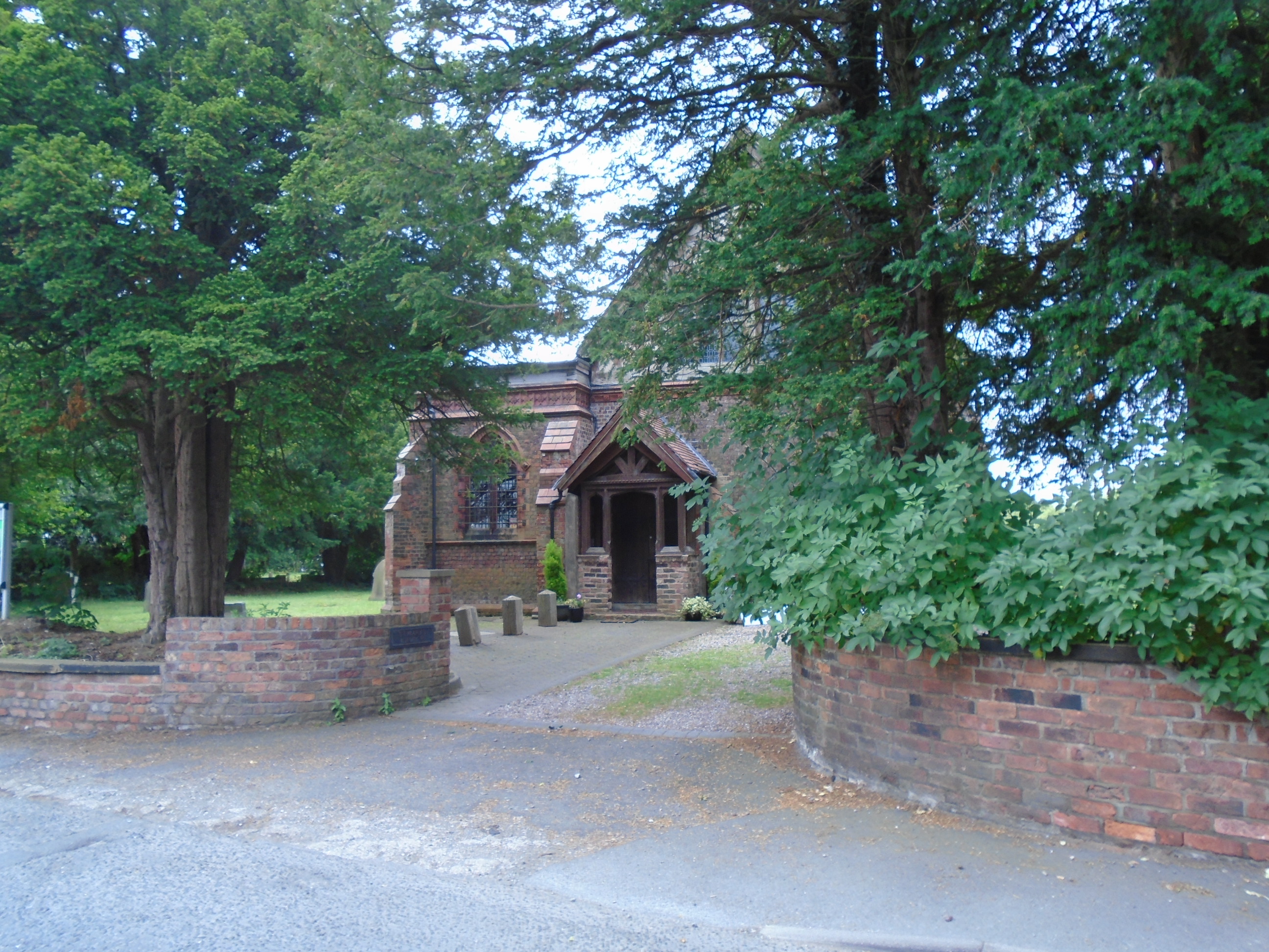
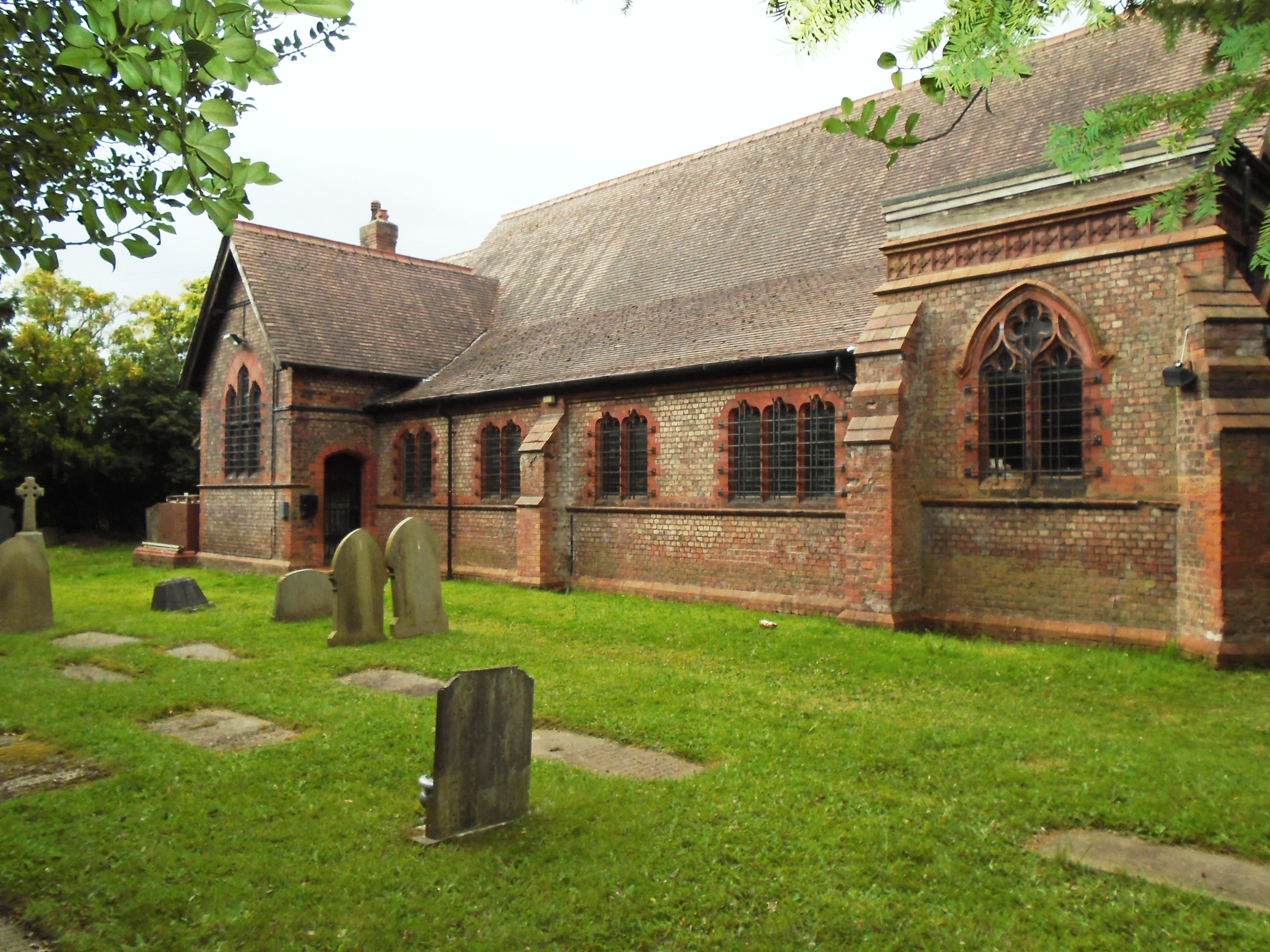
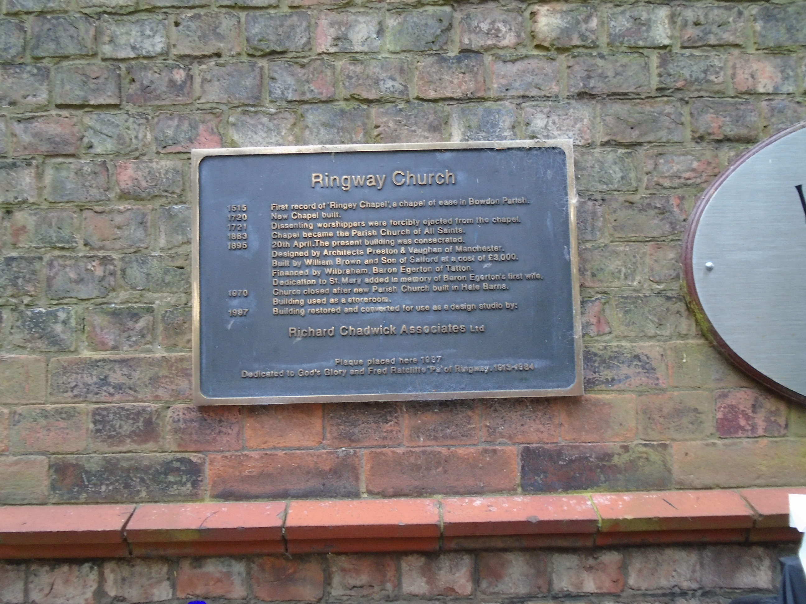
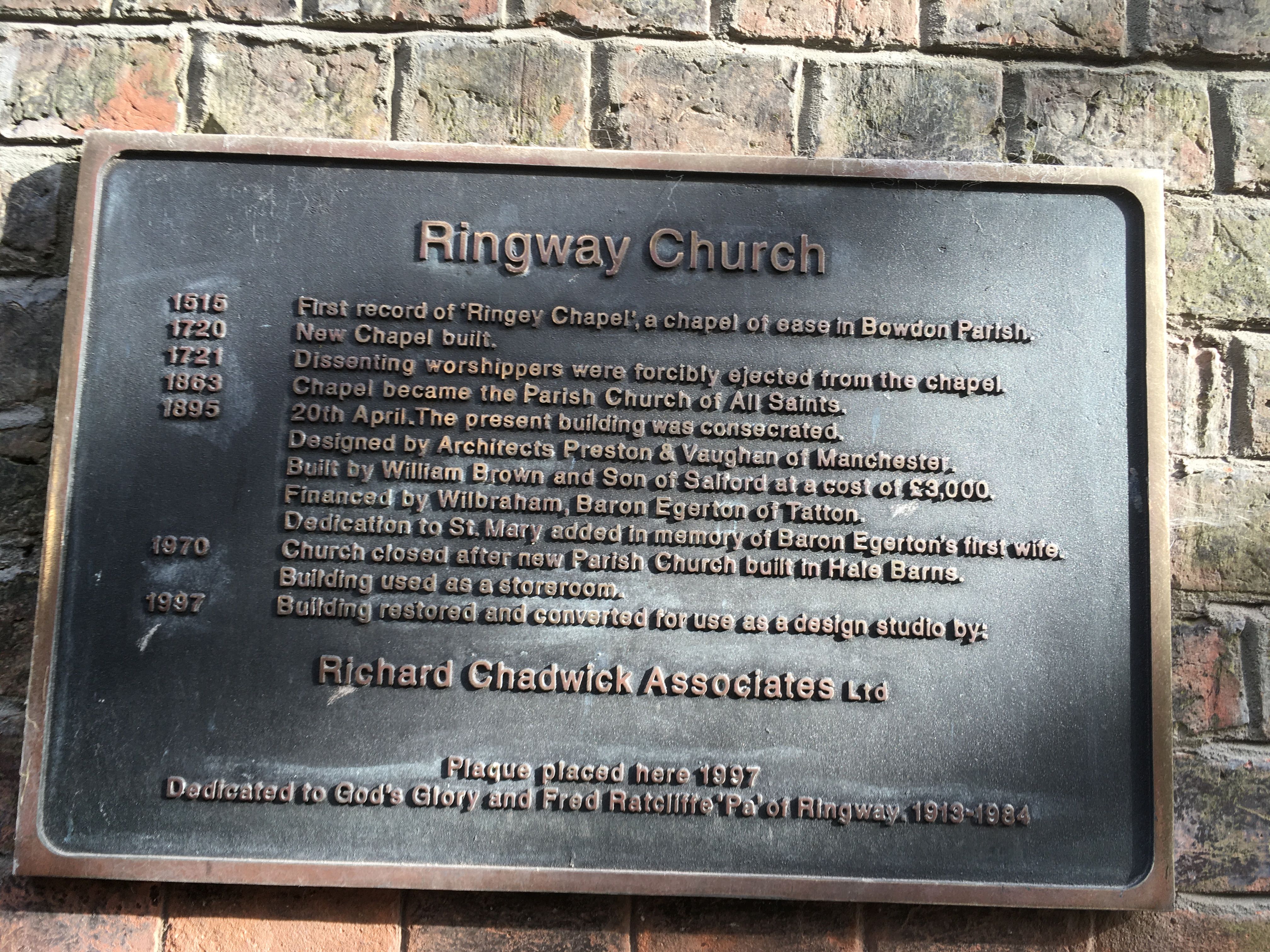
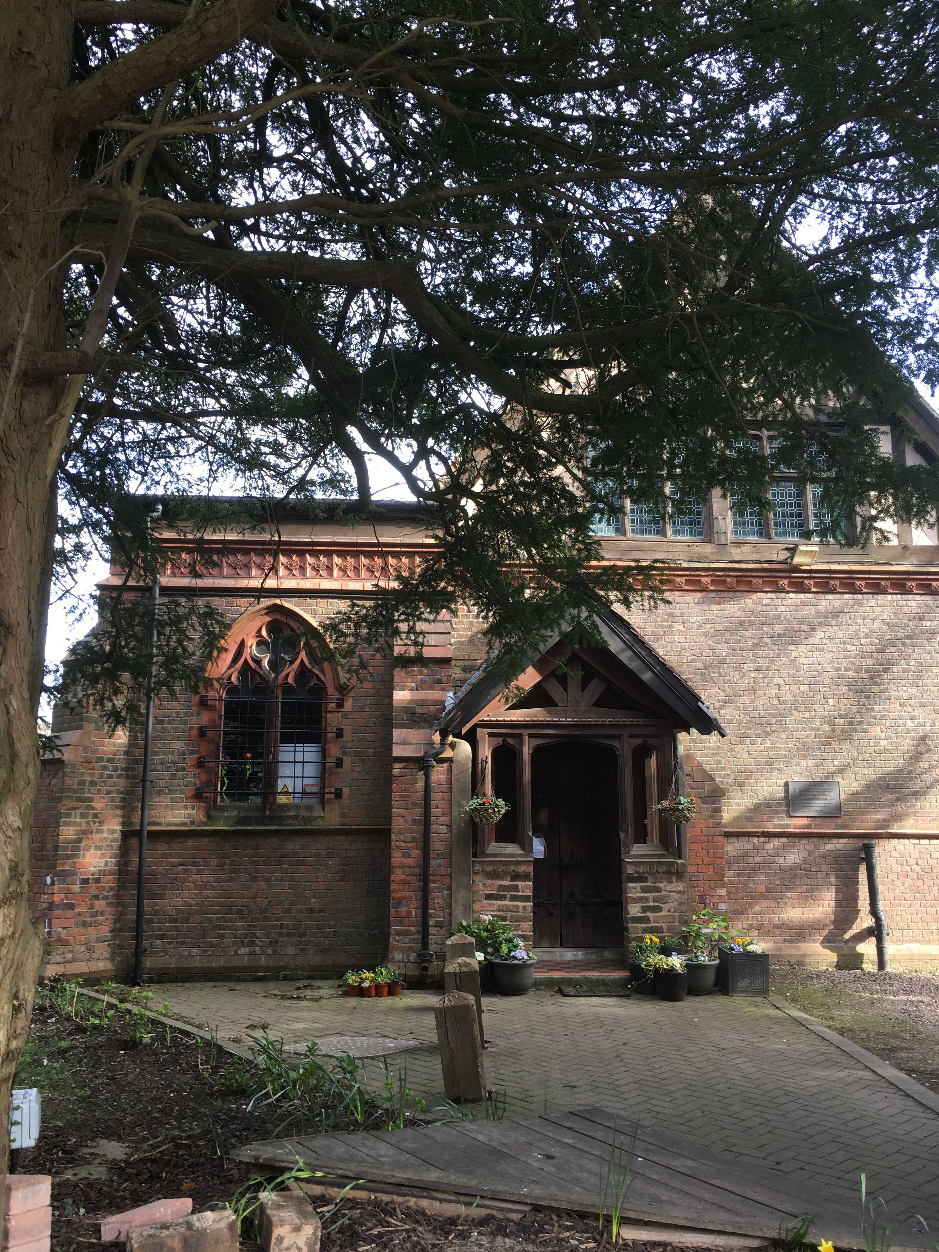
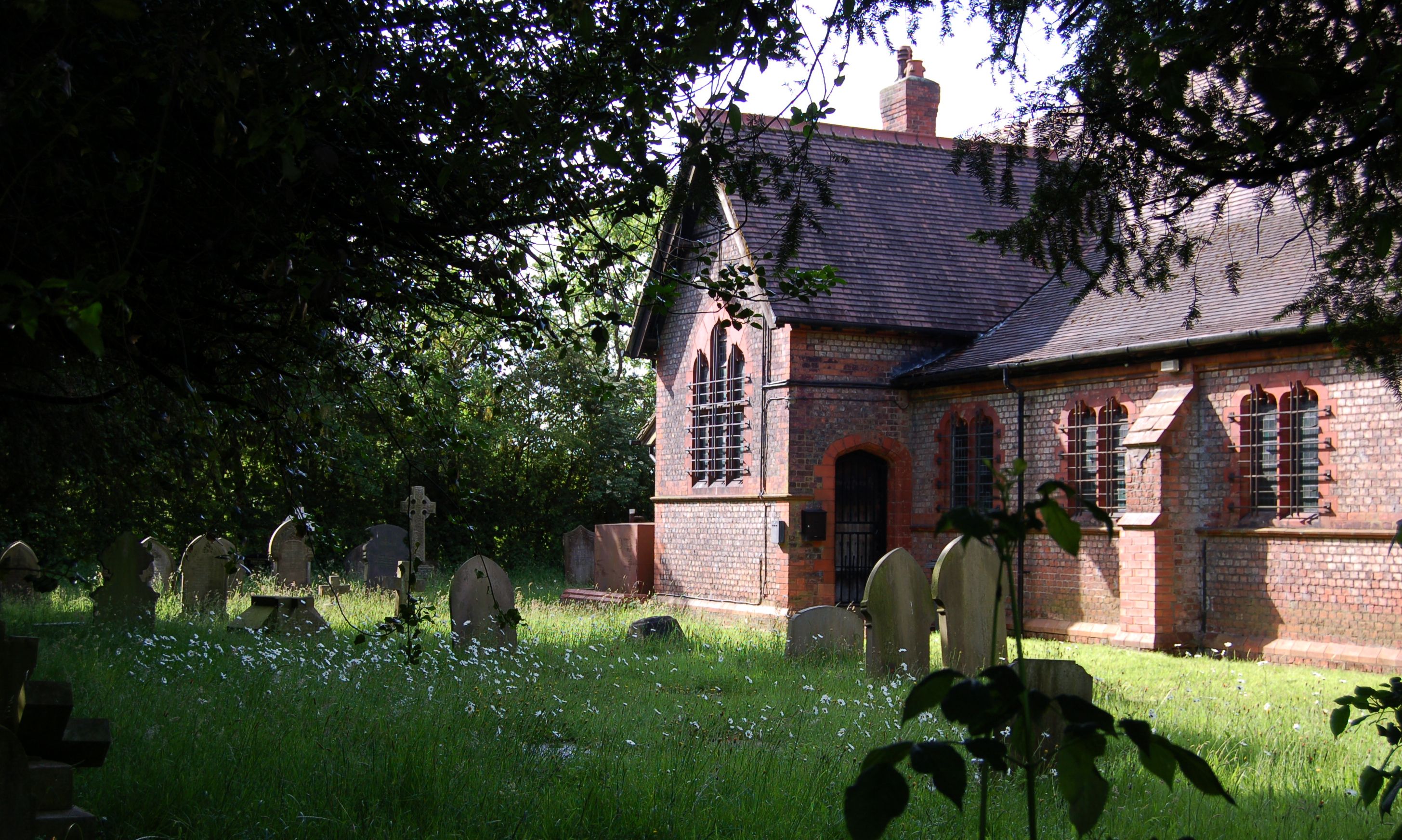
| Description | : | Also known as Ringway Chapel. It is one of the few remaining buildings that were originally Ringway Village. The village is now mostly covered by Manchester International Airport (formerly Ringway Airfield). It was in the county of Cheshire until local government changes in the 1970's took it into the Greater Manchester area. The church closed in 1970 and eventually became business premises. Any internal memorials, including the Roll of Honour for both World Wars were removed and taken to the new parish church of All Saints in nearby Hale Barns. It now has a sign outside for the Seventh Day... Read More |
frequently asked questions (FAQ):
-
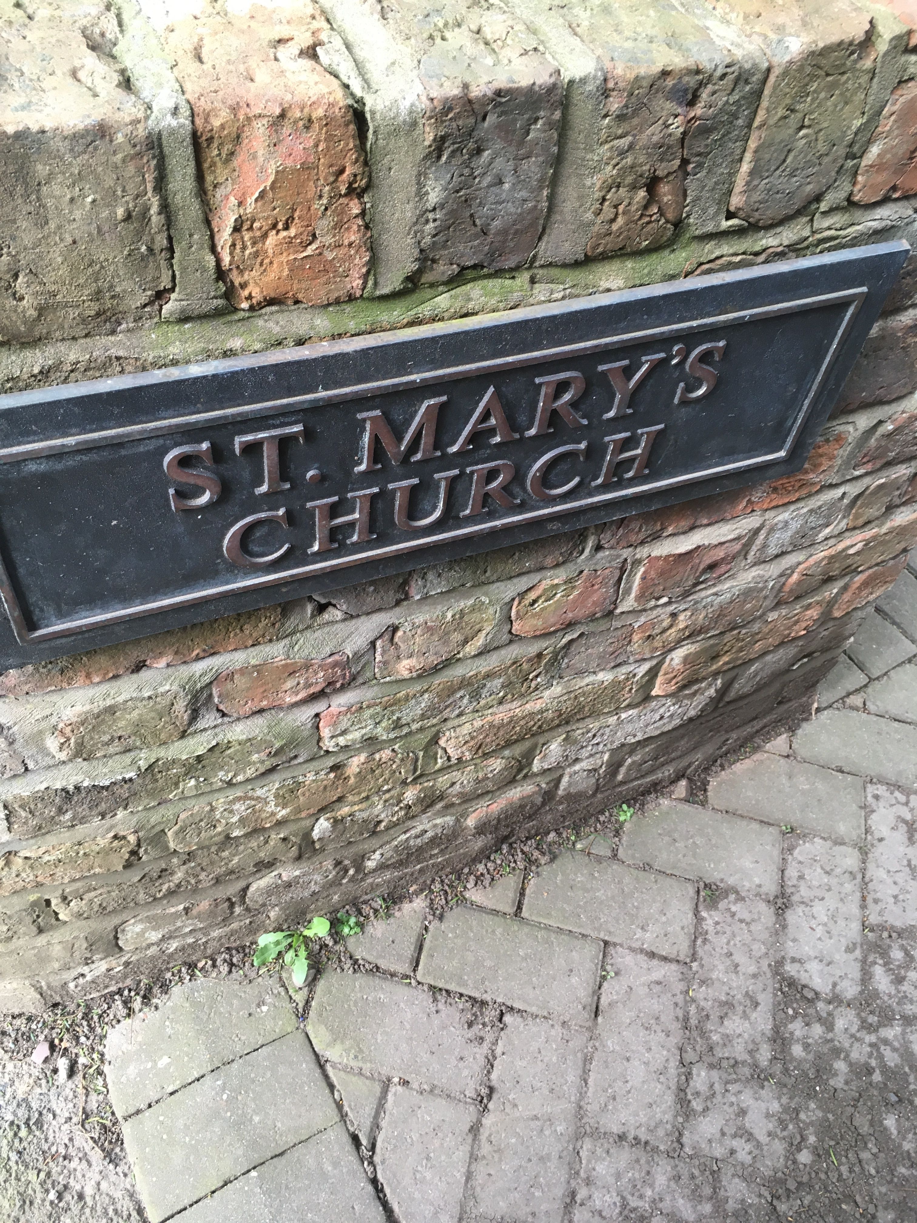
Where is Ringway St. Mary and All Saints Churchyard?
Ringway St. Mary and All Saints Churchyard is located at Sunbank Lane Altrincham, Metropolitan Borough of Trafford ,Greater Manchester , WA15 8XJEngland.
-
Ringway St. Mary and All Saints Churchyard cemetery's updated grave count on graveviews.com?
247 memorials
-
Where are the coordinates of the Ringway St. Mary and All Saints Churchyard?
Latitude: 53.3587900
Longitude: -2.2885800
Nearby Cemetories:
1. Bowdon and Hale Cemetery
Altrincham, Metropolitan Borough of Trafford, England
Coordinate: 53.3787830, -2.3330000
2. Christ Churchyard
Timperley, Metropolitan Borough of Trafford, England
Coordinate: 53.3901500, -2.3159770
3. St Peter Churchyard
Hale, Metropolitan Borough of Trafford, England
Coordinate: 53.3753110, -2.3417960
4. Quaker Burying Ground
Mobberley, Cheshire East Unitary Authority, England
Coordinate: 53.3174300, -2.2872500
5. Heald Green United Reformed Church
Heald Green, Metropolitan Borough of Stockport, England
Coordinate: 53.3674480, -2.2165710
6. St Wilfrid Churchyard
Mobberley, Cheshire East Unitary Authority, England
Coordinate: 53.3181500, -2.3161790
7. Wilmslow Cemetery
Wilmslow, Cheshire East Unitary Authority, England
Coordinate: 53.3374170, -2.2236590
8. St Chad
Handforth, Cheshire East Unitary Authority, England
Coordinate: 53.3485000, -2.2148100
9. St. Bartholomew Churchyard
Wilmslow, Cheshire East Unitary Authority, England
Coordinate: 53.3301250, -2.2296900
10. St George's Churchyard
Altrincham, Metropolitan Borough of Trafford, England
Coordinate: 53.3900000, -2.3511000
11. St Mary the Virgin Churchyard
Bowdon, Metropolitan Borough of Trafford, England
Coordinate: 53.3778850, -2.3643390
12. St. John's Churchyard
Wilmslow, Cheshire East Unitary Authority, England
Coordinate: 53.3122370, -2.2532400
13. St Mary's Churchyard
Cheadle, Metropolitan Borough of Stockport, England
Coordinate: 53.3944820, -2.2176205
14. Mill Lane Cemetery
Cheadle, Metropolitan Borough of Stockport, England
Coordinate: 53.3992000, -2.2150800
15. St James Churchyard
Didsbury, Metropolitan Borough of Manchester, England
Coordinate: 53.4088737, -2.2330498
16. St. Mary's Churchyard
Rostherne, Cheshire East Unitary Authority, England
Coordinate: 53.3494630, -2.3880170
17. Cheadle Cemetery
Cheadle, Metropolitan Borough of Stockport, England
Coordinate: 53.3927610, -2.2054690
18. Parsonage Gardens
Didsbury, Metropolitan Borough of Manchester, England
Coordinate: 53.4094440, -2.2302780
19. All Saints Churchyard
Cheadle Hulme, Metropolitan Borough of Stockport, England
Coordinate: 53.3669444, -2.1863889
20. Dean Row Chapelyard
Wilmslow, Cheshire East Unitary Authority, England
Coordinate: 53.3304820, -2.1951770
21. Alderley Edge Cemetery
Alderley Edge, Cheshire East Unitary Authority, England
Coordinate: 53.2995180, -2.2530880
22. Sale Brooklands Cemetery
Sale, Metropolitan Borough of Trafford, England
Coordinate: 53.4180020, -2.3279330
23. Saint Helena Chapel Burial Ground
Knutsford, Cheshire East Unitary Authority, England
Coordinate: 53.3055380, -2.3531060
24. Great Warford Baptist Chapel Graveyard
Alderley Edge, Cheshire East Unitary Authority, England
Coordinate: 53.2898500, -2.2769200