
| Memorials | : | 1629 |
| Location | : | Warburton, Metropolitan Borough of Trafford, England |
| Coordinate | : | 53.4021610, -2.4572830 |
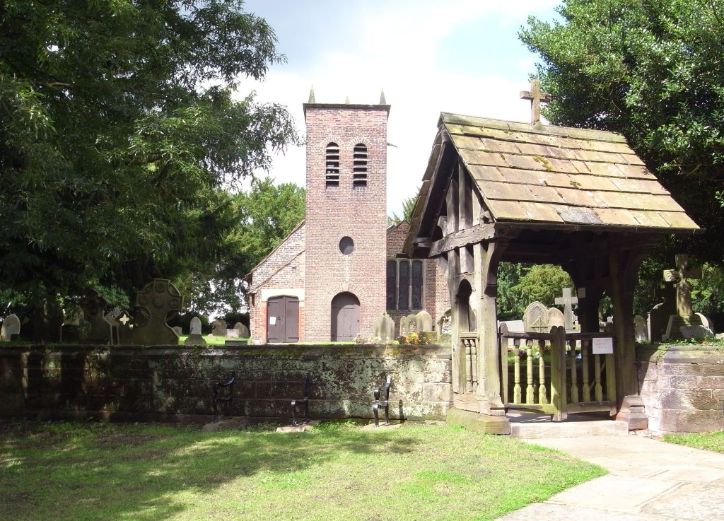
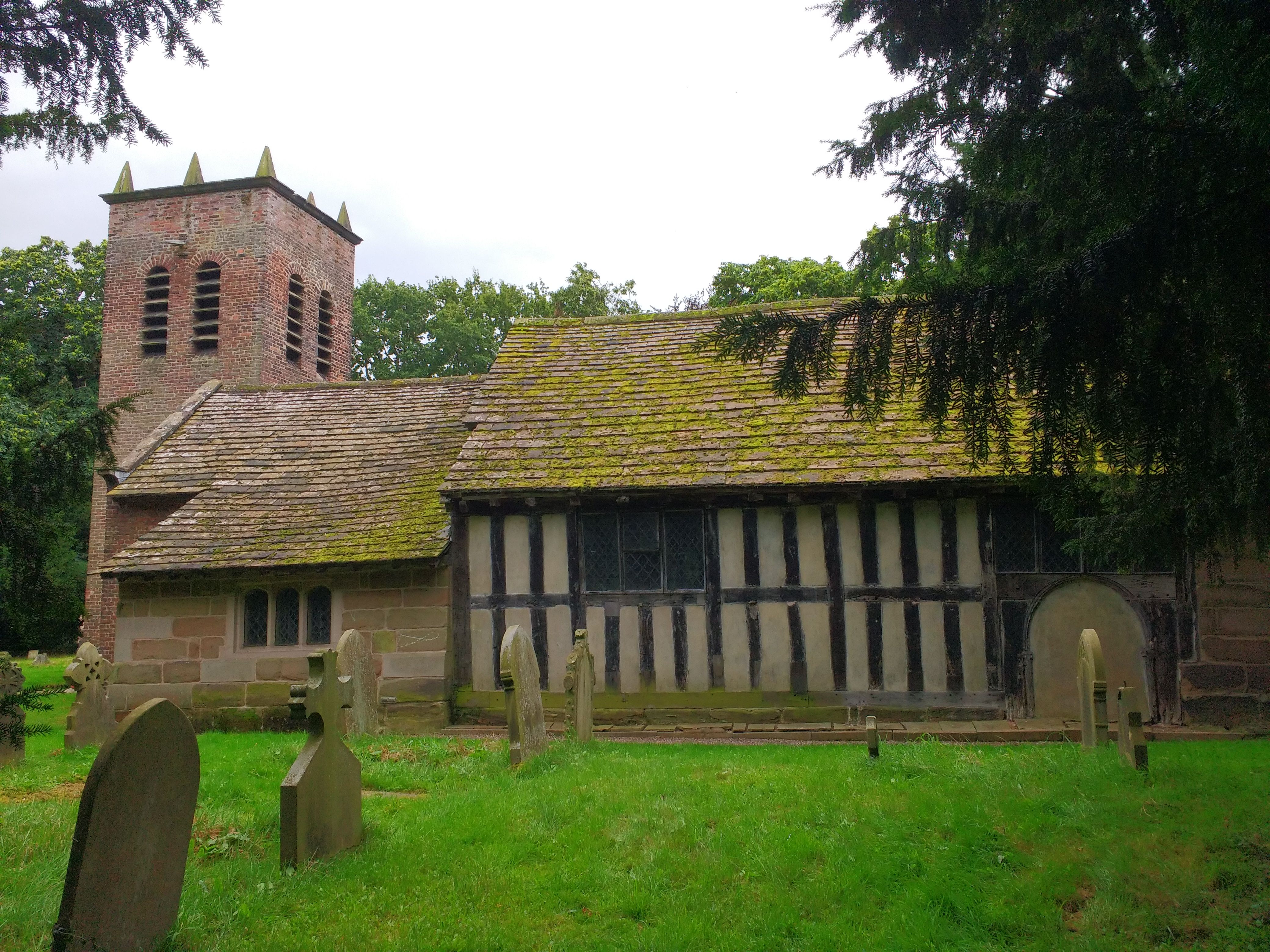
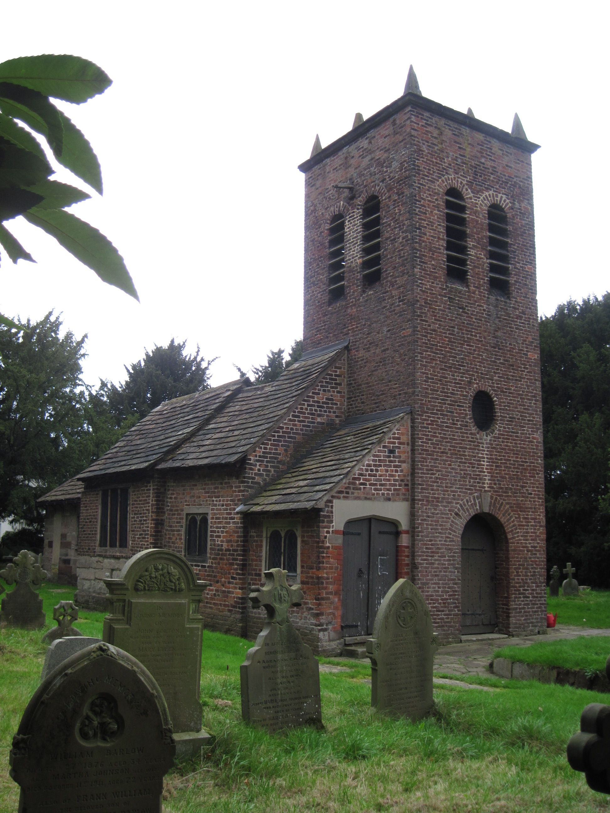
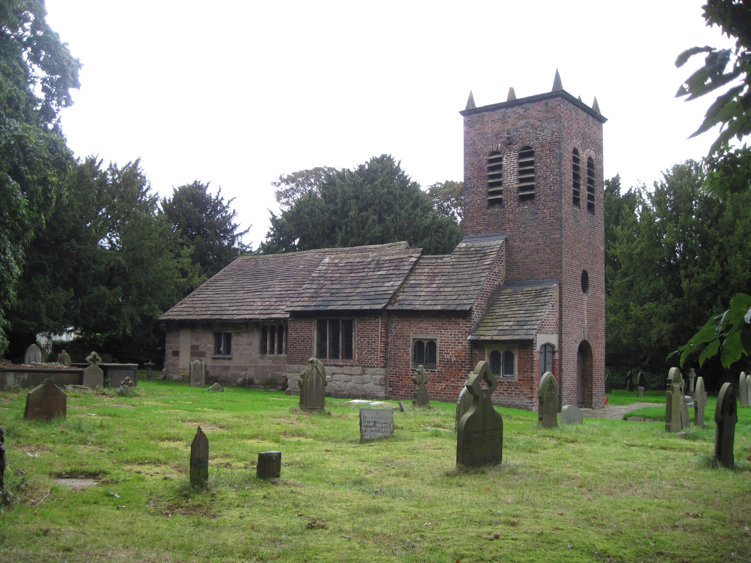
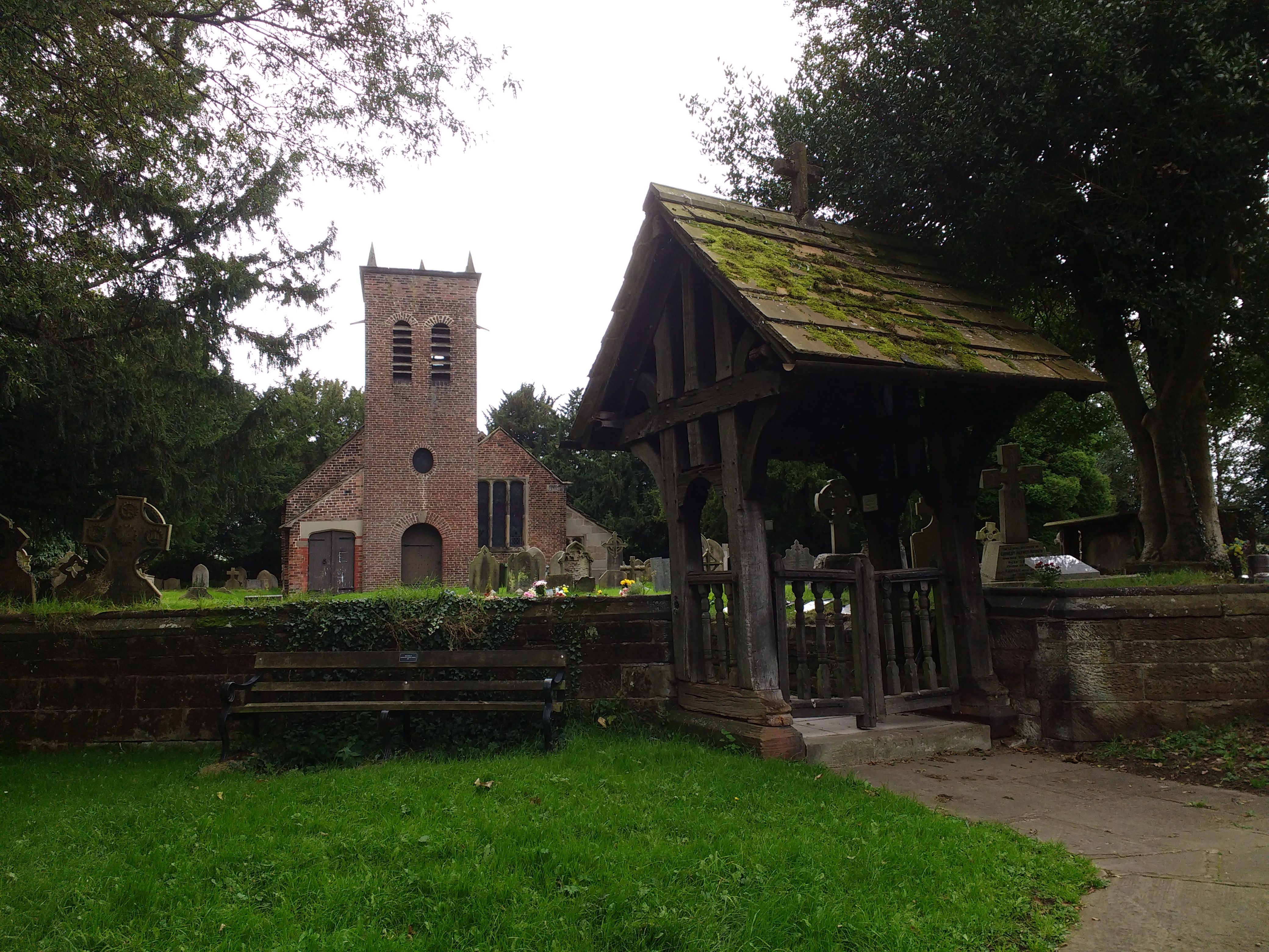
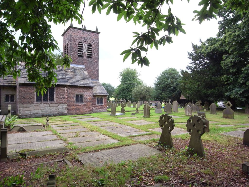
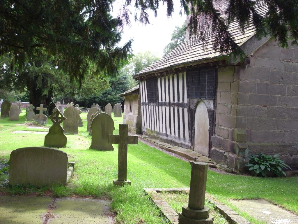
| Description | : | The Saint Werburgh cemetery in Warburton surrounds the old church building. The church at this original location was replaced by the new Saint Werburgh's in the 1880s. This new church was built about one mile away and is where the parish holds its regular worship services. There is no cemetery at the new facility. Most of the monumental inscriptions were taken from "The Inscriptions of St. Werbergh's (sic), The Old Parish Church of Warburton" copied and published by Graham C. Normansell, 1998, supplemented by inscriptions recorded by Rev. Geoffrey Egerton Warburton in 1909 which are no longer visible. |
frequently asked questions (FAQ):
-
Where is Saint Werburgh's Churchyard?
Saint Werburgh's Churchyard is located at Warburton, Metropolitan Borough of Trafford ,Greater Manchester ,England.
-
Saint Werburgh's Churchyard cemetery's updated grave count on graveviews.com?
1629 memorials
-
Where are the coordinates of the Saint Werburgh's Churchyard?
Latitude: 53.4021610
Longitude: -2.4572830
Nearby Cemetories:
1. Hollinfare Cemetery
Rixton with Glazebrook, Warrington Unitary Authority, England
Coordinate: 53.4165900, -2.4575100
2. St. Peter's Parish Churchyard
Lymm, Warrington Unitary Authority, England
Coordinate: 53.3802800, -2.4610000
3. Lymm Baptist Churchyard
Lymm, Warrington Unitary Authority, England
Coordinate: 53.3765240, -2.4724300
4. Saint Mary's Churchyard
Lymm, Warrington Unitary Authority, England
Coordinate: 53.3771000, -2.4784000
5. Dunham Lawn Cemetery
Dunham Massey, Metropolitan Borough of Trafford, England
Coordinate: 53.4036500, -2.3953800
6. Altrincham Crematorium
Dunham Massey, Metropolitan Borough of Trafford, England
Coordinate: 53.4041600, -2.3943760
7. Holy Trinity Churchyard
Little Bollington, Cheshire East Unitary Authority, England
Coordinate: 53.3744640, -2.4121950
8. Saint George Churchyard
Carrington, Metropolitan Borough of Trafford, England
Coordinate: 53.4300760, -2.4109550
9. All Saints Churchyard
Thelwall, Warrington Unitary Authority, England
Coordinate: 53.3822300, -2.5282700
10. Risley Presbyterian Church Churchyard
Warrington Unitary Authority, England
Coordinate: 53.4322500, -2.5283880
11. Newchurch Parish Church
Culcheth, Warrington Unitary Authority, England
Coordinate: 53.4505900, -2.5105500
12. St Wilfrid's Churchyard
Grappenhall, Warrington Unitary Authority, England
Coordinate: 53.3723000, -2.5434000
13. Christ Church Graveyard
Padgate, Warrington Unitary Authority, England
Coordinate: 53.4072619, -2.5565873
14. St Mary the Virgin Churchyard
Bowdon, Metropolitan Borough of Trafford, England
Coordinate: 53.3778850, -2.3643390
15. Unitarian Chapel
Croft, Warrington Unitary Authority, England
Coordinate: 53.4345995, -2.5440079
16. Christ Church Churchyard
Warrington, Warrington Unitary Authority, England
Coordinate: 53.4376659, -2.5428132
17. St George's Churchyard
Altrincham, Metropolitan Borough of Trafford, England
Coordinate: 53.3900000, -2.3511000
18. St. Mary's Churchyard
Rostherne, Cheshire East Unitary Authority, England
Coordinate: 53.3494630, -2.3880170
19. Warrington Cemetery
Warrington, Warrington Unitary Authority, England
Coordinate: 53.3964660, -2.5730780
20. All Saints Churchyard
Glazebury, Warrington Unitary Authority, England
Coordinate: 53.4698200, -2.4951800
21. Urmston Cemetery
Urmston, Metropolitan Borough of Trafford, England
Coordinate: 53.4419290, -2.3533890
22. St Peter Churchyard
Hale, Metropolitan Borough of Trafford, England
Coordinate: 53.3753110, -2.3417960
23. Appleton Thorn St. Cross Churchyard
Appleton, Warrington Unitary Authority, England
Coordinate: 53.3501000, -2.5455000
24. St. Elphin's Churchyard
Warrington, Warrington Unitary Authority, England
Coordinate: 53.3909750, -2.5800370