
| Memorials | : | 885 |
| Location | : | East Dereham, Breckland Borough, England |
| Coordinate | : | 52.6810280, 0.9379390 |
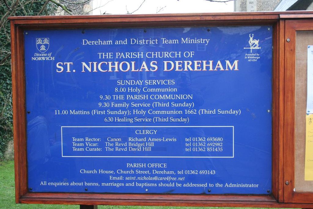
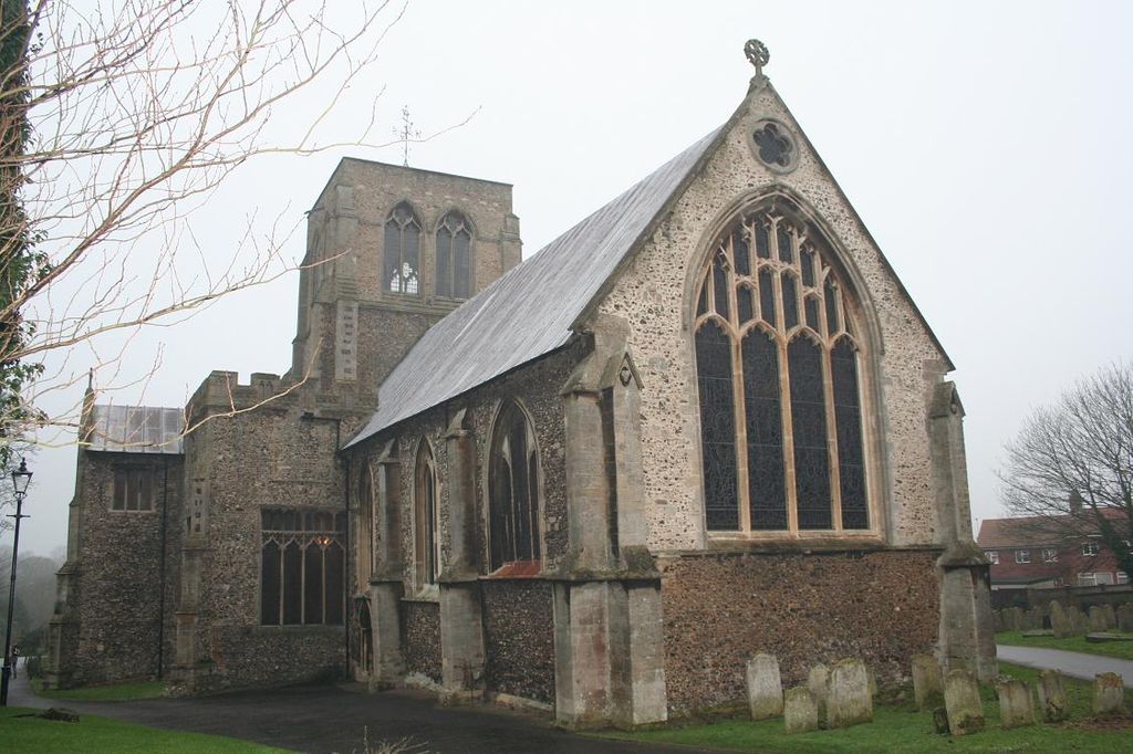
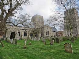
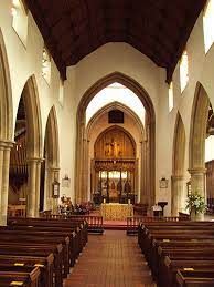
| Description | : | The church of St Nicholas Dereham is pre-Conquest in origin. The earliest visible fabric is 12th century with 13th, 14th and 15th century additions. The detached bell tower was built to the south circa 1515-25. The church was restored in the 19th century. A square churchyard surrounds the church and bell tower. Outside the west door is ‘St Withburga's Well' where the saint was first buried. This was an important shrine of pilgrimage in Saxon times. Near to the well is a memorial to a French POW who was shot in 1799 trying to escape the bell tower where he... Read More |
frequently asked questions (FAQ):
-
Where is St Nicholas Churchyard?
St Nicholas Churchyard is located at Church Street East Dereham, Breckland Borough ,Norfolk , NR19 1DNEngland.
-
St Nicholas Churchyard cemetery's updated grave count on graveviews.com?
885 memorials
-
Where are the coordinates of the St Nicholas Churchyard?
Latitude: 52.6810280
Longitude: 0.9379390
Nearby Cemetories:
1. East Dereham Cemetery
East Dereham, Breckland Borough, England
Coordinate: 52.6861090, 0.9446600
2. St. Andrews Churchyard
Hoe, Breckland Borough, England
Coordinate: 52.7084840, 0.9555160
3. St. Peter and St. Paul Parish Churchyard
Scarning, Breckland Borough, England
Coordinate: 52.6722444, 0.8887583
4. St. Mary's Churchyard
Gressenhall, Breckland Borough, England
Coordinate: 52.7017300, 0.8980110
5. St. Mary Magdalene Churchyard
Beetley, Breckland Borough, England
Coordinate: 52.7283590, 0.9215840
6. St. Andrew and St. Peter Churchyard
Longham, Breckland Borough, England
Coordinate: 52.7085850, 0.8586910
7. Shipdham Parish Cemetery
Shipdham, Breckland Borough, England
Coordinate: 52.6272990, 0.8971110
8. All Saints Churchyard
Shipdham, Breckland Borough, England
Coordinate: 52.6287050, 0.8916720
9. St. Mary's Churchyard
North Tuddenham, Breckland Borough, England
Coordinate: 52.6753000, 1.0389600
10. St. Mary's Churchyard
East Bilney, Breckland Borough, England
Coordinate: 52.7382920, 0.8961870
11. St. Margaret's Churchyard
Garvestone, Breckland Borough, England
Coordinate: 52.6264200, 0.9889550
12. Mattishall cemetery
Mattishall, Breckland Borough, England
Coordinate: 52.6597100, 1.0353800
13. All Saints' Churchyard
Mattishall, Breckland Borough, England
Coordinate: 52.6580670, 1.0346230
14. St Mary's Churchyard
Bylaugh, Breckland Borough, England
Coordinate: 52.7245880, 1.0136460
15. St Peter's Church Mattishall Burgh
Mattishall, Breckland Borough, England
Coordinate: 52.6647174, 1.0396513
16. Saint Mary the Virgin Churchyard
Elsing, Breckland Borough, England
Coordinate: 52.7076070, 1.0354460
17. St. Mary's Churchyard
Bradenham, Breckland Borough, England
Coordinate: 52.6389433, 0.8521896
18. St. Peter's Churchyard
Billingford, Breckland Borough, England
Coordinate: 52.7443680, 0.9812590
19. St Paul's Church Thuxton
Dereham, Breckland Borough, England
Coordinate: 52.6239060, 1.0013630
20. St. Peter's Churchyard
Reymerston, Breckland Borough, England
Coordinate: 52.6144500, 0.9827500
21. St. Mary the Virgin Churchyard
North Elmham, Breckland Borough, England
Coordinate: 52.7546410, 0.9443500
22. St. Michael's Churchyard
Hockering, Breckland Borough, England
Coordinate: 52.6771691, 1.0629078
23. St. Mary's Churchyard
Little Fransham, Breckland Borough, England
Coordinate: 52.6747700, 0.8118700
24. All Saints, Welborne
South Norfolk District, England
Coordinate: 52.6496860, 1.0546670