
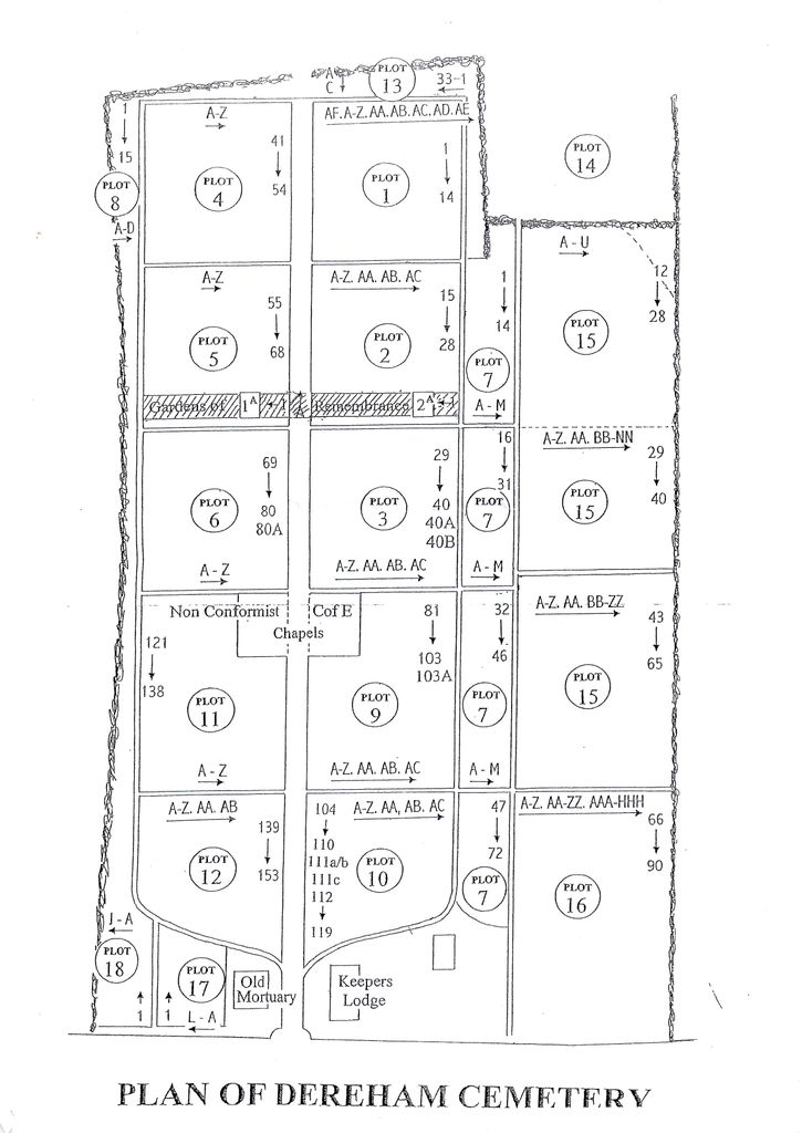
| Memorials | : | 856 |
| Location | : | East Dereham, Breckland Borough, England |
| Coordinate | : | 52.6861090, 0.9446600 |
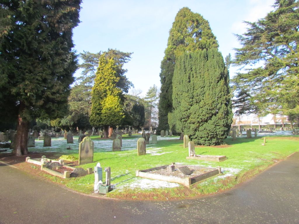
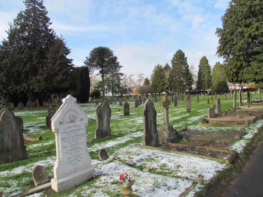
| Description | : | The Cemetery was opened in 1869: it is about 5 acres in extent and contains two mortuary chapels; it is under the control of a Burial Board of 9 members. |
frequently asked questions (FAQ):
-
Where is East Dereham Cemetery?
East Dereham Cemetery is located at 3 Cemetery Rd East Dereham, Breckland Borough ,Norfolk , NR19 2ETEngland.
-
East Dereham Cemetery cemetery's updated grave count on graveviews.com?
856 memorials
-
Where are the coordinates of the East Dereham Cemetery?
Latitude: 52.6861090
Longitude: 0.9446600

Nearby Cemetories:
1. St Nicholas Churchyard
East Dereham, Breckland Borough, England
Coordinate: 52.6810280, 0.9379390
2. St. Andrews Churchyard
Hoe, Breckland Borough, England
Coordinate: 52.7084840, 0.9555160
3. St. Mary's Churchyard
Gressenhall, Breckland Borough, England
Coordinate: 52.7017300, 0.8980110
4. St. Peter and St. Paul Parish Churchyard
Scarning, Breckland Borough, England
Coordinate: 52.6722444, 0.8887583
5. St. Mary Magdalene Churchyard
Beetley, Breckland Borough, England
Coordinate: 52.7283590, 0.9215840
6. St. Andrew and St. Peter Churchyard
Longham, Breckland Borough, England
Coordinate: 52.7085850, 0.8586910
7. St Mary's Churchyard
Bylaugh, Breckland Borough, England
Coordinate: 52.7245880, 1.0136460
8. St. Mary's Churchyard
North Tuddenham, Breckland Borough, England
Coordinate: 52.6753000, 1.0389600
9. Saint Mary the Virgin Churchyard
Elsing, Breckland Borough, England
Coordinate: 52.7076070, 1.0354460
10. St. Mary's Churchyard
East Bilney, Breckland Borough, England
Coordinate: 52.7382920, 0.8961870
11. Mattishall cemetery
Mattishall, Breckland Borough, England
Coordinate: 52.6597100, 1.0353800
12. All Saints' Churchyard
Mattishall, Breckland Borough, England
Coordinate: 52.6580670, 1.0346230
13. St Peter's Church Mattishall Burgh
Mattishall, Breckland Borough, England
Coordinate: 52.6647174, 1.0396513
14. St. Peter's Churchyard
Billingford, Breckland Borough, England
Coordinate: 52.7443680, 0.9812590
15. St. Margaret's Churchyard
Garvestone, Breckland Borough, England
Coordinate: 52.6264200, 0.9889550
16. Shipdham Parish Cemetery
Shipdham, Breckland Borough, England
Coordinate: 52.6272990, 0.8971110
17. All Saints Churchyard
Shipdham, Breckland Borough, England
Coordinate: 52.6287050, 0.8916720
18. St. Mary the Virgin Churchyard
North Elmham, Breckland Borough, England
Coordinate: 52.7546410, 0.9443500
19. St Paul's Church Thuxton
Dereham, Breckland Borough, England
Coordinate: 52.6239060, 1.0013630
20. St. Michael's Churchyard
Hockering, Breckland Borough, England
Coordinate: 52.6771691, 1.0629078
21. St. Mary's Churchyard
Bradenham, Breckland Borough, England
Coordinate: 52.6389433, 0.8521896
22. St. Peter's Churchyard
Reymerston, Breckland Borough, England
Coordinate: 52.6144500, 0.9827500
23. All Saints, Welborne
South Norfolk District, England
Coordinate: 52.6496860, 1.0546670
24. All Saints Churchyard
Mattishall, Breckland Borough, England
Coordinate: 52.6498440, 1.0551390