
| Memorials | : | 0 |
| Location | : | Alvaston, Derby Unitary Authority, England |
| Coordinate | : | 52.8961970, -1.4182020 |
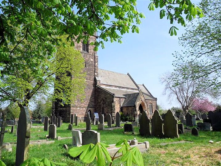
| Description | : | Derby St Michael is an Ancient Parish and a market town in the county of Derbyshire. The church, which is very ancient, and of unknown date, has some good specimens of early English architecture, and of the depressed arch of the time of Henry VII.; behind the pulpit the remains of a rood-loft. The chapel of Alvaston is in St. Michael's parish. The new edifice of Christchurch, Derby, was consecrated by the Bishop of Lichfield in January 1844. Records exist back to 1559. |
frequently asked questions (FAQ):
-
Where is St. Michael & All Angels Churchyard?
St. Michael & All Angels Churchyard is located at Alvaston, Derby Unitary Authority ,Derbyshire ,England.
-
St. Michael & All Angels Churchyard cemetery's updated grave count on graveviews.com?
0 memorials
-
Where are the coordinates of the St. Michael & All Angels Churchyard?
Latitude: 52.8961970
Longitude: -1.4182020
Nearby Cemetories:
1. St Mary Churchyard
Boulton Moor, Derby Unitary Authority, England
Coordinate: 52.8934130, -1.4300740
2. St Bartholomew Churchyard
Elvaston, South Derbyshire District, England
Coordinate: 52.8926540, -1.3965070
3. Saint Werburgh
Spondon, Derby Unitary Authority, England
Coordinate: 52.9192500, -1.4094400
4. Methodist Cemetery
Borrowash, Erewash Borough, England
Coordinate: 52.9064496, -1.3784038
5. St. Peter's Churchyard
Chellaston, Derby Unitary Authority, England
Coordinate: 52.8694725, -1.4350250
6. St Mary Churchyard
Chaddesden, Derby Unitary Authority, England
Coordinate: 52.9280661, -1.4333033
7. St. Mary's Parish Church Cemetery
Derby Unitary Authority, England
Coordinate: 52.9281277, -1.4335680
8. Nottingham Road Cemetery
Chaddesden, Derby Unitary Authority, England
Coordinate: 52.9262520, -1.4472770
9. All Saints Churchyard
Ockbrook, Erewash Borough, England
Coordinate: 52.9170770, -1.3713030
10. Chaddesden Cemetery
Chaddesden, Derby Unitary Authority, England
Coordinate: 52.9266230, -1.4476160
11. Ockbrook Moravian Burial Ground
Ockbrook, Erewash Borough, England
Coordinate: 52.9215600, -1.3755740
12. Moor Lane
Aston on Trent, South Derbyshire District, England
Coordinate: 52.8651600, -1.3826900
13. All Saints Churchyard
Aston on Trent, South Derbyshire District, England
Coordinate: 52.8606040, -1.3866670
14. Normanton Cemetery
Normanton, Derby Unitary Authority, England
Coordinate: 52.8968930, -1.4927830
15. Derby Cathedral
Derby, Derby Unitary Authority, England
Coordinate: 52.9248070, -1.4771920
16. St. James' Churchyard
Swarkestone, South Derbyshire District, England
Coordinate: 52.8535560, -1.4490940
17. Friar Gate Unitarian Chapel Chapelyard
Derby, Derby Unitary Authority, England
Coordinate: 52.9234250, -1.4840970
18. St. Alkmund's Churchyard
Derby, Derby Unitary Authority, England
Coordinate: 52.9281428, -1.4784725
19. St James Churchyard
Shardlow, South Derbyshire District, England
Coordinate: 52.8686280, -1.3508150
20. Uttoxeter Road Cemetery
Derby, Derby Unitary Authority, England
Coordinate: 52.9194000, -1.4938100
21. St Mary the Virgin Churchyard
Weston on Trent, South Derbyshire District, England
Coordinate: 52.8444900, -1.4105600
22. St Peter's Churchyard
Littleover, Derby Unitary Authority, England
Coordinate: 52.9039020, -1.5068650
23. Barrow Upon Trent Cemetery
Barrow upon Trent, South Derbyshire District, England
Coordinate: 52.8532164, -1.4788765
24. St Wilfrid Churchyard
Barrow upon Trent, South Derbyshire District, England
Coordinate: 52.8517910, -1.4773020