| Memorials | : | 0 |
| Location | : | Borrowash, Erewash Borough, England |
| Coordinate | : | 52.9064496, -1.3784038 |
| Description | : | On 27 August 1867 land was purchased for the interment of the dead by the inhabitants of Borrowash. All but one of the fifteen trustees were to be members of the Borrowash Wesleyan Chapel and the other from the Primitive Chapel. The first burial was on 15 March 1868; the last was on 3 August 1948. By 1970 there were no living trustees. In April 1979 the Charity Commissioners appointed Ockbrook Parish Council [sic] to be trustees of the charity. William Barron, who had been head gardener at Elvaston Castle, was buried in 1891 in the old burial ground (now off... Read More |
frequently asked questions (FAQ):
-
Where is Methodist Cemetery?
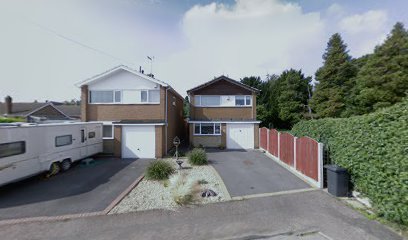
Methodist Cemetery is located at Off Nursery Close, Borrowash Borrowash, Erewash Borough ,Derbyshire ,England.
-
Methodist Cemetery cemetery's updated grave count on graveviews.com?
0 memorials
-
Where are the coordinates of the Methodist Cemetery?
Latitude: 52.9064496
Longitude: -1.3784038
Nearby Cemetories:
1. All Saints Churchyard
Ockbrook, Erewash Borough, England
Coordinate: 52.9170770, -1.3713030
2. Ockbrook Moravian Burial Ground
Ockbrook, Erewash Borough, England
Coordinate: 52.9215600, -1.3755740
3. St Bartholomew Churchyard
Elvaston, South Derbyshire District, England
Coordinate: 52.8926540, -1.3965070
4. Saint Werburgh
Spondon, Derby Unitary Authority, England
Coordinate: 52.9192500, -1.4094400
5. St. Michael & All Angels Churchyard
Alvaston, Derby Unitary Authority, England
Coordinate: 52.8961970, -1.4182020
6. St Mary Churchyard
Boulton Moor, Derby Unitary Authority, England
Coordinate: 52.8934130, -1.4300740
7. St. Michael Churchyard
Breaston, Erewash Borough, England
Coordinate: 52.8969700, -1.3176200
8. All Saints Risley Churchyard
Risley, Erewash Borough, England
Coordinate: 52.9164000, -1.3158000
9. St Mary Churchyard
Chaddesden, Derby Unitary Authority, England
Coordinate: 52.9280661, -1.4333033
10. St. Mary's Parish Church Cemetery
Derby Unitary Authority, England
Coordinate: 52.9281277, -1.4335680
11. St James Churchyard
Shardlow, South Derbyshire District, England
Coordinate: 52.8686280, -1.3508150
12. Moor Lane
Aston on Trent, South Derbyshire District, England
Coordinate: 52.8651600, -1.3826900
13. Nottingham Road Cemetery
Chaddesden, Derby Unitary Authority, England
Coordinate: 52.9262520, -1.4472770
14. All Saints Churchyard
Aston on Trent, South Derbyshire District, England
Coordinate: 52.8606040, -1.3866670
15. Chaddesden Cemetery
Chaddesden, Derby Unitary Authority, England
Coordinate: 52.9266230, -1.4476160
16. St. Peter's Churchyard
Chellaston, Derby Unitary Authority, England
Coordinate: 52.8694725, -1.4350250
17. St. Andrew's Churchyard
Stanley, Erewash Borough, England
Coordinate: 52.9594760, -1.3772680
18. Sawley Baptist Churchyard
Sawley, Erewash Borough, England
Coordinate: 52.8799410, -1.3009980
19. All Saints Churchyard
Sawley, Erewash Borough, England
Coordinate: 52.8776016, -1.2995000
20. St. Wilfrid Churchyard
West Hallam, Erewash Borough, England
Coordinate: 52.9656640, -1.3579720
21. Long Eaton Cemetery
Long Eaton, Erewash Borough, England
Coordinate: 52.8986580, -1.2785390
22. Derby Cathedral
Derby, Derby Unitary Authority, England
Coordinate: 52.9248070, -1.4771920
23. All Saints Churchyard
Breadsall, Erewash Borough, England
Coordinate: 52.9541194, -1.4485645
24. St. Alkmund's Churchyard
Derby, Derby Unitary Authority, England
Coordinate: 52.9281428, -1.4784725

