
| Memorials | : | 0 |
| Location | : | Littleover, Derby Unitary Authority, England |
| Coordinate | : | 52.9039020, -1.5068650 |
| Description | : | Littleover is a large suburb of Derby, England situated between Rose Hill, Normanton, Sunny Hill, South Derbyshire and Mickleover about three miles south west of Derby city center. |
frequently asked questions (FAQ):
-
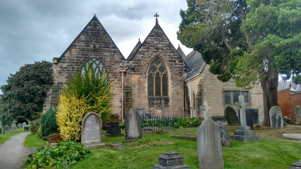
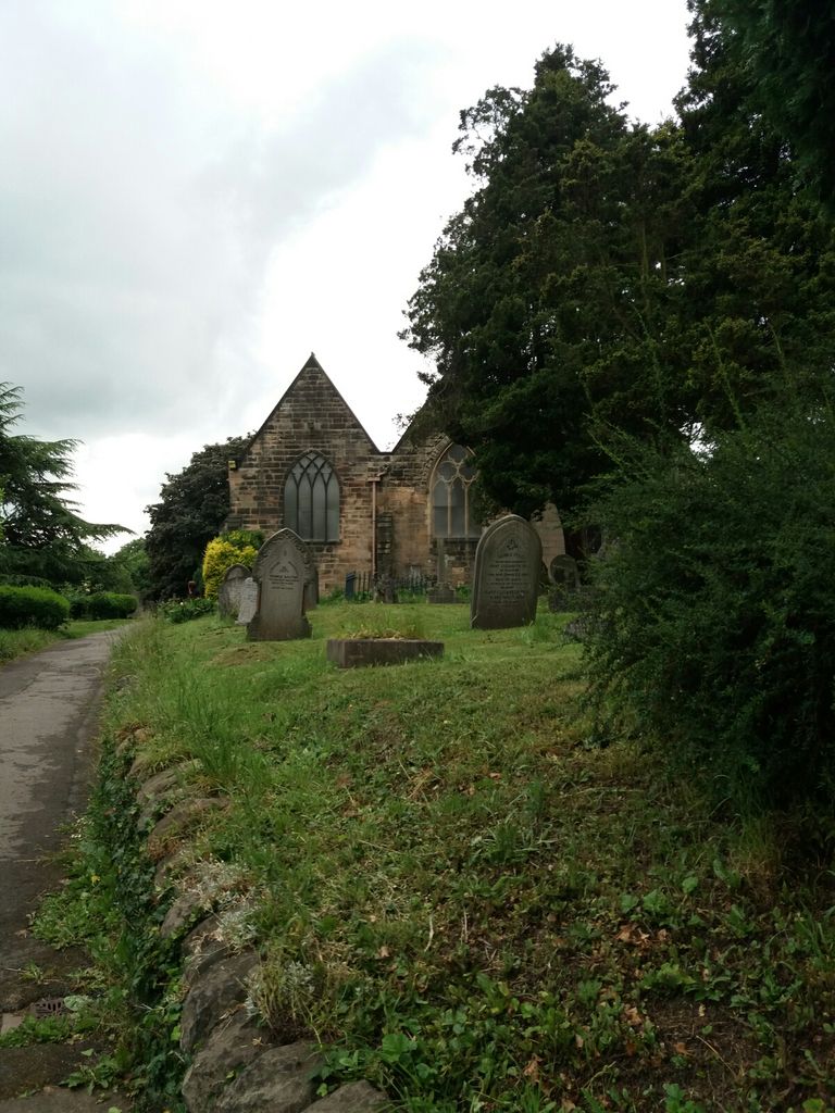
Where is St Peter's Churchyard?
St Peter's Churchyard is located at Church Street Littleover, Derby Unitary Authority ,Derbyshire , DE23 6GFEngland.
-
St Peter's Churchyard cemetery's updated grave count on graveviews.com?
0 memorials
-
Where are the coordinates of the St Peter's Churchyard?
Latitude: 52.9039020
Longitude: -1.5068650
Nearby Cemetories:
1. Normanton Cemetery
Normanton, Derby Unitary Authority, England
Coordinate: 52.8968930, -1.4927830
2. Uttoxeter Road Cemetery
Derby, Derby Unitary Authority, England
Coordinate: 52.9194000, -1.4938100
3. Friar Gate Unitarian Chapel Chapelyard
Derby, Derby Unitary Authority, England
Coordinate: 52.9234250, -1.4840970
4. All Saints Churchyard
Mickleover, Derby Unitary Authority, England
Coordinate: 52.9043630, -1.5476790
5. Derby Cathedral
Derby, Derby Unitary Authority, England
Coordinate: 52.9248070, -1.4771920
6. St. Alkmund's Churchyard
Derby, Derby Unitary Authority, England
Coordinate: 52.9281428, -1.4784725
7. Markeaton Crematorium
Derby, Derby Unitary Authority, England
Coordinate: 52.9338110, -1.5172230
8. All Saints Churchyard
Mackworth, Amber Valley Borough, England
Coordinate: 52.9362637, -1.5249797
9. Nottingham Road Cemetery
Chaddesden, Derby Unitary Authority, England
Coordinate: 52.9262520, -1.4472770
10. Chaddesden Cemetery
Chaddesden, Derby Unitary Authority, England
Coordinate: 52.9266230, -1.4476160
11. St Matthew Churchyard
Darley Abbey, Derby Unitary Authority, England
Coordinate: 52.9447240, -1.4793920
12. St Andrews Churchyard
Radbourne, South Derbyshire District, England
Coordinate: 52.9207000, -1.5759800
13. St Mary Churchyard
Boulton Moor, Derby Unitary Authority, England
Coordinate: 52.8934130, -1.4300740
14. St. Mary's Parish Church Cemetery
Derby Unitary Authority, England
Coordinate: 52.9281277, -1.4335680
15. St Mary Churchyard
Chaddesden, Derby Unitary Authority, England
Coordinate: 52.9280661, -1.4333033
16. St Edmund Churchyard
Allestree, Derby Unitary Authority, England
Coordinate: 52.9536510, -1.4835460
17. Barrow Upon Trent Cemetery
Barrow upon Trent, South Derbyshire District, England
Coordinate: 52.8532164, -1.4788765
18. Old Chapel
Quarndon, Amber Valley Borough, England
Coordinate: 52.9575000, -1.5063000
19. St. Michael & All Angels Churchyard
Alvaston, Derby Unitary Authority, England
Coordinate: 52.8961970, -1.4182020
20. St Wilfrid Churchyard
Barrow upon Trent, South Derbyshire District, England
Coordinate: 52.8517910, -1.4773020
21. St. Peter's Churchyard
Chellaston, Derby Unitary Authority, England
Coordinate: 52.8694725, -1.4350250
22. All Saints Churchyard
Kedleston, Amber Valley Borough, England
Coordinate: 52.9592000, -1.5367000
23. St Michaels Churchyard
Kirk Langley, Amber Valley Borough, England
Coordinate: 52.9463000, -1.5747000
24. Saint Helen's Churchyard
Etwall, South Derbyshire District, England
Coordinate: 52.8847700, -1.6017500