
| Memorials | : | 1 |
| Location | : | Caerhays, Cornwall Unitary Authority, England |
| Coordinate | : | 50.2443200, -4.8573900 |
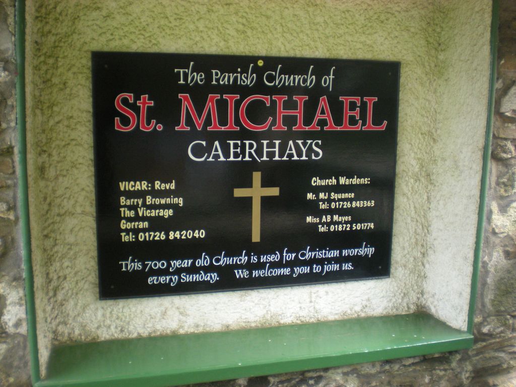
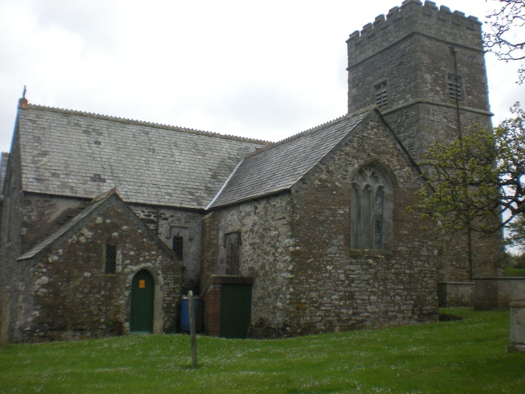
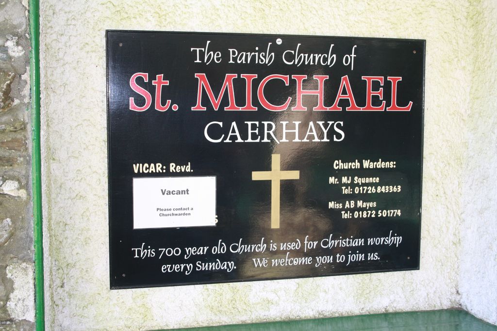
| Description | : | St Michael's Churchyard is small and well-kept, but the older stones are disintegrating. It is in the village of CAERHAYS. (Signposted from Gorran, St Ewe, and the St Austell-St Mawes road.) |
frequently asked questions (FAQ):
-
Where is St Michael Churchyard?
St Michael Churchyard is located at Caerhays Caerhays, Cornwall Unitary Authority ,Cornwall , PL26 6LYEngland.
-
St Michael Churchyard cemetery's updated grave count on graveviews.com?
1 memorials
-
Where are the coordinates of the St Michael Churchyard?
Latitude: 50.2443200
Longitude: -4.8573900
Nearby Cemetories:
1. St. Goran Parish Churchyard
Gorran Churchtown, Cornwall Unitary Authority, England
Coordinate: 50.2466460, -4.8075060
2. St. Crida Churchyard
Grampound, Cornwall Unitary Authority, England
Coordinate: 50.2887220, -4.9000630
3. Ladock Parish Cemetery
Ladock, Cornwall Unitary Authority, England
Coordinate: 50.3208230, -4.9577200
4. St. Paul's Churchyard
Charlestown, Cornwall Unitary Authority, England
Coordinate: 50.3364000, -4.7606820
5. Campdowns Cemetery
Charlestown, Cornwall Unitary Authority, England
Coordinate: 50.3375800, -4.7558700
6. St Feock Churchyard
Feock, Cornwall Unitary Authority, England
Coordinate: 50.2058070, -5.0497230
7. St. Keyne Churchyard
Kenwyn, Cornwall Unitary Authority, England
Coordinate: 50.2722640, -5.0611800
8. All Hallows Churchyard
Kea, Cornwall Unitary Authority, England
Coordinate: 50.2430560, -5.0729050
9. St John the Evangelist and St Petroc
Feock, Cornwall Unitary Authority, England
Coordinate: 50.2116600, -5.0929700
10. The Tristan Stone
Fowey, Cornwall Unitary Authority, England
Coordinate: 50.3386540, -4.6540860
11. St Cyriacus and St Julitta Church Cemetery
Luxulyan, Cornwall Unitary Authority, England
Coordinate: 50.3900250, -4.7415450
12. Fowey Cemetery
Fowey, Cornwall Unitary Authority, England
Coordinate: 50.3390083, -4.6395638
13. St Fimbarrus Churchyard
Fowey, Cornwall Unitary Authority, England
Coordinate: 50.3353540, -4.6357340
14. Baldhu Parish Churchyard
Kea, Cornwall Unitary Authority, England
Coordinate: 50.2460420, -5.1264660
15. Falmouth Cemetery
Falmouth, Cornwall Unitary Authority, England
Coordinate: 50.1437550, -5.0755230
16. St Budock Churchyard
Budock, Cornwall Unitary Authority, England
Coordinate: 50.1501600, -5.1003360
17. St Wyllow Churchyard
Lanteglos-by-Fowey, Cornwall Unitary Authority, England
Coordinate: 50.3345070, -4.6089950
18. Lanivet Churchyard
Lanivet, Cornwall Unitary Authority, England
Coordinate: 50.4000600, -4.7038300
19. Lanlivery Churchyard
Lanlivery, Cornwall Unitary Authority, England
Coordinate: 50.3998158, -4.7030720
20. Gunwen Methodist Chapel
Bodmin, Cornwall Unitary Authority, England
Coordinate: 50.4186600, -4.7427070
21. Lostwithiel Borough Cemetery
Lostwithiel, Cornwall Unitary Authority, England
Coordinate: 50.4028000, -4.6754800
22. Cowbridge Cemetery
Lostwithiel, Cornwall Unitary Authority, England
Coordinate: 50.4022400, -4.6732450
23. St. Wenappa Churchyard
Gwennap, Cornwall Unitary Authority, England
Coordinate: 50.2176600, -5.1709770
24. St. Bartholomew Church Cemetery
Lostwithiel, Cornwall Unitary Authority, England
Coordinate: 50.4073690, -4.6691250