
| Memorials | : | 23 |
| Location | : | Aveley, Thurrock Unitary Authority, England |
| Coordinate | : | 51.4980160, 0.2568560 |
frequently asked questions (FAQ):
-
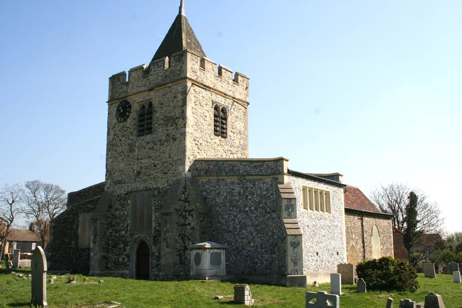
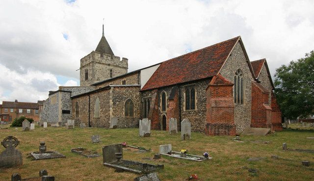
Where is St. Michael’s Churchyard?
St. Michael’s Churchyard is located at High Street/Ship Lane Aveley, Thurrock Unitary Authority ,Essex , RM15 4HBEngland.
-
St. Michael’s Churchyard cemetery's updated grave count on graveviews.com?
23 memorials
-
Where are the coordinates of the St. Michael’s Churchyard?
Latitude: 51.4980160
Longitude: 0.2568560
Nearby Cemetories:
1. St Mary and St Peter Churchyard
Wennington, London Borough of Havering, England
Coordinate: 51.5064790, 0.2173980
2. Hammersmith New Cemetery
Hammersmith, London Borough of Hammersmith and Fulham, England
Coordinate: 51.4710900, 0.2752400
3. Rainham Jewish Cemetery
Rainham, London Borough of Havering, England
Coordinate: 51.5226300, 0.2216150
4. St. Clement's Churchyard
West Thurrock, Thurrock Unitary Authority, England
Coordinate: 51.4722010, 0.2924900
5. St. Nicholas Churchyard
South Ockendon, Thurrock Unitary Authority, England
Coordinate: 51.5224830, 0.2976820
6. South Ockendon Cemetery
South Ockendon, Thurrock Unitary Authority, England
Coordinate: 51.5226000, 0.2988650
7. Cherry Orchard Congregational Church
South Ockendon, Thurrock Unitary Authority, England
Coordinate: 51.5241770, 0.2976050
8. Rainham Cemetery
Rainham, London Borough of Havering, England
Coordinate: 51.5221490, 0.2099420
9. Joyce Green Cemetery
Dartford, Dartford Borough, England
Coordinate: 51.4582590, 0.2299830
10. South Essex Crematorium
Upminster, London Borough of Havering, England
Coordinate: 51.5433380, 0.2583840
11. Upminster Cemetery
Corbets Tey, London Borough of Havering, England
Coordinate: 51.5433330, 0.2592730
12. St Helen and St Giles Churchyard
Rainham, London Borough of Havering, England
Coordinate: 51.5183040, 0.1905660
13. St Peter and St Paul Churchyard
Grays, Thurrock Unitary Authority, England
Coordinate: 51.4755400, 0.3221700
14. St. Mary Magdalene Churchyard
North Ockendon, London Borough of Havering, England
Coordinate: 51.5404030, 0.2875930
15. St. Mary the Virgin Churchyard
Stone, Dartford Borough, England
Coordinate: 51.4503160, 0.2673630
16. St Augustine's Churchyard
Slade Green, London Borough of Bexley, England
Coordinate: 51.4718340, 0.1888540
17. Bow Arrow Lane Cemetery
Dartford, Dartford Borough, England
Coordinate: 51.4472600, 0.2416900
18. Stone House Hospital Cemetery
Stone, Dartford Borough, England
Coordinate: 51.4470300, 0.2415700
19. Christ Church
Erith, London Borough of Bexley, England
Coordinate: 51.4797860, 0.1764520
20. All Saints Churchyard
Cranham, London Borough of Havering, England
Coordinate: 51.5522750, 0.2660270
21. St John the Baptist Churchyard
Erith, London Borough of Bexley, England
Coordinate: 51.4872437, 0.1698430
22. St. Alban's Church Churchyard
Dartford, Dartford Borough, England
Coordinate: 51.4446480, 0.2279500
23. St Mary the Virgin Churchyard
Little Thurrock, Thurrock Unitary Authority, England
Coordinate: 51.4756980, 0.3402920
24. St Stephen
Twickenham, London Borough of Richmond upon Thames, England
Coordinate: 51.4534000, 0.3130400