
| Memorials | : | 0 |
| Location | : | Newton by Toft, West Lindsey District, England |
| Website | : | www.achurchnearyou.com/church/14855/ |
| Coordinate | : | 53.3726210, -0.4216430 |
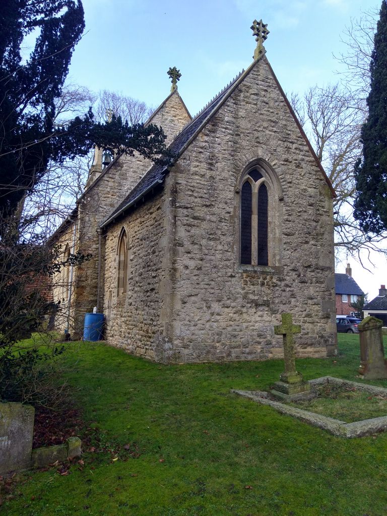
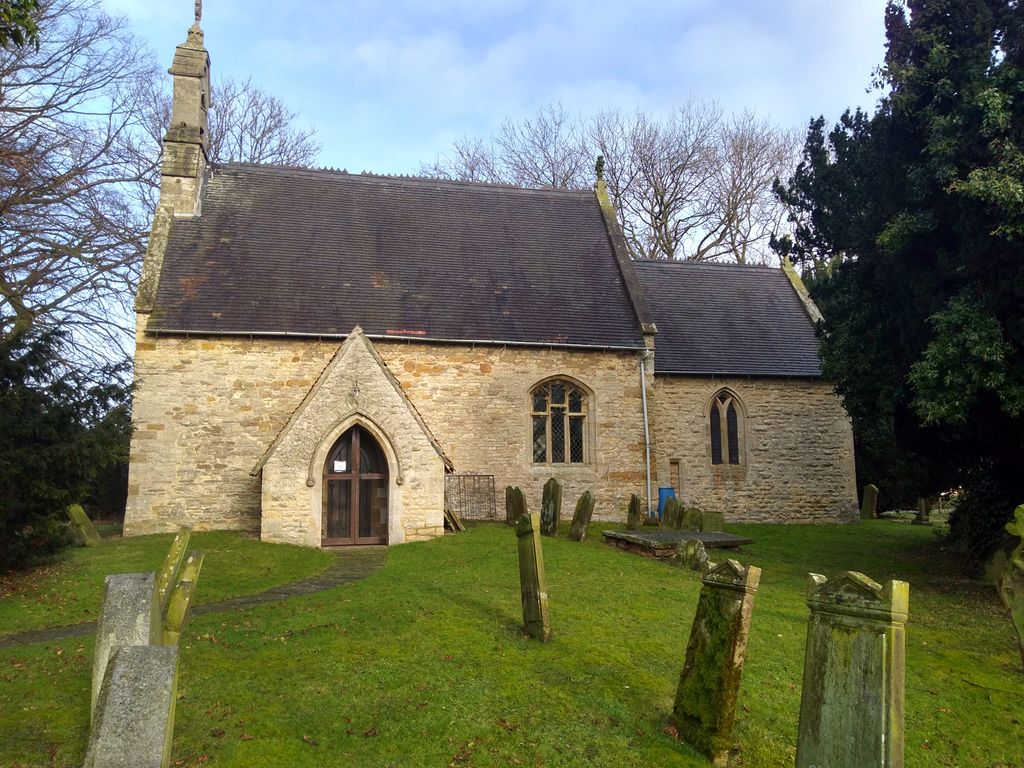
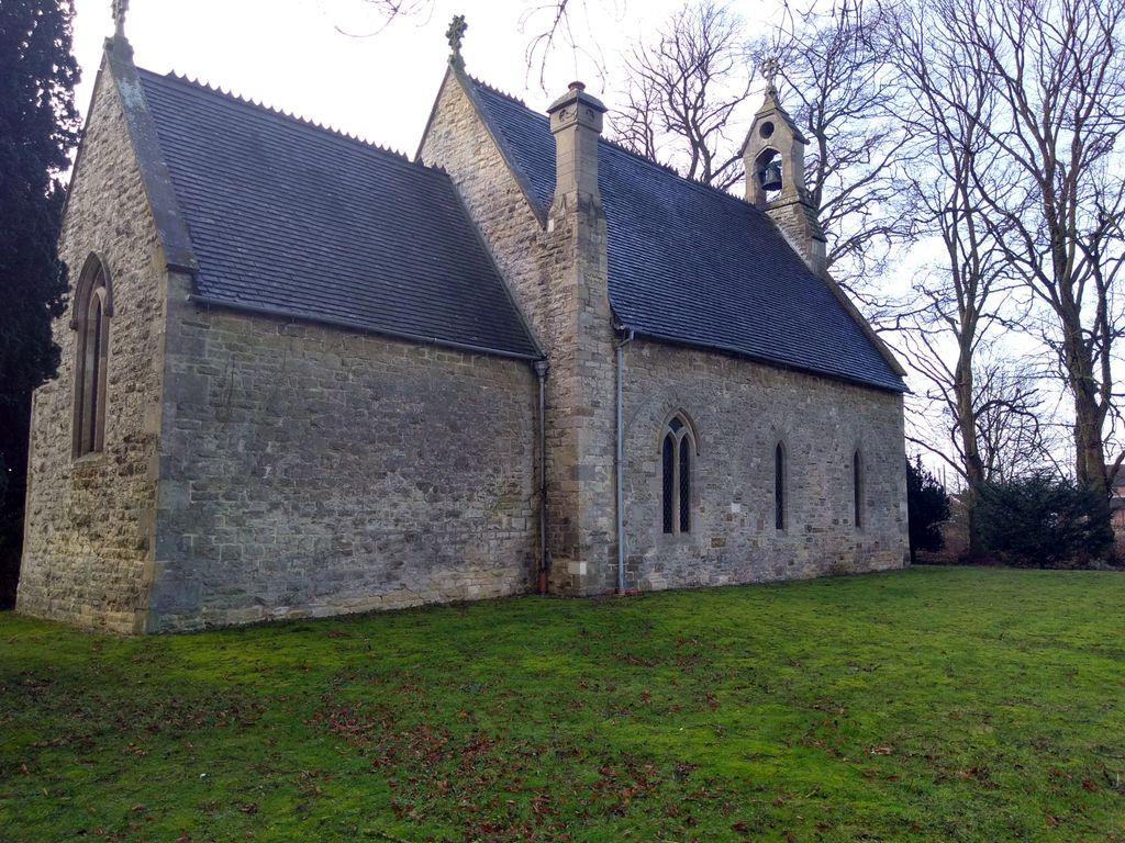
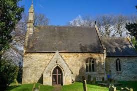
| Description | : | The small church of St Michael dates to at least the 12th century, with evidence of alteration in the 13th, 14th, and 15th centuries, plus a comprehensive restoration in 1860 under the direction of James Fowler, a church architect from Louth. About this church St Michael's is a very simple church composing of a nave, chancel, and south porch, with a bell cote over the western gable. There is a late 13th century window in the chancel and a blocked north arcade from the same period. The unadorned chancel arch is 12th century, but all the interior furnishings date to the Victorian... Read More |
frequently asked questions (FAQ):
-
Where is St Michaels Churchyard?
St Michaels Churchyard is located at Clay Lane Newton and Toft Market Rasen Newton by Toft, West Lindsey District ,Lincolnshire , LN8 3NFEngland.
-
St Michaels Churchyard cemetery's updated grave count on graveviews.com?
0 memorials
-
Where are the coordinates of the St Michaels Churchyard?
Latitude: 53.3726210
Longitude: -0.4216430
Nearby Cemetories:
1. All Saints Churchyard
Faldingworth, West Lindsey District, England
Coordinate: 53.3490800, -0.3995900
2. St. Michael's Churchyard
Buslingthorpe, West Lindsey District, England
Coordinate: 53.3520370, -0.3772470
3. St. Peter & St. Paul Churchyard
Middle Rasen, West Lindsey District, England
Coordinate: 53.3914120, -0.3664170
4. All Saints Churchyard
Cold Hanworth, West Lindsey District, England
Coordinate: 53.3357700, -0.4471700
5. God's Acre
Middle Rasen, West Lindsey District, England
Coordinate: 53.3904700, -0.3614800
6. St. Peter's Churchyard
Friesthorpe, West Lindsey District, England
Coordinate: 53.3367420, -0.3915860
7. St. Helen's Churchyard
Saxby, West Lindsey District, England
Coordinate: 53.3625100, -0.4920400
8. St. Lawrence Churchyard
Snarford, West Lindsey District, England
Coordinate: 53.3283300, -0.4239900
9. St. Peter's Churchyard
Normanby by Spital, West Lindsey District, England
Coordinate: 53.3802120, -0.4963050
10. St. Peter & Paul Churchyard
Owmby-by-Spital, West Lindsey District, England
Coordinate: 53.3735080, -0.4981220
11. Owmby-Normanby Cemetery
Owmby-by-Spital, West Lindsey District, England
Coordinate: 53.3770850, -0.4992190
12. St Nicholas Churchyard
Caenby, West Lindsey District, England
Coordinate: 53.3910500, -0.4976100
13. St Peter Churchyard
Kingerby, West Lindsey District, England
Coordinate: 53.4218900, -0.4104000
14. Kirkby cum Osgodby Cemetery
Kirkby cum Osgodby, West Lindsey District, England
Coordinate: 53.4202700, -0.3977200
15. St Andrew Churchyard
Kirkby cum Osgodby, West Lindsey District, England
Coordinate: 53.4210980, -0.4015720
16. St. Peter's Churchyard
Glentham, West Lindsey District, England
Coordinate: 53.4014270, -0.4927420
17. St. Cornelius Churchyard
Linwood, West Lindsey District, England
Coordinate: 53.3626176, -0.3361707
18. St. Thomas Churchyard
Market Rasen, West Lindsey District, England
Coordinate: 53.3883500, -0.3376700
19. Market Rasen Cemetery
Market Rasen, West Lindsey District, England
Coordinate: 53.3830880, -0.3275890
20. St. John The Baptist Churchyard
Lissington, West Lindsey District, England
Coordinate: 53.3363600, -0.3359800
21. All Saints Churchyard
Snelland, West Lindsey District, England
Coordinate: 53.3120800, -0.3812000
22. St. Martin Churchyard
North Owersby, West Lindsey District, England
Coordinate: 53.4387500, -0.4029500
23. St Michael Churchyard
Hackthorn, West Lindsey District, England
Coordinate: 53.3288810, -0.5134350
24. St. Chad Churchyard
Dunholme, West Lindsey District, England
Coordinate: 53.3018330, -0.4638100