
| Memorials | : | 14 |
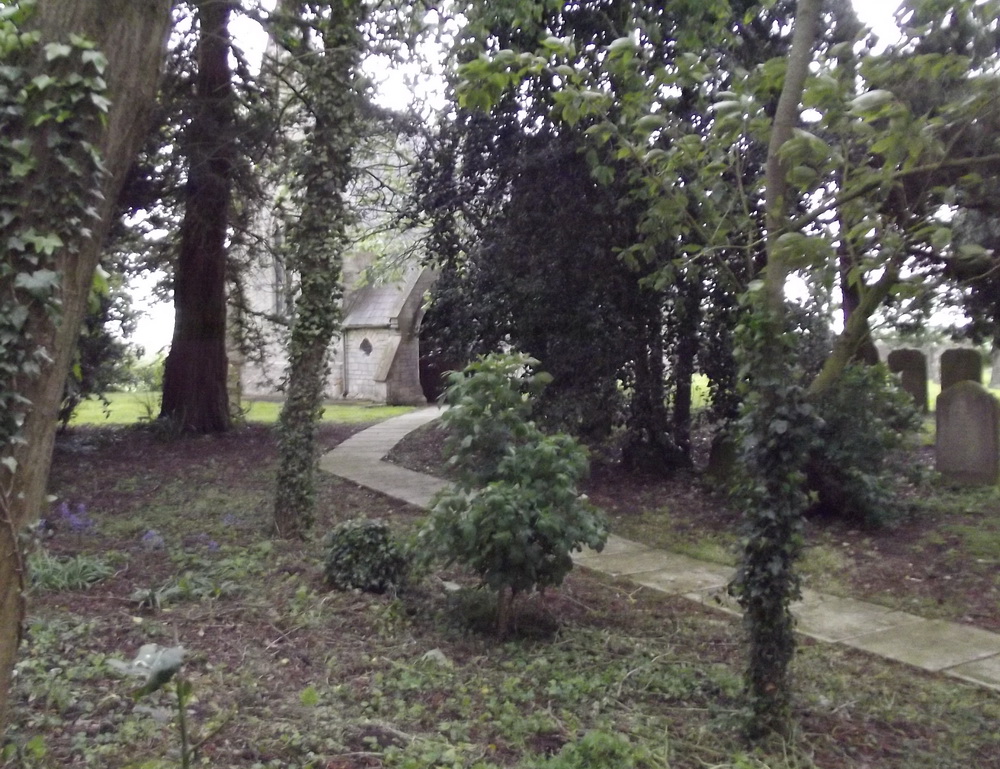
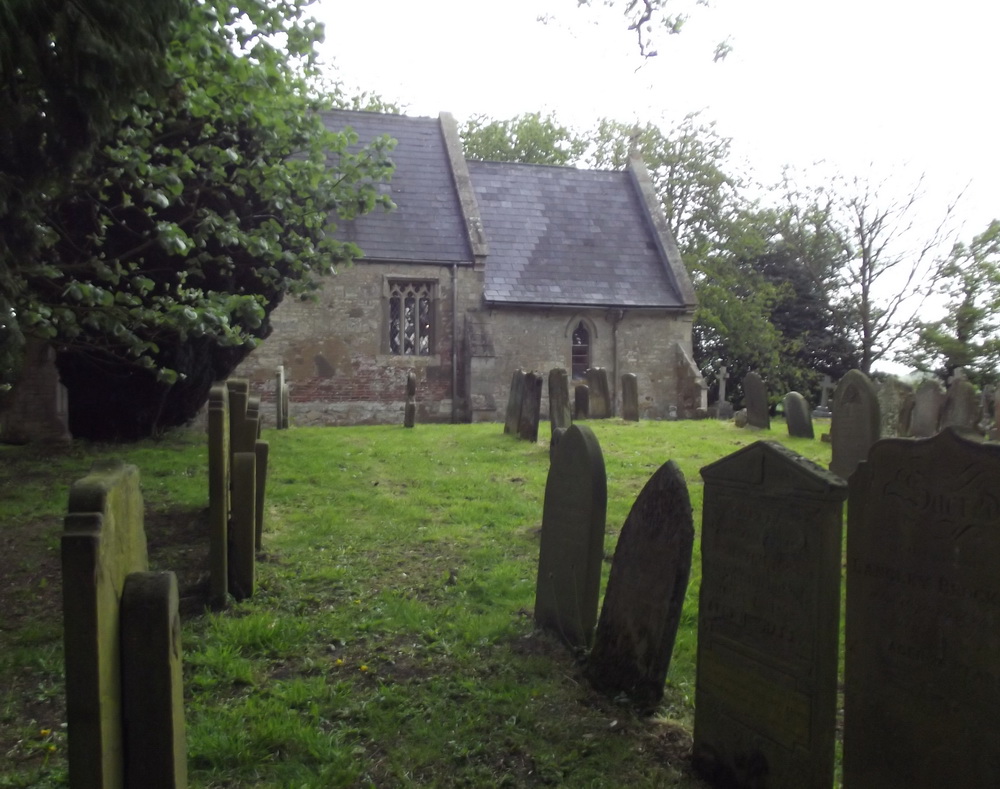
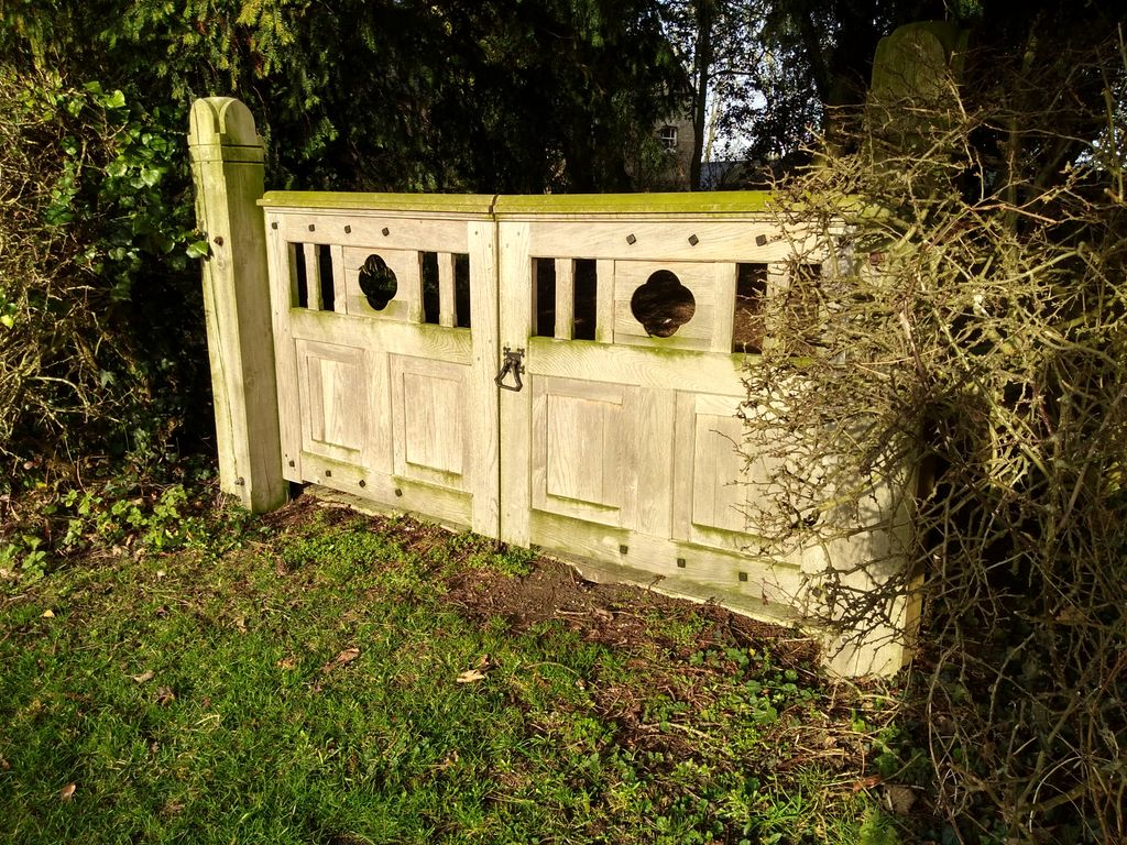
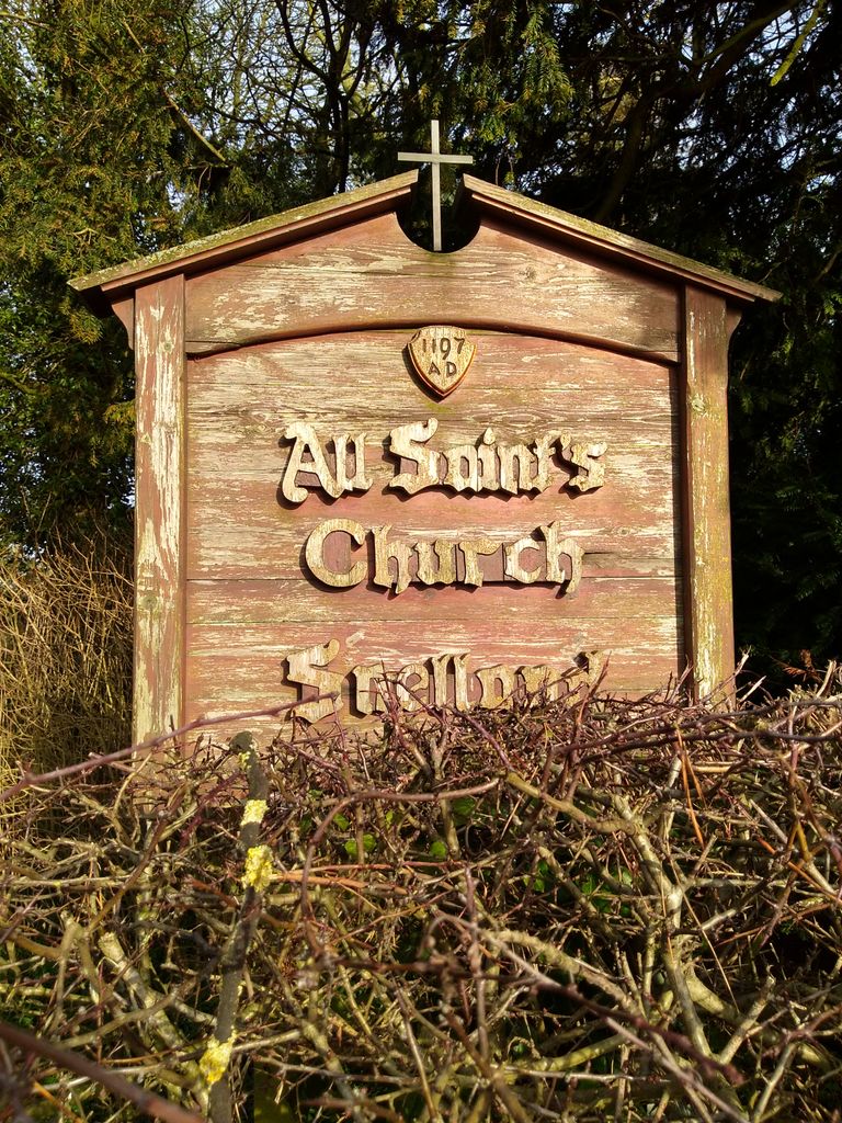
| Location | : | Snelland, West Lindsey District, England |
| Coordinate | : | 53.3120800, -0.3812000 |
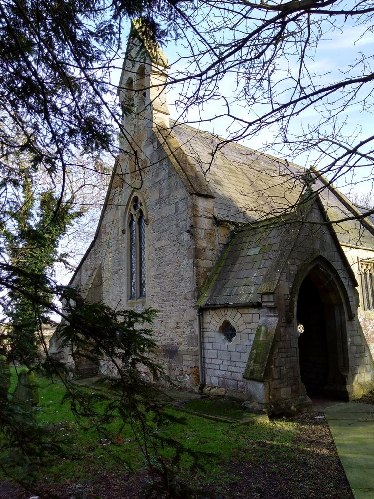
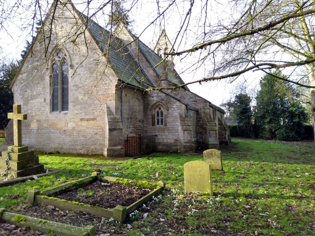
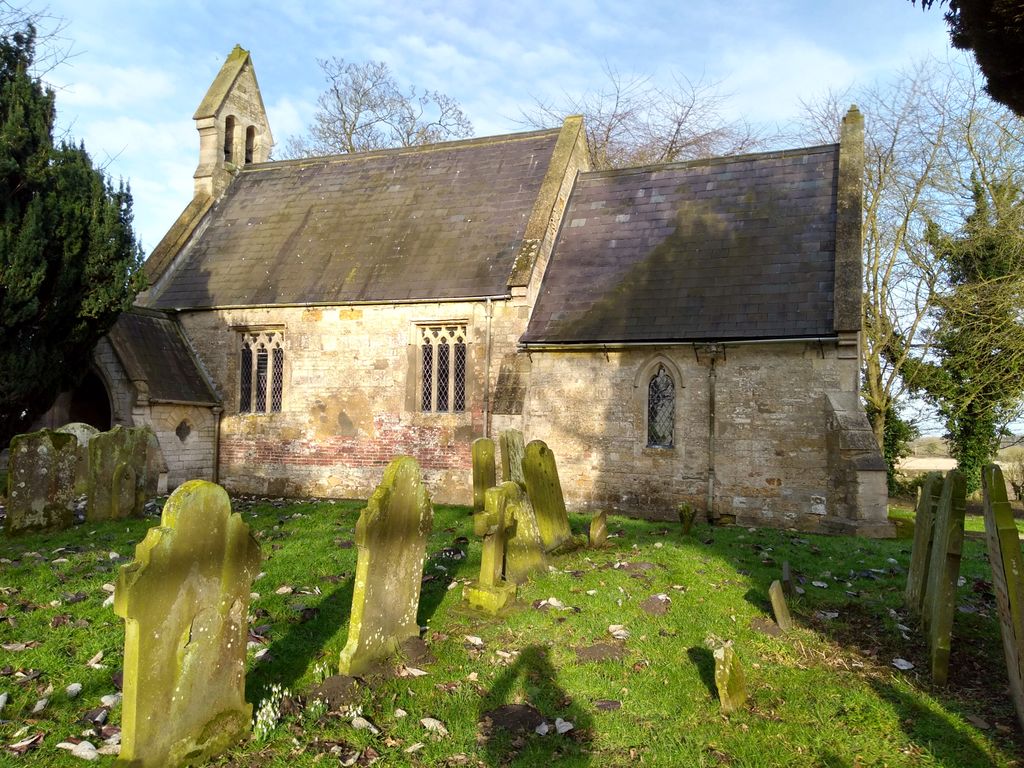
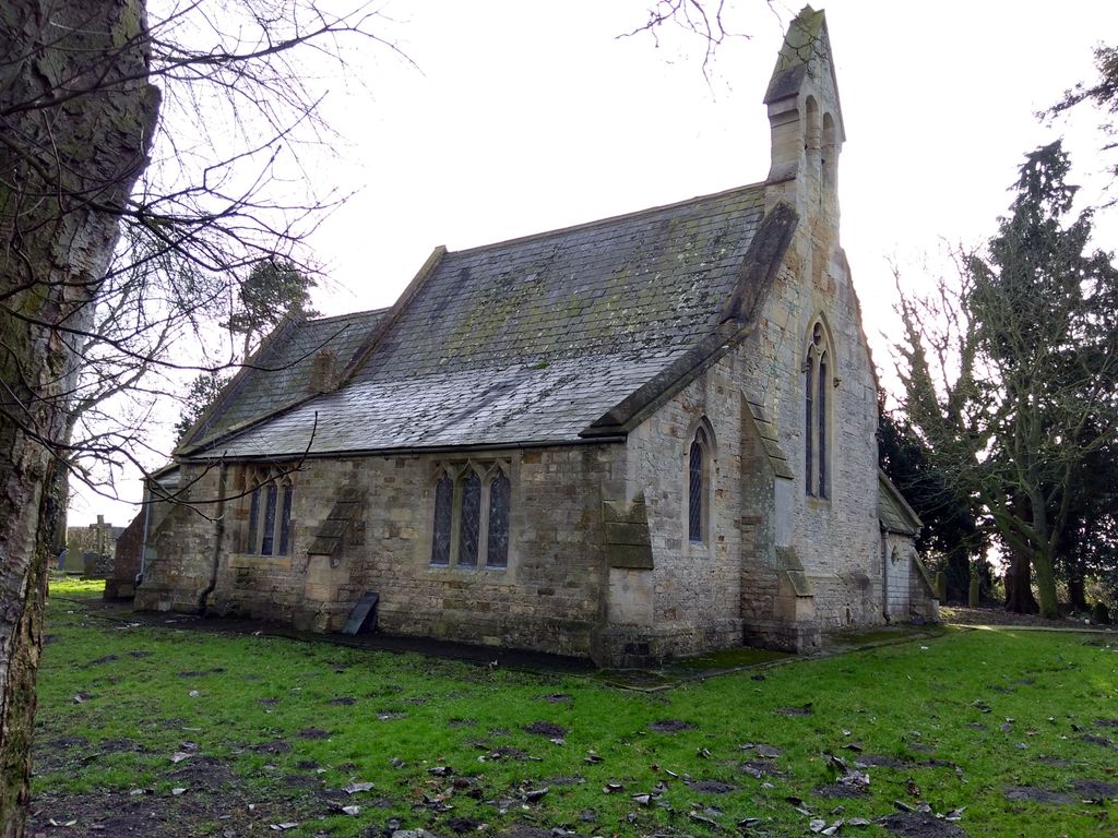
| Description | : | The church dates back to the 12c, there is a Leper's window on the side of the church, Lepers were not permitted inside the church. |
frequently asked questions (FAQ):
-
Where is All Saints Churchyard?
All Saints Churchyard is located at Snelland, West Lindsey District ,Lincolnshire ,England.
-
All Saints Churchyard cemetery's updated grave count on graveviews.com?
0 memorials
-
Where are the coordinates of the All Saints Churchyard?
Latitude: 53.3120800
Longitude: -0.3812000
Nearby Cemetories:
1. St. Peter's Churchyard
Friesthorpe, West Lindsey District, England
Coordinate: 53.3367420, -0.3915860
2. St. Oswald's Churchyard
Rand, West Lindsey District, England
Coordinate: 53.2970600, -0.3404500
3. St. Lawrence Churchyard
Snarford, West Lindsey District, England
Coordinate: 53.3283300, -0.4239900
4. St. John the Baptist Churchyard
Langworth, West Lindsey District, England
Coordinate: 53.2843900, -0.4086800
5. All Saints Churchyard
Holton-cum-Beckering, West Lindsey District, England
Coordinate: 53.3167370, -0.3257753
6. St. John The Baptist Churchyard
Lissington, West Lindsey District, England
Coordinate: 53.3363600, -0.3359800
7. All Saints Churchyard
Faldingworth, West Lindsey District, England
Coordinate: 53.3490800, -0.3995900
8. St. Michael's Churchyard
Buslingthorpe, West Lindsey District, England
Coordinate: 53.3520370, -0.3772470
9. Barlings Cemetery
Langworth, West Lindsey District, England
Coordinate: 53.2728290, -0.4041870
10. All Saints Churchyard
Cold Hanworth, West Lindsey District, England
Coordinate: 53.3357700, -0.4471700
11. St Chad Church Extension
Dunholme, West Lindsey District, England
Coordinate: 53.3008900, -0.4621500
12. St. Chad Churchyard
Dunholme, West Lindsey District, England
Coordinate: 53.3018330, -0.4638100
13. St. Germain Churchyard
Scothern, West Lindsey District, England
Coordinate: 53.2835790, -0.4513370
14. St. Edward's Churchyard
Barlings, West Lindsey District, England
Coordinate: 53.2600000, -0.3890000
15. Scothern Cemetery
Scothern, West Lindsey District, England
Coordinate: 53.2798200, -0.4515500
16. St. Andrew's Churchyard
Apley, West Lindsey District, England
Coordinate: 53.2613400, -0.3390200
17. St. Cornelius Churchyard
Linwood, West Lindsey District, England
Coordinate: 53.3626176, -0.3361707
18. St. Edward the Confessor Churchyard
Sudbrooke, West Lindsey District, England
Coordinate: 53.2717840, -0.4553930
19. St Michaels Churchyard
Newton by Toft, West Lindsey District, England
Coordinate: 53.3726210, -0.4216430
20. St. Peter and St. Paul Churchyard
Reepham, West Lindsey District, England
Coordinate: 53.2518050, -0.4450120
21. St. Giles' Churchyard
Langton by Wragby, East Lindsey District, England
Coordinate: 53.2764400, -0.2777700
22. St Andrew's Churchyard
Bardney, West Lindsey District, England
Coordinate: 53.2442000, -0.3351800
23. Hawthorn Road Cemetery
Reepham, West Lindsey District, England
Coordinate: 53.2489252, -0.4513445
24. St. Mary's Churchyard
East Barkwith, East Lindsey District, England
Coordinate: 53.3175900, -0.2514400