
| Memorials | : | 0 |
| Location | : | Holford, West Somerset District, England |
| Coordinate | : | 51.1902700, -3.1949170 |
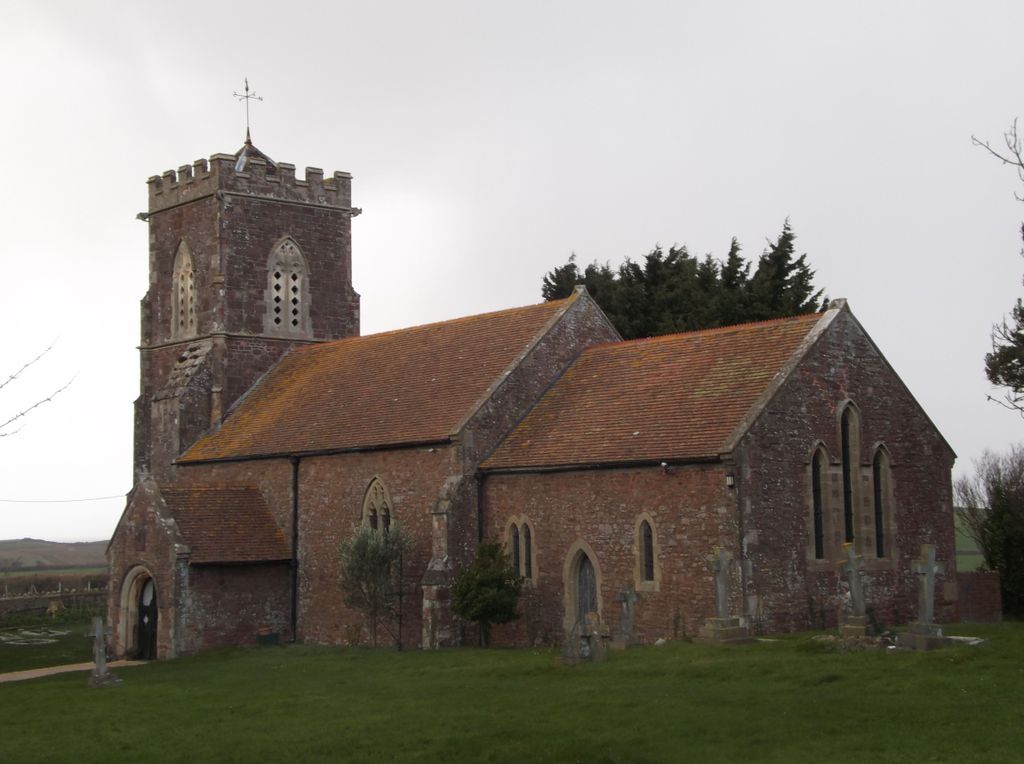
| Description | : | Overlooking the Bristol Channel, north from the A39 at Puttenham Hill stands the Church of St. Nicholas, though history dates it from 1100 AD, evidence could establish a building as earlier than 800. Dedicated in 1533, it comprised a chancel with north vestry, nave with south porch, west tower, four bells, a late medieval 14 century font. Parts of the chancel arch and tower date from the 14th century - with a possibly earlier plan of the chancel and nave - windows were renewed 15/16th century. Partially rebuilt and extensively restored 1861-64 by John Norton who added the... Read More |
frequently asked questions (FAQ):
-
Where is St. Nicholas's Churchyard?
St. Nicholas's Churchyard is located at Cross Elms Hill Holford, West Somerset District ,Somerset , TA5 1STEngland.
-
St. Nicholas's Churchyard cemetery's updated grave count on graveviews.com?
0 memorials
-
Where are the coordinates of the St. Nicholas's Churchyard?
Latitude: 51.1902700
Longitude: -3.1949170
Nearby Cemetories:
1. St. Andrew's Churchyard
Lilstock, West Somerset District, England
Coordinate: 51.1971070, -3.1936420
2. St Mary's Churchyard
Kilve, West Somerset District, England
Coordinate: 51.1883100, -3.2223530
3. St. Mary's Churchyard
Stringston, West Somerset District, England
Coordinate: 51.1748960, -3.1795460
4. Burton Baptist Chapel
Stogursey, West Somerset District, England
Coordinate: 51.1910560, -3.1560340
5. St. Mary's Churchyard
East Quantoxhead, West Somerset District, England
Coordinate: 51.1855220, -3.2370690
6. St. Mary's Churchyard
Holford, West Somerset District, England
Coordinate: 51.1627900, -3.2074238
7. All Saints Churchyard
Dodington, West Somerset District, England
Coordinate: 51.1583770, -3.1854620
8. Stogursey Extension Cemetery
Stogursey, West Somerset District, England
Coordinate: 51.1793740, -3.1398040
9. St Andrew Churchyard
Stogursey, West Somerset District, England
Coordinate: 51.1795900, -3.1392800
10. Nether Stowey Cemetery
Nether Stowey, Sedgemoor District, England
Coordinate: 51.1498667, -3.1530087
11. St. Mary's Churchyard
Nether Stowey, Sedgemoor District, England
Coordinate: 51.1502280, -3.1494270
12. St. Audries Churchyard
West Quantoxhead, West Somerset District, England
Coordinate: 51.1688420, -3.2717650
13. Over Stowey Cemetery
Over Stowey, Sedgemoor District, England
Coordinate: 51.1404020, -3.1661850
14. St Peter and St Paul Churchyard
Over Stowey, Sedgemoor District, England
Coordinate: 51.1399680, -3.1656040
15. St. Martin's Churchyard
Fiddington, Sedgemoor District, England
Coordinate: 51.1591640, -3.1229530
16. Saint George Churchyard
Bicknoller, West Somerset District, England
Coordinate: 51.1472610, -3.2722430
17. St.Mary Magdalene
Stockland Bristol, Sedgemoor District, England
Coordinate: 51.1867260, -3.0886950
18. Holy Ghost Churchyard
Crowcombe, West Somerset District, England
Coordinate: 51.1232260, -3.2293260
19. All Saints Churchyard
Otterhampton, Sedgemoor District, England
Coordinate: 51.1829540, -3.0796420
20. Otterhampton Extension Cemetery
Otterhampton, Sedgemoor District, England
Coordinate: 51.1828490, -3.0791630
21. St. George's Churchyard
Sampford Brett, West Somerset District, England
Coordinate: 51.1538990, -3.3033380
22. All Saints Churchyard
Aisholt, Sedgemoor District, England
Coordinate: 51.1142070, -3.1532890
23. Saint Margaret's Churchyard
Spaxton, Sedgemoor District, England
Coordinate: 51.1273090, -3.1087000
24. Spaxton Extension Cemetery
Spaxton, Sedgemoor District, England
Coordinate: 51.1267650, -3.1082920