
| Memorials | : | 0 |
| Location | : | Oddington, Cotswold District, England |
| Coordinate | : | 51.9278340, -1.6597080 |
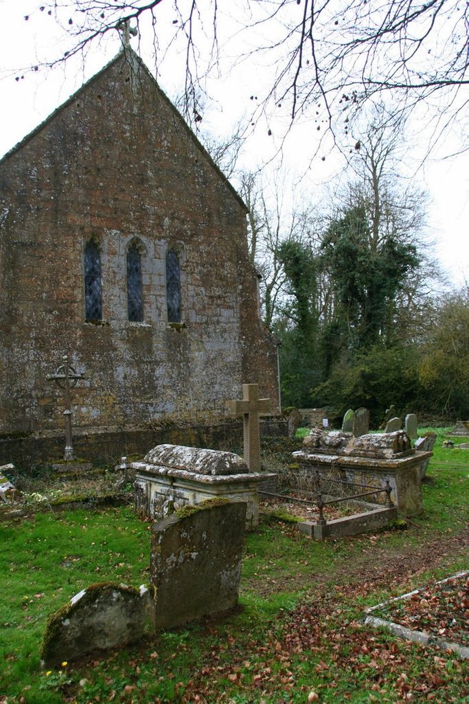
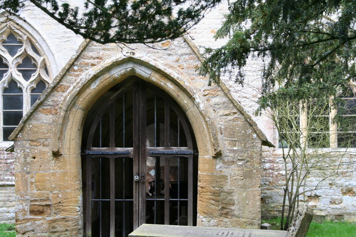
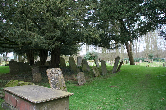
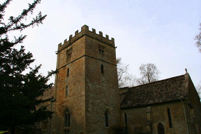
| Description | : | St Nicholas Church of Oddington Gloucestershire, England, is one of the oldest extant Norman churches in England. This Medieval church with its dramatic doom paintings was likely built at the center of an early Norman settlement circa 1080. It was expanded about 1250 and was in regular use until 1852. The earliest surviving recorded burial is in the year 1549. The cemetery surrounding it has stones from several centuries, however, due to time,weathering and decay, many are no longer legible. There are also many burials which are no longer marked by a headstone. The surrounding is a woodland countryside, and the... Read More |
frequently asked questions (FAQ):
-
Where is St Nicholas Churchyard?
St Nicholas Churchyard is located at Church Lane Oddington, Cotswold District ,Gloucestershire , GL56 0XEEngland.
-
St Nicholas Churchyard cemetery's updated grave count on graveviews.com?
0 memorials
-
Where are the coordinates of the St Nicholas Churchyard?
Latitude: 51.9278340
Longitude: -1.6597080

Nearby Cemetories:
1. St Peter Churchyard
Daylesford, Cotswold District, England
Coordinate: 51.9310080, -1.6479680
2. St Andrew's Churchyard
Kingham, West Oxfordshire District, England
Coordinate: 51.9113760, -1.6255990
3. St. Mary the Virgin Churchyard
Icomb, Cotswold District, England
Coordinate: 51.9018000, -1.6905000
4. St. Mary the Virgin Churchyard
Chastleton, West Oxfordshire District, England
Coordinate: 51.9595360, -1.6395330
5. St Peter's Church
Cornwell, West Oxfordshire District, England
Coordinate: 51.9418660, -1.6062440
6. St Paul Churchyard
Broadwell, Cotswold District, England
Coordinate: 51.9476200, -1.7095100
7. St. Edward Churchyard
Stow-on-the-Wold, Cotswold District, England
Coordinate: 51.9299810, -1.7238290
8. Stow-on-the-Wold Cemetery
Stow-on-the-Wold, Cotswold District, England
Coordinate: 51.9264100, -1.7254670
9. All Saints Churchyard
Churchill, West Oxfordshire District, England
Coordinate: 51.9146590, -1.5898010
10. St Nicholas Churchyard
Idbury, West Oxfordshire District, England
Coordinate: 51.8784370, -1.6584080
11. St. Mary's Churchyard
Salford, West Oxfordshire District, England
Coordinate: 51.9505810, -1.5844700
12. St Mary's Churchyard
Upper Swell, Cotswold District, England
Coordinate: 51.9398030, -1.7441910
13. St James' Church
Sarsden, West Oxfordshire District, England
Coordinate: 51.9048470, -1.5806760
14. Saint John the Baptist Church
Fifield, West Oxfordshire District, England
Coordinate: 51.8668460, -1.6536260
15. St. James Churchyard
Longborough, Cotswold District, England
Coordinate: 51.9658220, -1.7407990
16. St. Peter's Churchyard
Little Rissington, Cotswold District, England
Coordinate: 51.8780460, -1.7262610
17. Milton-under-Wychwood Cemetery
Milton-under-Wychwood, West Oxfordshire District, England
Coordinate: 51.8684380, -1.6176370
18. Chipping Norton Cemetery
Chipping Norton, West Oxfordshire District, England
Coordinate: 51.9414200, -1.5555900
19. St. Philip Church
Little Rollright, West Oxfordshire District, England
Coordinate: 51.9688330, -1.5742230
20. St Lawrence's Church
Barton-on-the-Heath, Stratford-on-Avon District, England
Coordinate: 51.9918300, -1.6272375
21. St. Simon-St. Jude
Milton-under-Wychwood, West Oxfordshire District, England
Coordinate: 51.8660230, -1.6170140
22. St. Mary's Churchyard
Lower Slaughter, Cotswold District, England
Coordinate: 51.9018830, -1.7605380
23. Friends Burial Ground
Chipping Norton, West Oxfordshire District, England
Coordinate: 51.9415950, -1.5498310
24. Milton-under-Wychwood Friends Burial Ground
Milton-under-Wychwood, West Oxfordshire District, England
Coordinate: 51.8638040, -1.6109590