| Memorials | : | 2 |
| Location | : | Harringworth, East Northamptonshire Borough, England |
| Coordinate | : | 52.0539000, -1.0797000 |
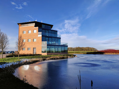
| Description | : | A Cistercian abbey founded in 1147 by Arnold de Bosco de Bois, steward to the Earl of Leicester. The abbey was wealthy, allowing the monks to pay for its continuation and survival past the Dissolution of 1536, but was finally surrendered in September 1538 and became the possession of Thomas Lord Wriothesley. Biddlesden Park House now sits on the site, and only a few stones of the original abbey remain. |
frequently asked questions (FAQ):
-
Where is Biddlesden Abbey?
Biddlesden Abbey is located at Harringworth, East Northamptonshire Borough ,Northamptonshire ,England.
-
Biddlesden Abbey cemetery's updated grave count on graveviews.com?
2 memorials
-
Where are the coordinates of the Biddlesden Abbey?
Latitude: 52.0539000
Longitude: -1.0797000
Nearby Cemetories:
1. St. Margaret's Churchyard
Biddlesden, Aylesbury Vale District, England
Coordinate: 52.0535450, -1.0782870
2. St. Edward the Confessor Churchyard
Shalstone, Aylesbury Vale District, England
Coordinate: 52.0225079, -1.0666653
3. St. Mary's Churchyard
Turweston, Aylesbury Vale District, England
Coordinate: 52.0345400, -1.1257500
4. St. Augustine's Churchyard
Westbury, Aylesbury Vale District, England
Coordinate: 52.0154200, -1.0941150
5. St. Peter's Churchyard
Brackley, South Northamptonshire Borough, England
Coordinate: 52.0309710, -1.1390480
6. St. Giles' Churchyard
Water Stratford, Aylesbury Vale District, England
Coordinate: 52.0136475, -1.0515046
7. Halse Road Cemetery
Brackley, South Northamptonshire Borough, England
Coordinate: 52.0395310, -1.1494450
8. St. Mary Magdalene's Churchyard
Helmdon, South Northamptonshire Borough, England
Coordinate: 52.0838310, -1.1404000
9. Hospital of St James and St John
Brackley, South Northamptonshire Borough, England
Coordinate: 52.0284000, -1.1473000
10. St. Mary the Virgin Churchyard
Wappenham, South Northamptonshire Borough, England
Coordinate: 52.1057700, -1.0890570
11. Church of the Assumption of Blessed Virgin Mary
Stowe, Aylesbury Vale District, England
Coordinate: 52.0182720, -1.0174270
12. Mixbury All Saints Churchyard
Mixbury, Cherwell District, England
Coordinate: 52.0010100, -1.1131800
13. St. Michael and All Angels
Finmere, Cherwell District, England
Coordinate: 51.9931740, -1.0740240
14. St. John the Baptist Churchyard
Abthorpe, South Northamptonshire Borough, England
Coordinate: 52.1131262, -1.0529425
15. St. Botolph's Churchyard
Slapton, South Northamptonshire Borough, England
Coordinate: 52.1166000, -1.0666000
16. Tingewick Cemetery
Tingewick, Aylesbury Vale District, England
Coordinate: 51.9917800, -1.0514420
17. St. Nicholas of Myra Churchyard
Lillingstone Dayrell, Aylesbury Vale District, England
Coordinate: 52.0524510, -0.9728480
18. St. Mary's Churchyard
Tingewick, Aylesbury Vale District, England
Coordinate: 51.9919690, -1.0432400
19. Saint John the Evangelist Churchyard
Buckingham, Aylesbury Vale District, England
Coordinate: 51.9996500, -1.0174090
20. St Mary and St Peter Churchyard
Weedon Lois, South Northamptonshire Borough, England
Coordinate: 52.1178320, -1.1228690
21. St. James' Churchyard
Akeley, Aylesbury Vale District, England
Coordinate: 52.0340000, -0.9692000
22. Holy Trinity Church
Hinton-in-the-Hedges, South Northamptonshire Borough, England
Coordinate: 52.0281190, -1.1881330
23. Parish Church of the Assumption
Lillingstone Lovell, Aylesbury Vale District, England
Coordinate: 52.0582400, -0.9621460
24. Lillingstone Lovell Cemetery
Lillingstone Lovell, Aylesbury Vale District, England
Coordinate: 52.0584600, -0.9619000

