
| Memorials | : | 1 |
| Location | : | Gatcombe, Isle of Wight Unitary Authority, England |
| Coordinate | : | 50.6636110, -1.3041670 |
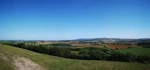
| Description | : | St. Olave's Church, Gatcombe is a parish church in the Church of England located in Gatcombe, Isle of Wight. Building began on the site in the 13th century and the church was dedicated in 1292. It originally served the Estur family as a chapel to Gatcombe House. The manor later passed into the hands of the Worsley family who provided the church with both financial support and a number of Rectors. |
frequently asked questions (FAQ):
-
Where is St Olave's Churchyard?
St Olave's Churchyard is located at Gatcombe, Isle of Wight Unitary Authority ,Isle of Wight ,England.
-
St Olave's Churchyard cemetery's updated grave count on graveviews.com?
1 memorials
-
Where are the coordinates of the St Olave's Churchyard?
Latitude: 50.6636110
Longitude: -1.3041670
Nearby Cemetories:
1. Carisbrooke Priory
Carisbrooke, Isle of Wight Unitary Authority, England
Coordinate: 50.6859710, -1.3070000
2. Carisbrooke Cemetery
Carisbrooke, Isle of Wight Unitary Authority, England
Coordinate: 50.6882160, -1.3083040
3. Billingham Manor
Newport, Isle of Wight Unitary Authority, England
Coordinate: 50.6347663, -1.3140535
4. St Thomas Church
Newport, Isle of Wight Unitary Authority, England
Coordinate: 50.6997610, -1.2940130
5. St Peter's Parish Church
Shorwell, Isle of Wight Unitary Authority, England
Coordinate: 50.6449290, -1.3545580
6. St Peter New Churchyard
Shorwell, Isle of Wight Unitary Authority, England
Coordinate: 50.6433100, -1.3541400
7. Newport Cemetery
Newport, Isle of Wight Unitary Authority, England
Coordinate: 50.7041360, -1.2887540
8. All Saints Churchyard
Godshill, Isle of Wight Unitary Authority, England
Coordinate: 50.6336900, -1.2558300
9. Parkhurst Military Cemetery
Newport, Isle of Wight Unitary Authority, England
Coordinate: 50.7084440, -1.3044120
10. St Paul's Cemetery
Newport, Isle of Wight Unitary Authority, England
Coordinate: 50.7072300, -1.2827400
11. Isle of Wight Workhouse Burial Ground
Carisbrooke, Isle of Wight Unitary Authority, England
Coordinate: 50.7112150, -1.2979810
12. Parkhurst Prison Cemetery
Newport, Isle of Wight Unitary Authority, England
Coordinate: 50.7152100, -1.3082790
13. Calbourne Burial Ground
Calbourne, Isle of Wight Unitary Authority, England
Coordinate: 50.6832007, -1.3864018
14. St. Mary the Virgin Churchyard
Brighstone, Isle of Wight Unitary Authority, England
Coordinate: 50.6422540, -1.3944850
15. All Saints Churchyard
Calbourne, Isle of Wight Unitary Authority, England
Coordinate: 50.6772990, -1.3996370
16. Isle of Wight Crematorium
Whippingham, Isle of Wight Unitary Authority, England
Coordinate: 50.7217910, -1.2573910
17. Porchfield Congregational Cemetery
Porchfield, Isle of Wight Unitary Authority, England
Coordinate: 50.7190660, -1.3679770
18. St John the Baptist Church
Northwood, Isle of Wight Unitary Authority, England
Coordinate: 50.7340380, -1.3023130
19. Whitwell New Burial Ground
Whitwell, Isle of Wight Unitary Authority, England
Coordinate: 50.5943366, -1.2689275
20. St Peter's
Havenstreet, Isle of Wight Unitary Authority, England
Coordinate: 50.7095580, -1.2063290
21. St. Mildred's Churchyard
Whippingham, Isle of Wight Unitary Authority, England
Coordinate: 50.7398230, -1.2768350
22. St Peter and St Paul’s Churchyard
Mottistone, Isle of Wight Unitary Authority, England
Coordinate: 50.6517620, -1.4275530
23. Niton Baptist Church
Ventnor, Isle of Wight Unitary Authority, England
Coordinate: 50.5850100, -1.2864900
24. St. Michael the Archangel Churchyard
Shalfleet, Isle of Wight Unitary Authority, England
Coordinate: 50.7014300, -1.4156370