
| Memorials | : | 0 |
| Location | : | Methley, Metropolitan Borough of Leeds, England |
| Coordinate | : | 53.7345120, -1.4086560 |
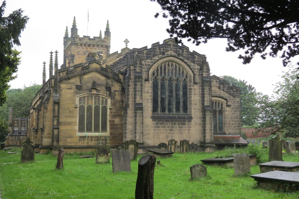
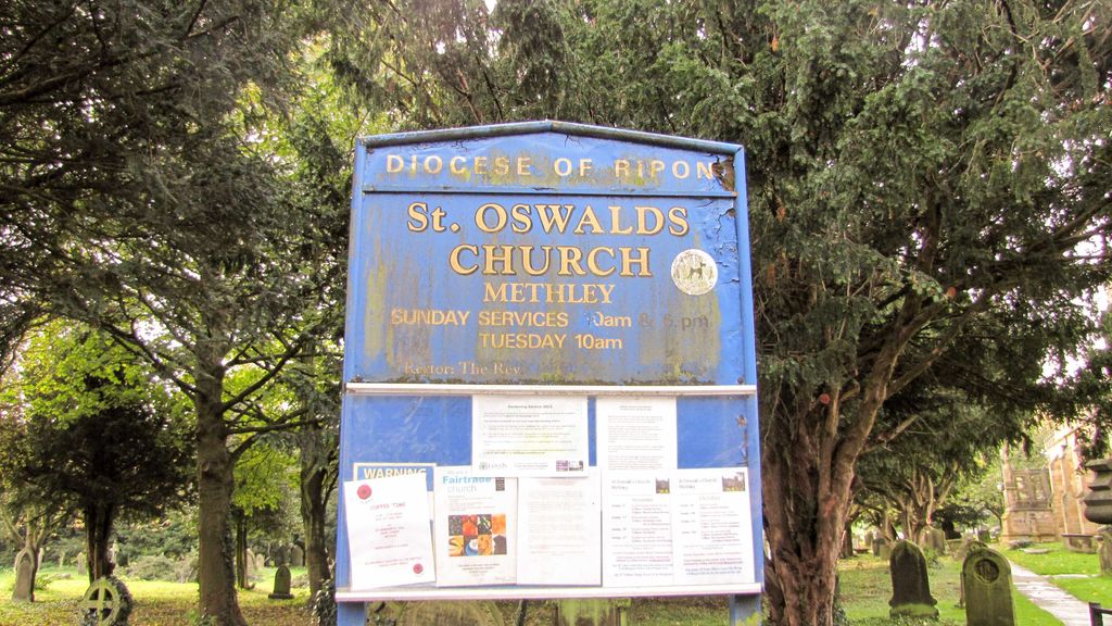
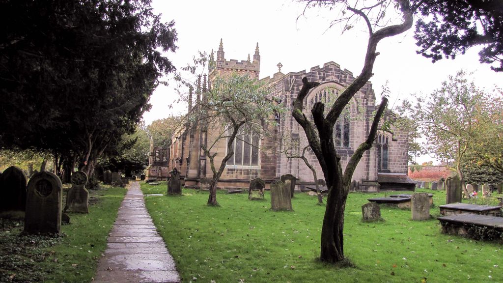
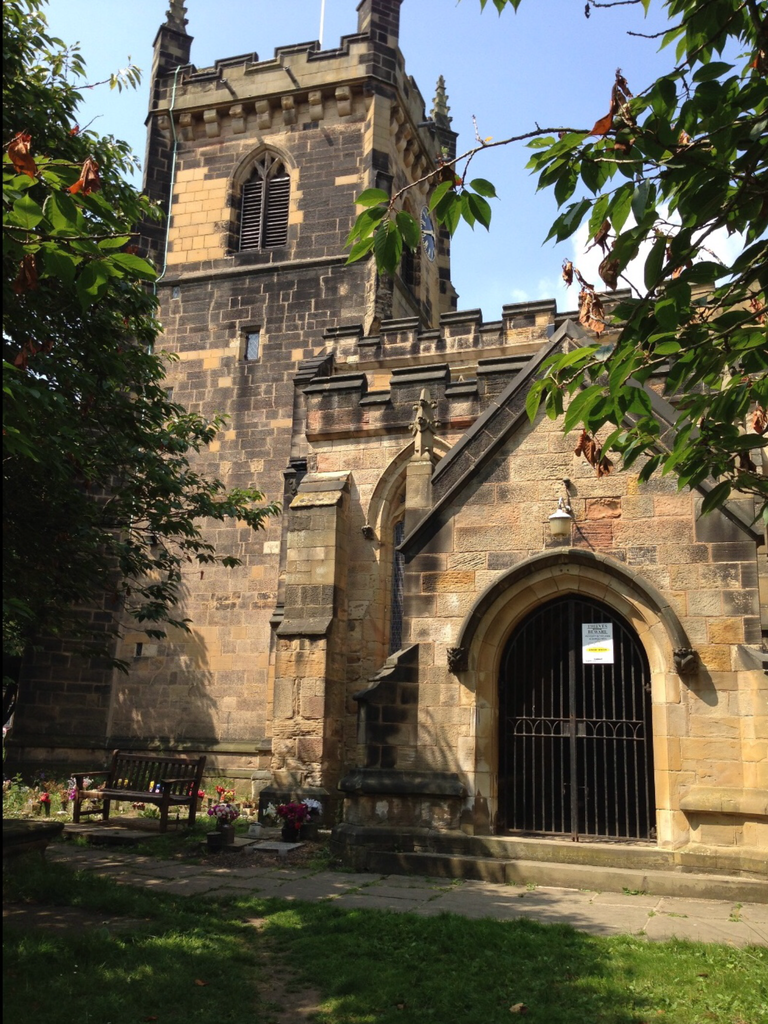
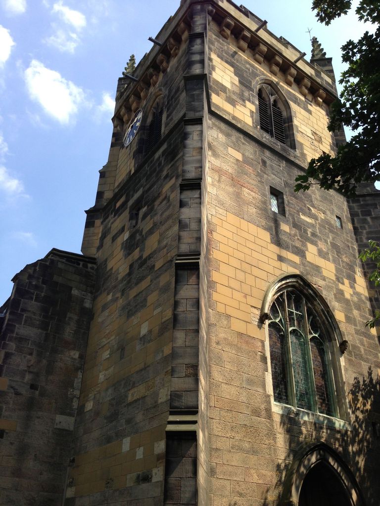
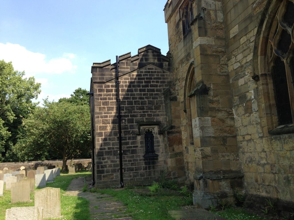
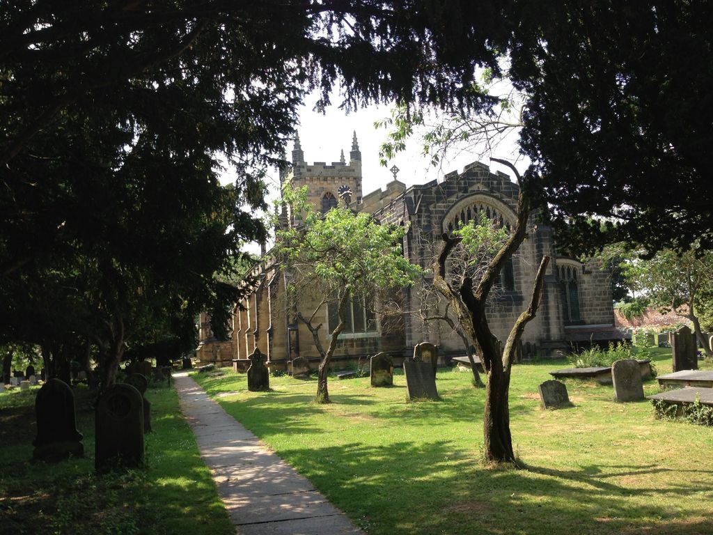
| Description | : | Methley is a dispersed, agricultural and former mining village in the City of Leeds metropolitan borough, about 10 miles south east of Leeds, West Yorkshire, England. he Church of Methley of St. Oswald was in existence at the time of Domesday, but has been wholly rebuilt, and in the present fabric is nothing peculiar, except the chantry on the South side of the choir, founded and endowed by Robert Waterton, in 1424, and which contains many monuments of exquisite workmanship. The greatest piece of antiquity about the Church, is a statue of King Oswald, the Patron Saint, over... Read More |
frequently asked questions (FAQ):
-
Where is St. Oswald Churchyard?
St. Oswald Churchyard is located at Methley, Metropolitan Borough of Leeds ,West Yorkshire ,England.
-
St. Oswald Churchyard cemetery's updated grave count on graveviews.com?
0 memorials
-
Where are the coordinates of the St. Oswald Churchyard?
Latitude: 53.7345120
Longitude: -1.4086560
Nearby Cemetories:
1. St Philip Churchyard
Whitwood, Metropolitan Borough of Wakefield, England
Coordinate: 53.7147550, -1.3898610
2. Whitwood Cemetery
Castleford, Metropolitan Borough of Wakefield, England
Coordinate: 53.7181510, -1.3746570
3. St Mary the Less Churchyard
Allerton Bywater, Metropolitan Borough of Leeds, England
Coordinate: 53.7452000, -1.3673620
4. St Mary Magdalene Churchyard
Altofts, Metropolitan Borough of Wakefield, England
Coordinate: 53.7094970, -1.4289600
5. Altofts Cemetery
Altofts, Metropolitan Borough of Wakefield, England
Coordinate: 53.7089350, -1.4352310
6. St. John the Evangelist Churchyard
Oulton, Metropolitan Borough of Leeds, England
Coordinate: 53.7480340, -1.4560300
7. All Saints Churchyard
Castleford, Metropolitan Borough of Wakefield, England
Coordinate: 53.7264590, -1.3563080
8. Normanton Lower Cemetery
Normanton, Metropolitan Borough of Wakefield, England
Coordinate: 53.7002440, -1.4081200
9. St Mary Churchyard
Swillington, Metropolitan Borough of Leeds, England
Coordinate: 53.7689620, -1.4173580
10. All Saints Churchyard
Normanton, Metropolitan Borough of Wakefield, England
Coordinate: 53.6979280, -1.4142980
11. Normanton Upper Cemetery
Normanton, Metropolitan Borough of Wakefield, England
Coordinate: 53.6964700, -1.4156370
12. St Mary the Virgin Churchyard
Kippax, Metropolitan Borough of Leeds, England
Coordinate: 53.7676520, -1.3686680
13. Castleford New Extension Cemetery
Castleford, Metropolitan Borough of Wakefield, England
Coordinate: 53.7277600, -1.3391000
14. Castleford Old Cemetery
Castleford, Metropolitan Borough of Wakefield, England
Coordinate: 53.7269200, -1.3390300
15. St Peter Churchyard
Stanley, Metropolitan Borough of Wakefield, England
Coordinate: 53.7136330, -1.4712940
16. Castleford New Cemetery
Castleford, Metropolitan Borough of Wakefield, England
Coordinate: 53.7259920, -1.3380580
17. Stanley Cemetery
Stanley, Metropolitan Borough of Wakefield, England
Coordinate: 53.7147890, -1.4735250
18. Rothwell Cemetery
Rothwell, Metropolitan Borough of Leeds, England
Coordinate: 53.7545200, -1.4734100
19. Featherstone Cemetery
Featherstone, Metropolitan Borough of Wakefield, England
Coordinate: 53.6977610, -1.3637000
20. Holy Trinity Churchyard
Rothwell, Metropolitan Borough of Leeds, England
Coordinate: 53.7503340, -1.4810830
21. All Saints Churchyard
Featherstone, Metropolitan Borough of Wakefield, England
Coordinate: 53.6935500, -1.3626070
22. Lofthouse Cemetery
Lofthouse, Metropolitan Borough of Leeds, England
Coordinate: 53.7332670, -1.4959060
23. Christ Church Churchyard
Lofthouse, Metropolitan Borough of Leeds, England
Coordinate: 53.7287400, -1.4960500
24. St. Peter's Churchyard
Fryston, Metropolitan Borough of Wakefield, England
Coordinate: 53.7355400, -1.3151100