
| Memorials | : | 0 |
| Location | : | Fryston, Metropolitan Borough of Wakefield, England |
| Coordinate | : | 53.7355400, -1.3151100 |
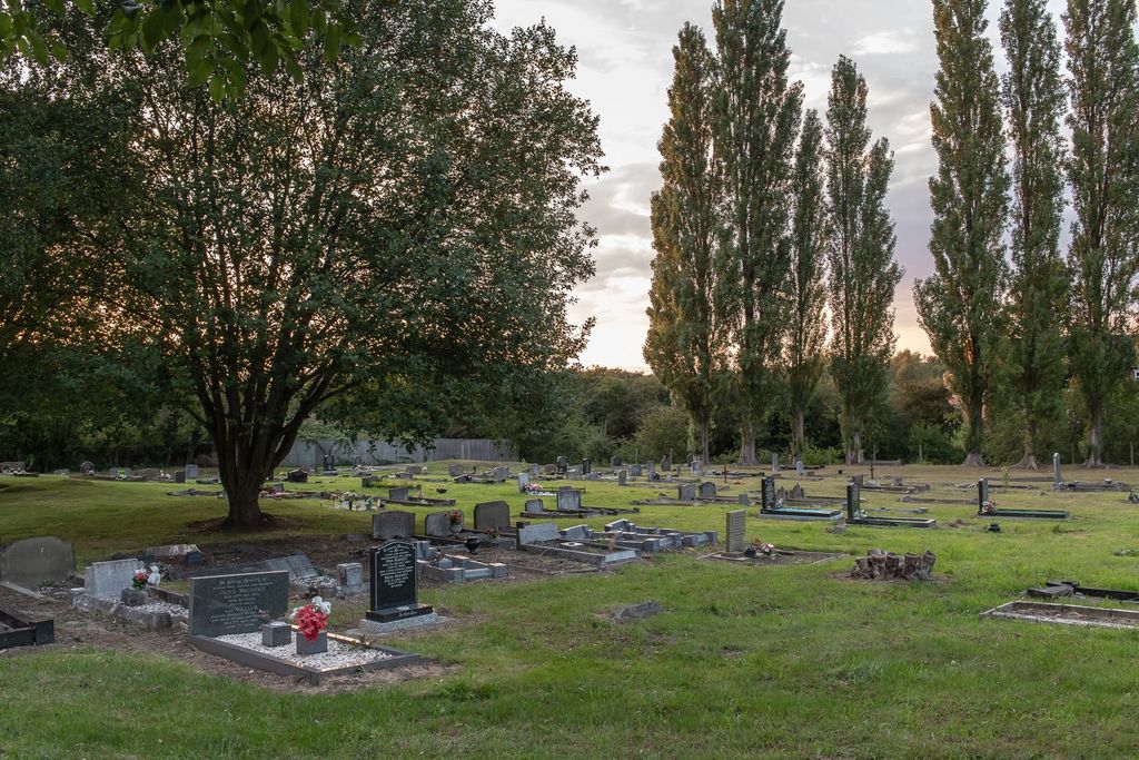
| Description | : | Established in 1896, the church building was demolished in 1991, leaving the churchyard and a war memorial at this site. In 1935, St Peter parish merged with the new parish of Holy Cross in neighbouring Airedale. Burials from both churches took place in the St Peter Churchyard. The St Peter burial register prior to 1920 has been lost and surviving burials records for 1920-1947 are listed under Holy Cross in Airdale. The West Yorkshire Archives in Wakefield hold the interment register for St Peter Churchyard/Holy Cross covering the years 1898-1956. |
frequently asked questions (FAQ):
-
Where is St. Peter's Churchyard?
St. Peter's Churchyard is located at 1932 Wheldon Rd Fryston, Metropolitan Borough of Wakefield ,West Yorkshire , WF10 2QHEngland.
-
St. Peter's Churchyard cemetery's updated grave count on graveviews.com?
0 memorials
-
Where are the coordinates of the St. Peter's Churchyard?
Latitude: 53.7355400
Longitude: -1.3151100
Nearby Cemetories:
1. Castleford New Extension Cemetery
Castleford, Metropolitan Borough of Wakefield, England
Coordinate: 53.7277600, -1.3391000
2. Castleford Old Cemetery
Castleford, Metropolitan Borough of Wakefield, England
Coordinate: 53.7269200, -1.3390300
3. Castleford New Cemetery
Castleford, Metropolitan Borough of Wakefield, England
Coordinate: 53.7259920, -1.3380580
4. St James Churchyard
Fairburn, Selby District, England
Coordinate: 53.7426700, -1.2841000
5. All Saints Churchyard
Castleford, Metropolitan Borough of Wakefield, England
Coordinate: 53.7264590, -1.3563080
6. All Saints Churchyard
Ledsham, Metropolitan Borough of Leeds, England
Coordinate: 53.7622160, -1.3091920
7. St Edward the Confessor Churchyard
Brotherton, Selby District, England
Coordinate: 53.7259200, -1.2709600
8. Brotherton United Reformed Church
Brotherton, Selby District, England
Coordinate: 53.7277104, -1.2698131
9. St. Andrew's Old Churchyard
Ferrybridge, Metropolitan Borough of Wakefield, England
Coordinate: 53.7193380, -1.2748540
10. St Mary the Less Churchyard
Allerton Bywater, Metropolitan Borough of Leeds, England
Coordinate: 53.7452000, -1.3673620
11. Ferrybridge Cemetery
Ferrybridge, Metropolitan Borough of Wakefield, England
Coordinate: 53.7102530, -1.2795200
12. St John's Priory of Pontefract
Pontefract, Metropolitan Borough of Wakefield, England
Coordinate: 53.6978050, -1.2987420
13. Whitwood Cemetery
Castleford, Metropolitan Borough of Wakefield, England
Coordinate: 53.7181510, -1.3746570
14. All Saints Churchyard
Pontefract, Metropolitan Borough of Wakefield, England
Coordinate: 53.6960100, -1.3010400
15. Pontefract Cemetery
Pontefract, Metropolitan Borough of Wakefield, England
Coordinate: 53.6945160, -1.3108810
16. Friends Burial Ground
Pontefract, Metropolitan Borough of Wakefield, England
Coordinate: 53.6924940, -1.3061380
17. St Giles with St Mary Church
Pontefract, Metropolitan Borough of Wakefield, England
Coordinate: 53.6915100, -1.3118300
18. St Mary the Virgin Churchyard
Kippax, Metropolitan Borough of Leeds, England
Coordinate: 53.7676520, -1.3686680
19. Featherstone Cemetery
Featherstone, Metropolitan Borough of Wakefield, England
Coordinate: 53.6977610, -1.3637000
20. Black Friars Pontefract
Pontefract, Metropolitan Borough of Wakefield, England
Coordinate: 53.6876090, -1.3152690
21. St. Botolph Churchyard
Knottingley, Metropolitan Borough of Wakefield, England
Coordinate: 53.7108080, -1.2441680
22. St Philip Churchyard
Whitwood, Metropolitan Borough of Wakefield, England
Coordinate: 53.7147550, -1.3898610
23. All Saints Churchyard
Featherstone, Metropolitan Borough of Wakefield, England
Coordinate: 53.6935500, -1.3626070
24. United Reformed Churchyard
Knottingley, Metropolitan Borough of Wakefield, England
Coordinate: 53.7104820, -1.2397270