
| Memorials | : | 3 |
| Location | : | Morley Saint Botolph, South Norfolk District, England |
| Coordinate | : | 52.5464700, 1.0416520 |
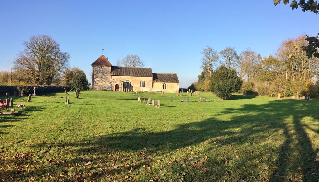
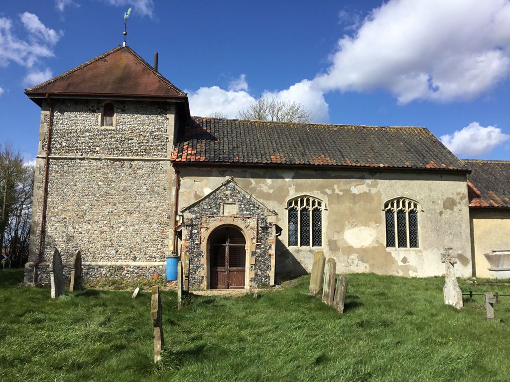
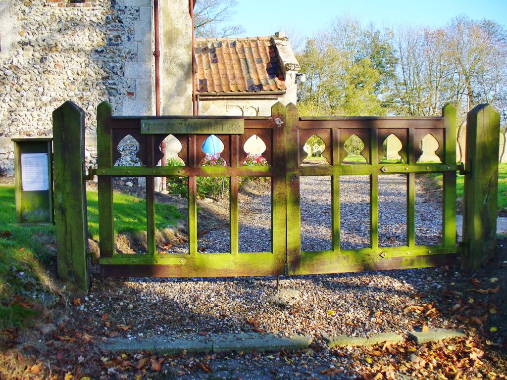
| Description | : | Morley St. Peter is a small, well maintained, Mediaeval church, established about 960 AD. Until 1986, it was previously known as the Parish of Morley.It is located about 3 miles southwest of Wymondham, in the county of Norfolk. The church's interior was restored during Victorian times. |
frequently asked questions (FAQ):
-
Where is St. Peter's Chapel?
St. Peter's Chapel is located at Morley Saint Botolph, South Norfolk District ,Norfolk ,England.
-
St. Peter's Chapel cemetery's updated grave count on graveviews.com?
3 memorials
-
Where are the coordinates of the St. Peter's Chapel?
Latitude: 52.5464700
Longitude: 1.0416520
Nearby Cemetories:
1. St. Botolphs Churchyard
Morley Saint Botolph, South Norfolk District, England
Coordinate: 52.5601960, 1.0512010
2. St. Andrew's Churchyard
Deopham, South Norfolk District, England
Coordinate: 52.5635040, 1.0224710
3. All Saints Churchyard
Besthorpe, Breckland Borough, England
Coordinate: 52.5192800, 1.0431370
4. Attleborough Cemetery
Attleborough, Breckland Borough, England
Coordinate: 52.5206640, 1.0157790
5. Blessed Virgin Mary Churchyard
Attleborough, Breckland Borough, England
Coordinate: 52.5178950, 1.0181880
6. Parkside Garden
Attleborough, Breckland Borough, England
Coordinate: 52.5167420, 1.0209100
7. St. Mary's Churchyard
Deopham, South Norfolk District, England
Coordinate: 52.5788950, 1.0377920
8. St. James Churchyard
Great Ellingham, Breckland Borough, England
Coordinate: 52.5347590, 0.9774180
9. St. Andrew's Churchyard
Hingham, South Norfolk District, England
Coordinate: 52.5791660, 0.9825900
10. Hingham Cemetery
Hingham, South Norfolk District, England
Coordinate: 52.5759750, 0.9773700
11. St. Peter's Churchyard
Kimberley, South Norfolk District, England
Coordinate: 52.5958100, 1.0572070
12. St. Peter's Churchyard
Little Ellingham, Breckland Borough, England
Coordinate: 52.5531500, 0.9560740
13. Buckenham Priory
Buckenham, Broadland District, England
Coordinate: 52.4911000, 1.0497000
14. St. George's Churchyard
Hardingham, Breckland Borough, England
Coordinate: 52.6058090, 1.0040050
15. All Saints Churchyard
Old Buckenham, Breckland Borough, England
Coordinate: 52.4816260, 1.0433160
16. All Saints Churchyard
Rocklands, Breckland Borough, England
Coordinate: 52.5253020, 0.9385050
17. St. Peter's Cemetery
Rockland St Peter, Breckland Borough, England
Coordinate: 52.5349241, 0.9327301
18. St Peter Churchyard
Rocklands, Breckland Borough, England
Coordinate: 52.5350220, 0.9325260
19. St Mary's Churchyard
Carleton Forehoe, South Norfolk District, England
Coordinate: 52.6100400, 1.0847490
20. Carleton Rode Baptist Churchyard
Carleton Rode, South Norfolk District, England
Coordinate: 52.4937320, 1.1185210
21. All Saints Churchyard
Carleton Rode, South Norfolk District, England
Coordinate: 52.4892230, 1.1133590
22. All Saints Churchyard
Runhall, South Norfolk District, England
Coordinate: 52.6209876, 1.0390341
23. All Saints Churchyard
Ashwellthorpe, South Norfolk District, England
Coordinate: 52.5346560, 1.1638810
24. St. Martin's Churchyard
New Buckenham, Breckland Borough, England
Coordinate: 52.4728860, 1.0728380