
| Memorials | : | 157 |
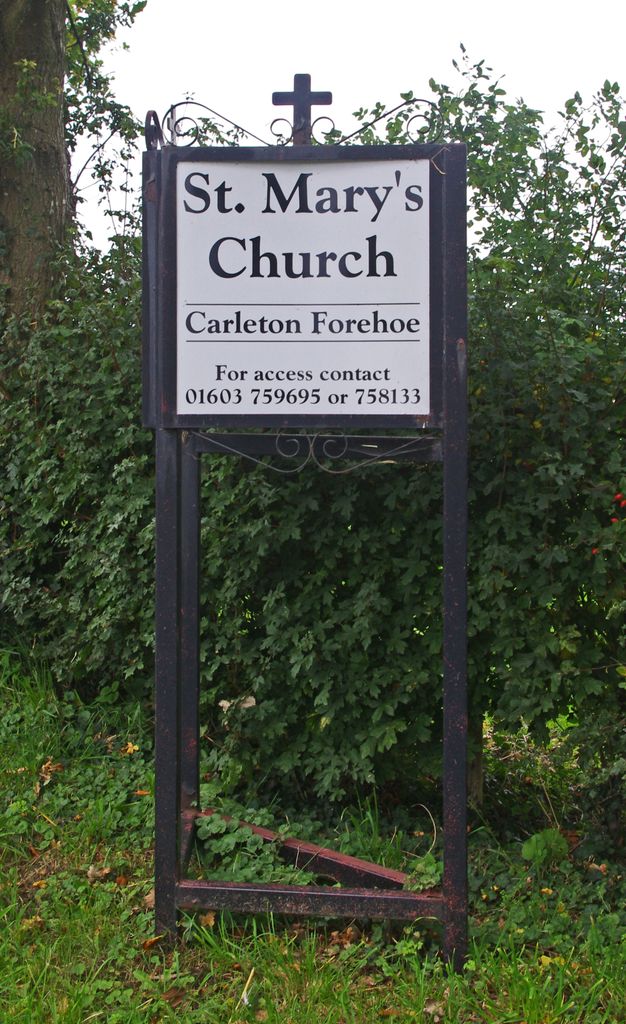
| Location | : | Carleton Forehoe, South Norfolk District, England |
| Coordinate | : | 52.6100400, 1.0847490 |
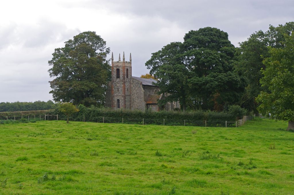
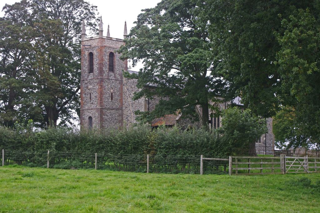
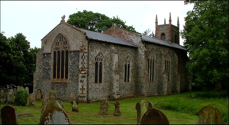
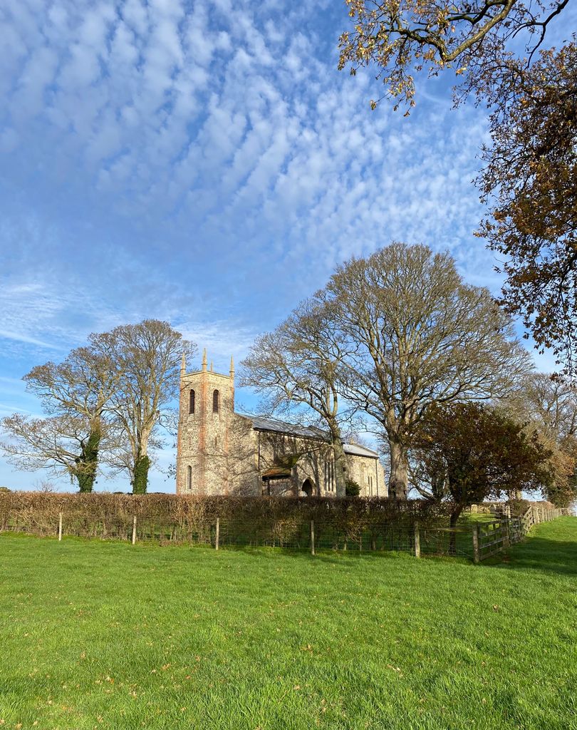
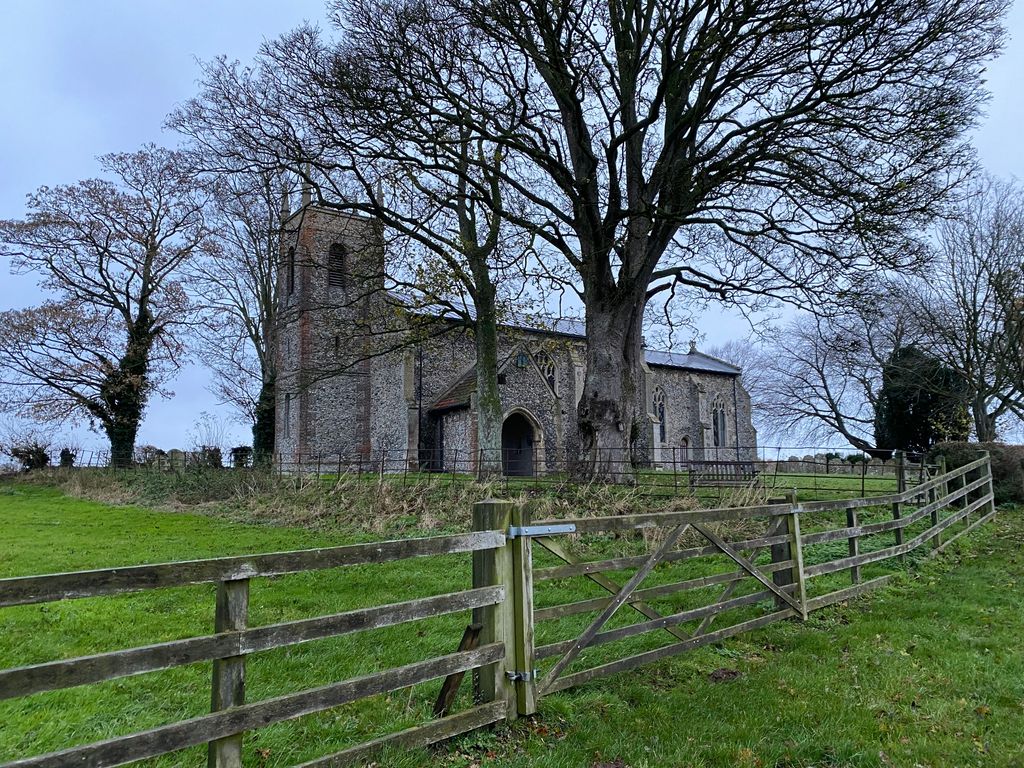
| Description | : | A path cuts off across the fields to where St Mary sits in its tree-shrouded graveyard. In summer, the graveyard is a riot of leaves, and all that can be seen from the road is St Mary's pretty and idiosyncratic tower rising above the churchyard hedge. |
frequently asked questions (FAQ):
-
Where is St Mary's Churchyard?
St Mary's Churchyard is located at Carleton Forehoe, South Norfolk District ,Norfolk ,England.
-
St Mary's Churchyard cemetery's updated grave count on graveviews.com?
157 memorials
-
Where are the coordinates of the St Mary's Churchyard?
Latitude: 52.6100400
Longitude: 1.0847490
Nearby Cemetories:
1. St. Peter and St. Paul Churchyard
Barnham Broom, South Norfolk District, England
Coordinate: 52.6281830, 1.0749820
2. St. Peter's Churchyard
Kimberley, South Norfolk District, England
Coordinate: 52.5958100, 1.0572070
3. St Botolphs
Barford, South Norfolk District, England
Coordinate: 52.6287000, 1.1118000
4. All Saints Churchyard
Runhall, South Norfolk District, England
Coordinate: 52.6209876, 1.0390341
5. St. Andrew's Churchyard
Colton, South Norfolk District, England
Coordinate: 52.6407700, 1.1089300
6. St. Mary's Churchyard
Marlingford, South Norfolk District, England
Coordinate: 52.6310660, 1.1416800
7. St. Mary's Churchyard
Deopham, South Norfolk District, England
Coordinate: 52.5788950, 1.0377920
8. All Saints, Welborne
South Norfolk District, England
Coordinate: 52.6496860, 1.0546670
9. All Saints Churchyard
Mattishall, Breckland Borough, England
Coordinate: 52.6498440, 1.0551390
10. All Saints & St Mary Churchyard
Great Melton, South Norfolk District, England
Coordinate: 52.6108700, 1.1602200
11. St. George's Churchyard
Hardingham, Breckland Borough, England
Coordinate: 52.6058090, 1.0040050
12. All Saints Churchyard
East Tuddenham, Breckland Borough, England
Coordinate: 52.6602410, 1.0813620
13. St Paul's Church Thuxton
Dereham, Breckland Borough, England
Coordinate: 52.6239060, 1.0013630
14. St Andrew's Churchyard
Honingham, Broadland District, England
Coordinate: 52.6573170, 1.1244600
15. St. Botolphs Churchyard
Morley Saint Botolph, South Norfolk District, England
Coordinate: 52.5601960, 1.0512010
16. All Saints' Churchyard
Mattishall, Breckland Borough, England
Coordinate: 52.6580670, 1.0346230
17. Mattishall cemetery
Mattishall, Breckland Borough, England
Coordinate: 52.6597100, 1.0353800
18. St Mary's and All Saints Churchyard
Little Melton, South Norfolk District, England
Coordinate: 52.6173083, 1.1798046
19. St. Peter's Churchyard
Easton, South Norfolk District, England
Coordinate: 52.6543660, 1.1478070
20. St. Andrew's Churchyard
Deopham, South Norfolk District, England
Coordinate: 52.5635040, 1.0224710
21. St. Margaret's Churchyard
Garvestone, Breckland Borough, England
Coordinate: 52.6264200, 0.9889550
22. St Peter's Church Mattishall Burgh
Mattishall, Breckland Borough, England
Coordinate: 52.6647174, 1.0396513
23. St. Mary and St. Walstan Churchyard
Bawburgh, South Norfolk District, England
Coordinate: 52.6327480, 1.1796530
24. St. Peter's Churchyard
Reymerston, Breckland Borough, England
Coordinate: 52.6144500, 0.9827500