
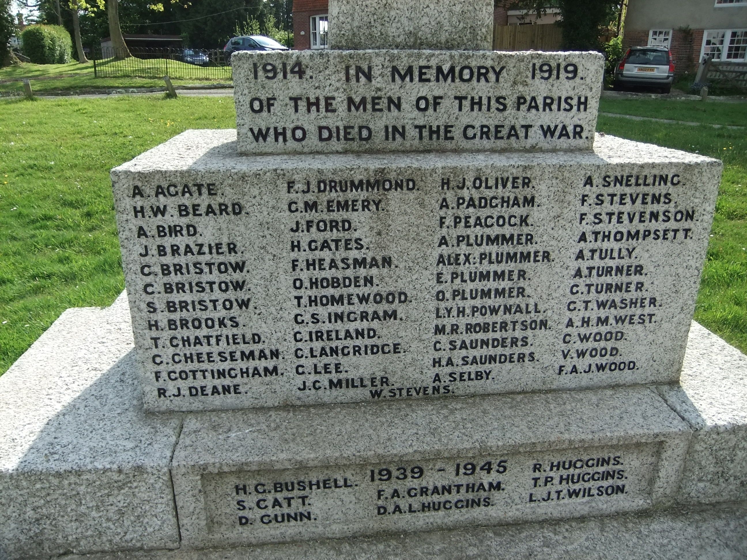
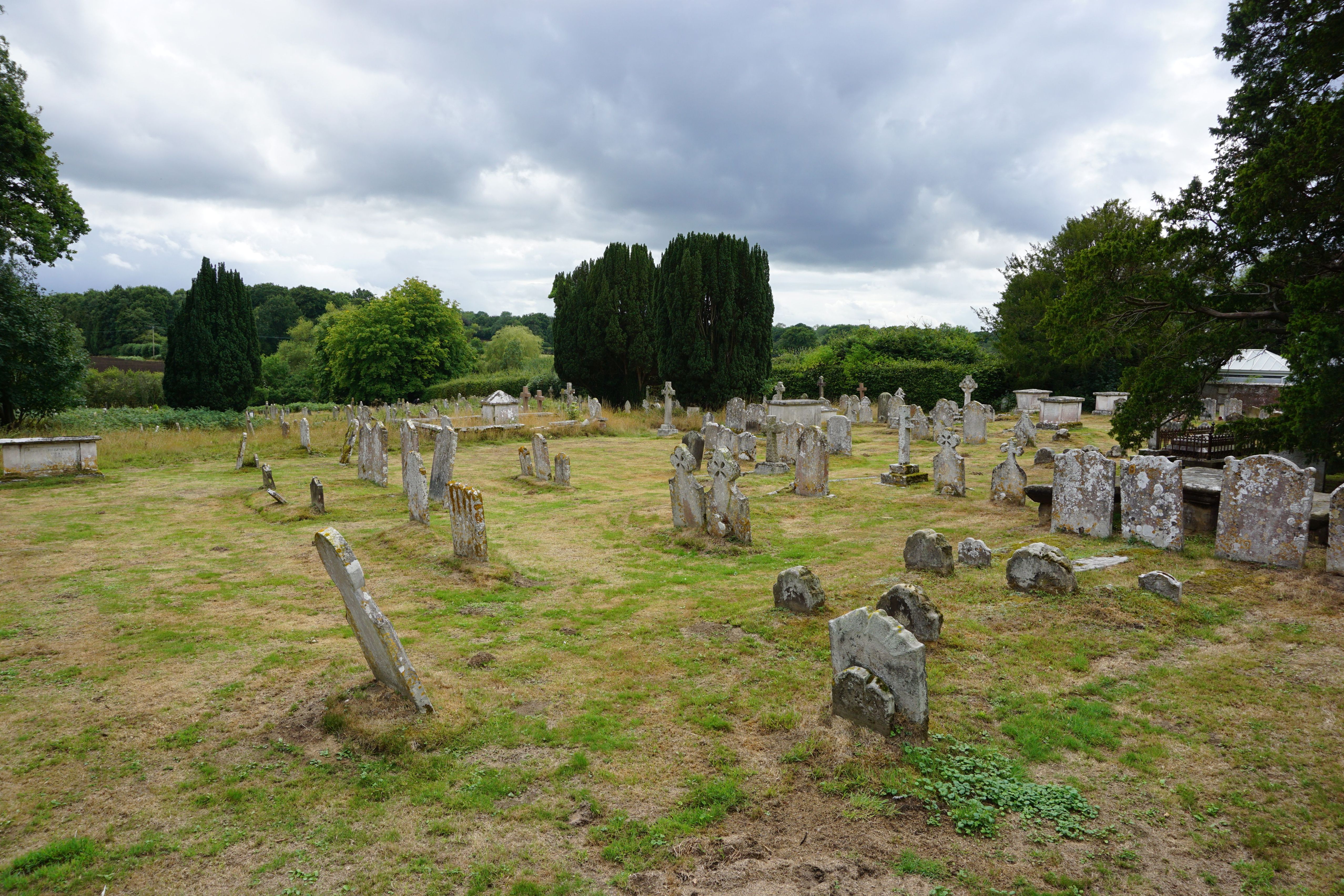
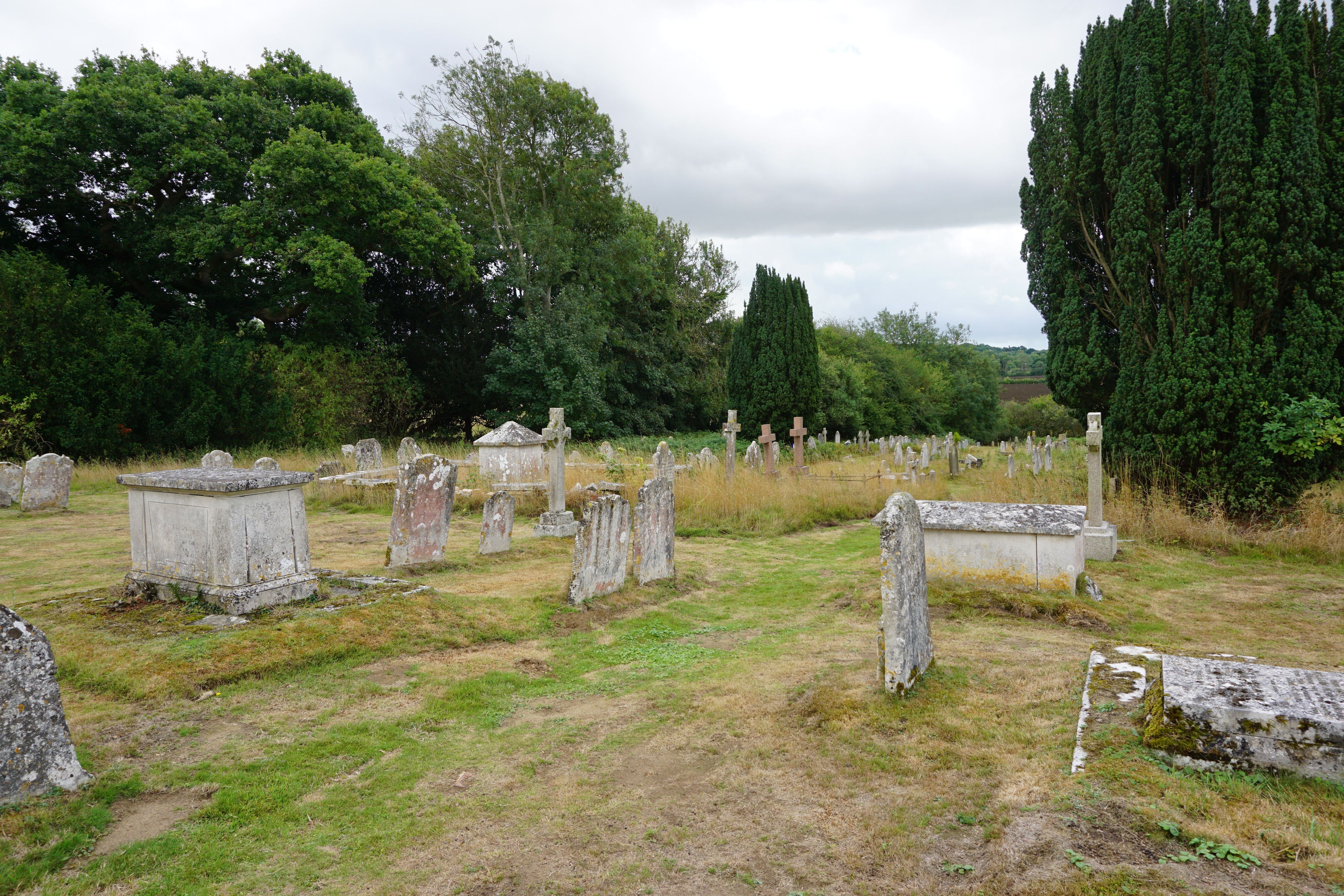
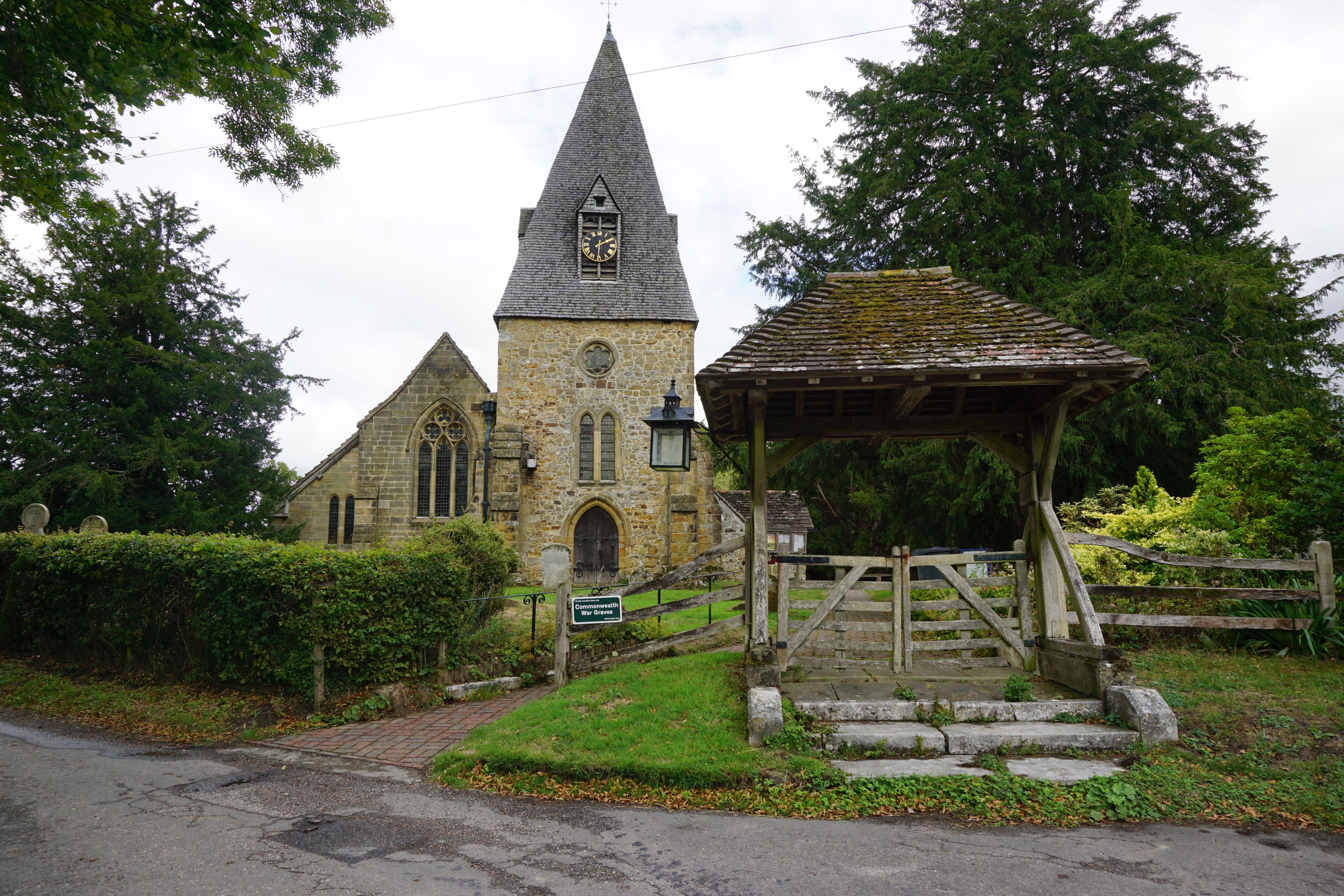
| Memorials | : | 582 |
| Location | : | Chailey, Lewes District, England |
| Coordinate | : | 50.9566700, -0.0191720 |
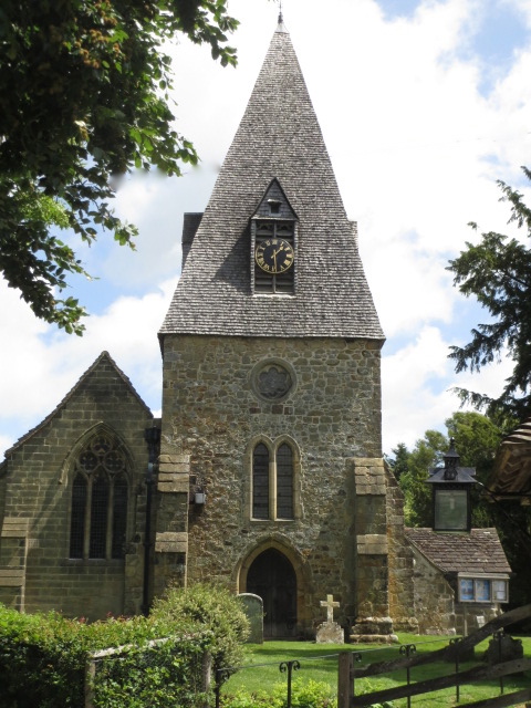
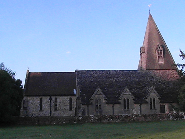
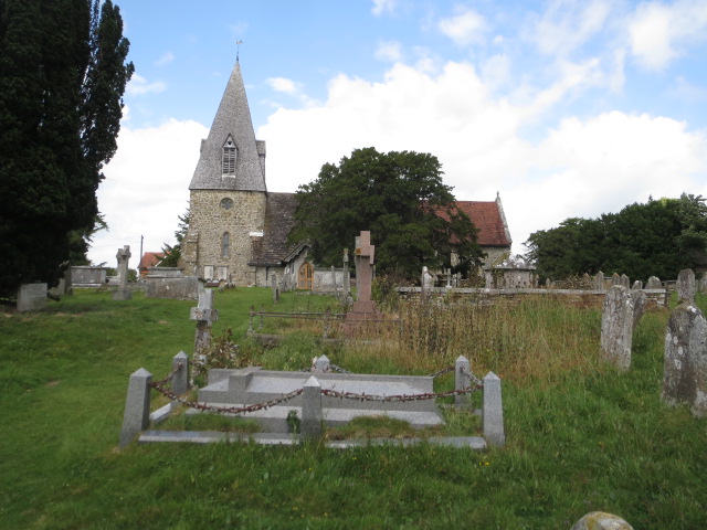
| Description | : | Chailey is a village and civil parish in the Lewes District of East Sussex, England. It is located ten miles north of Lewes, on the A272 road from Winchester to Canterbury. The Prime Meridian passes just to the east of Chailey. The parish consists of the settlements: South Chailey (which also incorporates South Common), South Street, Chailey (also known as Chailey Green) and North Chailey (which incorporates the North Common). The churches being St Peter's, St Martin's (within Chailey Heritage), Chailey Free Church, St John's (now housing in South Common), and St Mary's (now redundant) at North Common |
frequently asked questions (FAQ):
-
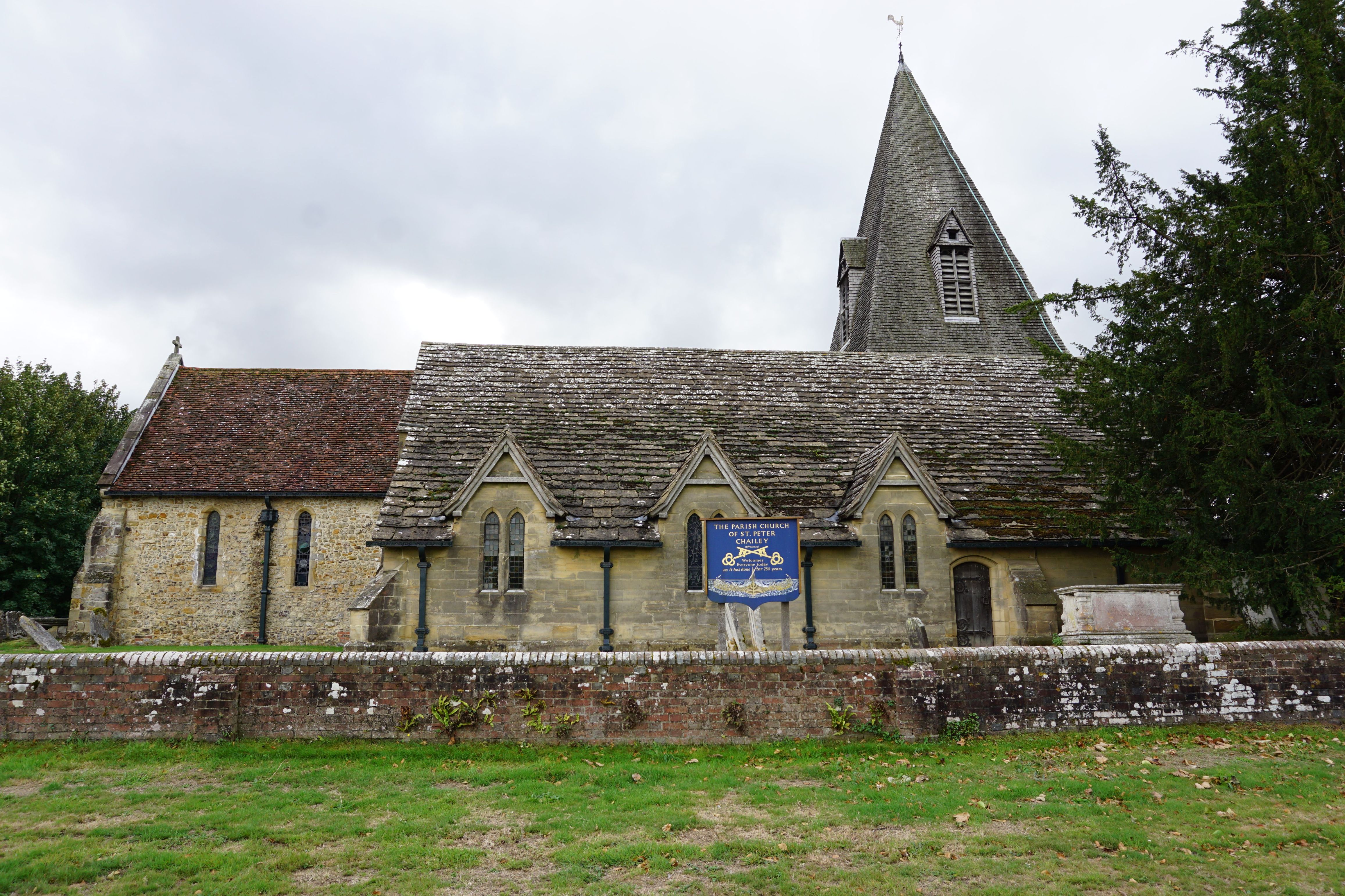
Where is St. Peter's Churchyard?
St. Peter's Churchyard is located at South Common Chailey, Lewes District ,East Sussex ,England.
-
St. Peter's Churchyard cemetery's updated grave count on graveviews.com?
582 memorials
-
Where are the coordinates of the St. Peter's Churchyard?
Latitude: 50.9566700
Longitude: -0.0191720
Nearby Cemetories:
1. St Marys Churchyard
Chailey, Lewes District, England
Coordinate: 50.9720890, -0.0218170
2. Begraafplaats Madonna
Langemark-Poelkapelle, Arrondissement Ieper, Belgium
Coordinate: 50.9354160, 0.0000000
3. St. Mary's Churchyard
Newick, Lewes District, England
Coordinate: 50.9692030, 0.0231970
4. Spithurst St Bartholomew Churchyard
Barcombe, Lewes District, England
Coordinate: 50.9391390, 0.0284310
5. East Chiltington Churchyard
East Chiltington, Lewes District, England
Coordinate: 50.9192280, -0.0526570
6. St. Margaret of Antioch Churchyard
Isfield, Wealden District, England
Coordinate: 50.9444820, 0.0538680
7. Bethel Baptist Chapel
Wivelsfield, Lewes District, England
Coordinate: 50.9626990, -0.0952615
8. St. Andrew and St. Mary the Virgin Churchyard
Fletching, Wealden District, England
Coordinate: 50.9929360, 0.0349030
9. St. Peter & St. John the Baptist Churchyard
Wivelsfield, Lewes District, England
Coordinate: 50.9708740, -0.0952190
10. St Mary Churchyard
Barcombe, Lewes District, England
Coordinate: 50.9108230, 0.0165980
11. Streat Churchyard
Streat, Lewes District, England
Coordinate: 50.9202600, -0.0794500
12. St Michael and All Angels Churchyard
Plumpton, Lewes District, England
Coordinate: 50.9050700, -0.0717450
13. Western Road Cemetery
Haywards Heath, Mid Sussex District, England
Coordinate: 50.9987100, -0.0920000
14. St Andrew Churchyard
Burgess Hill, Mid Sussex District, England
Coordinate: 50.9604300, -0.1219500
15. Ditchling Cemetery
Ditchling, Lewes District, England
Coordinate: 50.9196160, -0.1050510
16. All Saints United Reformed Church
Burgess Hill, Mid Sussex District, England
Coordinate: 50.9537245, -0.1252350
17. St Peter Churchyard
Hamsey, Lewes District, England
Coordinate: 50.8911800, 0.0095670
18. St Wilfrid's Churchyard
Haywards Heath, Mid Sussex District, England
Coordinate: 50.9993130, -0.1046570
19. The Browne Burial Ground
Ditchling, Lewes District, England
Coordinate: 50.9213097, -0.1128219
20. Ditchling Unitarian Chapel Chapelyard
Ditchling, Lewes District, England
Coordinate: 50.9214096, -0.1129916
21. St Martin Churchyard
Westmeston, Lewes District, England
Coordinate: 50.9066840, -0.0971980
22. All Saints Churchyard
Lindfield, Mid Sussex District, England
Coordinate: 51.0163470, -0.0784980
23. Horsted Parva Churchyard
Isfield, Wealden District, England
Coordinate: 50.9457670, 0.0918710
24. Saint Michael and All Angels Church
Little Horsted, Wealden District, England
Coordinate: 50.9456000, 0.0921400