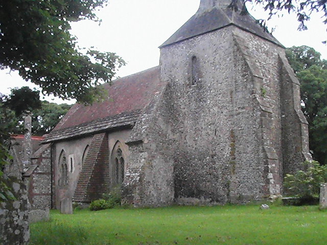
| Memorials | : | 0 |
| Location | : | Plumpton, Lewes District, England |
| Coordinate | : | 50.9050700, -0.0717450 |
| Description | : | Plumpton is a village and civil parish in the Lewes District of East Sussex, England. The village is located five miles (8 km) north-west of Lewes. The parish includes the small village of Plumpton and the larger village of Plumpton Green to the north where most of the community and services are based. Added by Wertypop. |
frequently asked questions (FAQ):
-
Where is St Michael and All Angels Churchyard?
St Michael and All Angels Churchyard is located at Plumpton, Lewes District ,East Sussex , BN7England.
-
St Michael and All Angels Churchyard cemetery's updated grave count on graveviews.com?
0 memorials
-
Where are the coordinates of the St Michael and All Angels Churchyard?
Latitude: 50.9050700
Longitude: -0.0717450
Nearby Cemetories:
1. Streat Churchyard
Streat, Lewes District, England
Coordinate: 50.9202600, -0.0794500
2. St Martin Churchyard
Westmeston, Lewes District, England
Coordinate: 50.9066840, -0.0971980
3. East Chiltington Churchyard
East Chiltington, Lewes District, England
Coordinate: 50.9192280, -0.0526570
4. Ditchling Cemetery
Ditchling, Lewes District, England
Coordinate: 50.9196160, -0.1050510
5. The Browne Burial Ground
Ditchling, Lewes District, England
Coordinate: 50.9213097, -0.1128219
6. Ditchling Unitarian Chapel Chapelyard
Ditchling, Lewes District, England
Coordinate: 50.9214096, -0.1129916
7. Stanmer Churchyard
Stanmer, Brighton and Hove Unitary Authority, England
Coordinate: 50.8702740, -0.1019400
8. St Cosmas and St Damian Churchyard
Hassocks, Mid Sussex District, England
Coordinate: 50.9219800, -0.1305650
9. St Laurence Churchyard
Falmer, Lewes District, England
Coordinate: 50.8623110, -0.0762390
10. St John the Baptist Churchyard
Clayton, Mid Sussex District, England
Coordinate: 50.9105170, -0.1534370
11. Patcham Down Indian Forces Cremation Memorial
Patcham, Brighton and Hove Unitary Authority, England
Coordinate: 50.8841200, -0.1473900
12. HMP Lewes
Lewes District, England
Coordinate: 50.8729973, -0.0048753
13. St Peter Churchyard
Hamsey, Lewes District, England
Coordinate: 50.8911800, 0.0095670
14. Clayton Wood Natural Burial Ground
Clayton, Mid Sussex District, England
Coordinate: 50.9160900, -0.1547600
15. Begraafplaats Madonna
Langemark-Poelkapelle, Arrondissement Ieper, Belgium
Coordinate: 50.9354160, 0.0000000
16. Saint Michael The Archangel Churchyard
South Malling, Lewes District, England
Coordinate: 50.8811470, 0.0069090
17. Lewes Cemetery
Lewes, Lewes District, England
Coordinate: 50.8707680, -0.0017370
18. St Mary Churchyard
Barcombe, Lewes District, England
Coordinate: 50.9108230, 0.0165980
19. St. Anne's Churchyard
Lewes, Lewes District, England
Coordinate: 50.8723390, 0.0017700
20. St Pancras Churchyard
Kingston, Lewes District, England
Coordinate: 50.8562900, -0.0245250
21. Church of the Transfiguration Churchyard
Pyecombe, Mid Sussex District, England
Coordinate: 50.8984590, -0.1642370
22. St. John Sub Castro Churchyard
Lewes, Lewes District, England
Coordinate: 50.8759800, 0.0093800
23. All Saints United Reformed Church
Burgess Hill, Mid Sussex District, England
Coordinate: 50.9537245, -0.1252350
24. Bethel Baptist Chapel
Wivelsfield, Lewes District, England
Coordinate: 50.9626990, -0.0952615

