
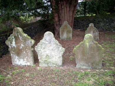
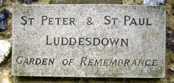
| Memorials | : | 0 |
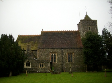
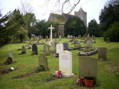
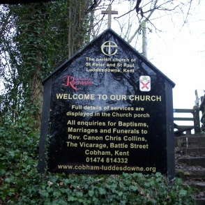
| Location | : | Luddesdown, Gravesham Borough, England |
| Coordinate | : | 51.3700218, 0.3974010 |
frequently asked questions (FAQ):
-
Where is St Peter and St Paul Churchyard?
St Peter and St Paul Churchyard is located at Luddesdown, Gravesham Borough ,Kent ,England.
-
St Peter and St Paul Churchyard cemetery's updated grave count on graveviews.com?
0 memorials
-
Where are the coordinates of the St Peter and St Paul Churchyard?
Latitude: 51.3700218
Longitude: 0.3974010
Nearby Cemetories:
1. St. Mary Magdalene New Churchyard
Cobham, Gravesham Borough, England
Coordinate: 51.3899060, 0.3983090
2. Cobham War Memorial
Cobham, Gravesham Borough, England
Coordinate: 51.3900719, 0.4043670
3. St. John the Baptist Churchyard
Meopham, Gravesham Borough, England
Coordinate: 51.3713500, 0.3615600
4. Meopham Cemetery
Meopham, Gravesham Borough, England
Coordinate: 51.3709100, 0.3600900
5. St Mildred Churchyard
Nurstead, Gravesham Borough, England
Coordinate: 51.3902931, 0.3574180
6. Halling War Memorial
Halling, Medway Unitary Authority, England
Coordinate: 51.3519630, 0.4439060
7. Halling Church Cemetery
Halling, Medway Unitary Authority, England
Coordinate: 51.3499140, 0.4447960
8. St. Michael and All Angels Churchyard
Cuxton, Medway Unitary Authority, England
Coordinate: 51.3714120, 0.4546760
9. St John the Baptist Churchyard
Halling, Medway Unitary Authority, England
Coordinate: 51.3484993, 0.4468510
10. St. Margaret Churchyard
Cobham, Gravesham Borough, England
Coordinate: 51.4059906, 0.3749080
11. St. Benedict Churchyard
Snodland, Tonbridge and Malling Borough, England
Coordinate: 51.3332200, 0.4171600
12. All Saints Churchyard
Wouldham, Tonbridge and Malling Borough, England
Coordinate: 51.3528130, 0.4580580
13. Snodland Cemetery
Snodland, Tonbridge and Malling Borough, England
Coordinate: 51.3336110, 0.4348770
14. St Peter and St Paul Churchyard
Shorne, Gravesham Borough, England
Coordinate: 51.4132347, 0.4297970
15. All Saints Churchyard
Hartley, Sevenoaks District, England
Coordinate: 51.3761177, 0.3164520
16. All Saints Churchyard
Birling, Tonbridge and Malling Borough, England
Coordinate: 51.3197010, 0.4097520
17. Hartley Parish Burial Ground
Hartley, Sevenoaks District, England
Coordinate: 51.3765290, 0.3164040
18. All Saints Churchyard
Snodland, Tonbridge and Malling Borough, England
Coordinate: 51.3299000, 0.4496900
19. All Saints with Christchurch Churchyard
Snodland, Tonbridge and Malling Borough, England
Coordinate: 51.3246110, 0.4406010
20. St Peter and St Paul Churchyard
Trottiscliffe, Tonbridge and Malling Borough, England
Coordinate: 51.3201520, 0.3612360
21. St Matthew Churchyard
Borstal, Medway Unitary Authority, England
Coordinate: 51.3736150, 0.4868020
22. St Mary Old Churchyard
Burham, Tonbridge and Malling Borough, England
Coordinate: 51.3312262, 0.4619326
23. Strood Cemetery
Strood, Medway Unitary Authority, England
Coordinate: 51.3900220, 0.4838640
24. St Mary the Virgin Churchyard
Chalk, Gravesham Borough, England
Coordinate: 51.4265213, 0.4195510