
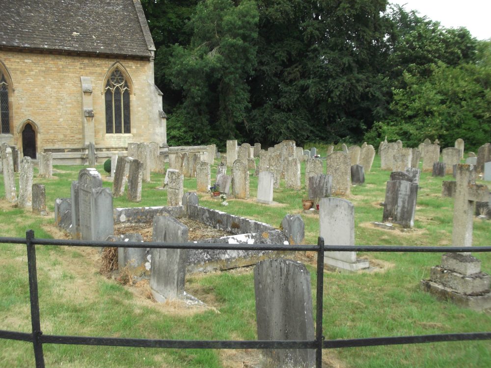
| Memorials | : | 61 |
| Location | : | Exton, Rutland Unitary Authority, England |
| Coordinate | : | 52.6905790, -0.6396910 |
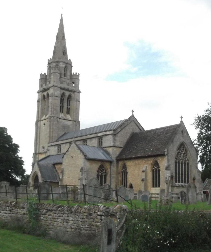
| Description | : | The first church was built in the C12th. Although the present church dates from C13th and C14th, it was restored by the Victorians because of a hailstorm in 1843 which caused a lot of damage. Five of the six bells date from the C17th. The church contains nine important monuments; the earliest dating from the C14th. |
frequently asked questions (FAQ):
-
Where is St Peter and St Paul Churchyard?
St Peter and St Paul Churchyard is located at Exton, Rutland Unitary Authority ,Rutland , LE15 8AXEngland.
-
St Peter and St Paul Churchyard cemetery's updated grave count on graveviews.com?
50 memorials
-
Where are the coordinates of the St Peter and St Paul Churchyard?
Latitude: 52.6905790
Longitude: -0.6396910
Nearby Cemetories:
1. St. Nicholas Churchyard
Cottesmore, Rutland Unitary Authority, England
Coordinate: 52.7128800, -0.6655820
2. St Mary the Virgin Churchyard
Greetham, Rutland Unitary Authority, England
Coordinate: 52.7216100, -0.6325650
3. Empingham Whitwell Road Cemetery
Empingham, Rutland Unitary Authority, England
Coordinate: 52.6676155, -0.6029043
4. St Peter Churchyard
Empingham, Rutland Unitary Authority, England
Coordinate: 52.6656310, -0.5957880
5. St Andrew Churchyard
Hambleton, Rutland Unitary Authority, England
Coordinate: 52.6585060, -0.6712280
6. St Mary the Virgin Churchyard
Edith Weston, Rutland Unitary Authority, England
Coordinate: 52.6379100, -0.6311100
7. St Mary the Virgin Churchyard
Ashwell, Rutland Unitary Authority, England
Coordinate: 52.7144490, -0.7200580
8. Oakham Cemetery
Oakham, Rutland Unitary Authority, England
Coordinate: 52.6768700, -0.7297400
9. Saint Peter and Saint Paul's Churchyard
Market Overton, Rutland Unitary Authority, England
Coordinate: 52.7385000, -0.6893000
10. St Nicholas Churchyard
Thistleton, Rutland Unitary Authority, England
Coordinate: 52.7516900, -0.6483100
11. St Peter's Churchyard
Tickencote, Rutland Unitary Authority, England
Coordinate: 52.6741278, -0.5365826
12. Holy Trinity Churchyard
Teigh, Rutland Unitary Authority, England
Coordinate: 52.7348560, -0.7207040
13. SS Peter and Paul Church
Langham, Rutland Unitary Authority, England
Coordinate: 52.6918700, -0.7529300
14. St. John The Baptist Church
North Luffenham, Rutland Unitary Authority, England
Coordinate: 52.6186570, -0.6211140
15. St Nicholas Churchyard
Pilton, Rutland Unitary Authority, England
Coordinate: 52.6165200, -0.6504100
16. St Peter & St Paul Churchyard
Great Casterton, Rutland Unitary Authority, England
Coordinate: 52.6676700, -0.5203600
17. St. Peter and St. Paul's Churchyard
Wing, Rutland Unitary Authority, England
Coordinate: 52.6172140, -0.6814150
18. Saint Michael and All Angels Churchyard
Edmondthorpe, Melton Borough, England
Coordinate: 52.7488800, -0.7301600
19. Edmondthorpe Main Street Cemetery
Edmondthorpe, Melton Borough, England
Coordinate: 52.7491560, -0.7300030
20. Ketton Park Burial Ground
Ketton, Rutland Unitary Authority, England
Coordinate: 52.6240570, -0.5604330
21. Ketton St Mary the Virgin Churchyard
Ketton, Rutland Unitary Authority, England
Coordinate: 52.6274671, -0.5509559
22. St Andrew Churchyard
Whissendine, Rutland Unitary Authority, England
Coordinate: 52.7200520, -0.7682370
23. St Mary the Virgin Churchyard
South Luffenham, Rutland Unitary Authority, England
Coordinate: 52.6067200, -0.6114100
24. St Wilfrid
Holywell, South Kesteven District, England
Coordinate: 52.7329915, -0.5149881