
| Memorials | : | 0 |
| Location | : | Flushing, Cornwall Unitary Authority, England |
| Coordinate | : | 50.0844440, -5.1009980 |
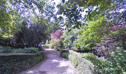
| Description | : | Flushing parish church (Anglican) is located on St Peter's Road and is dedicated to Saint Peter. It is built in the Norman style and was opened for divine worship in February 1842 (consecrated: August 1842). St Peter's was renovated in 1871 by subscriptions collected by Capt Nevill Norway RN, when a vestry was added. It is now a Grade II listed building. Part of the Diocese of Truro, the parish is part of a united benefice with the Parish of Mylor. |
frequently asked questions (FAQ):
-
Where is St. Peter Churchyard?
St. Peter Churchyard is located at Flushing, Cornwall Unitary Authority ,Cornwall ,England.
-
St. Peter Churchyard cemetery's updated grave count on graveviews.com?
0 memorials
-
Where are the coordinates of the St. Peter Churchyard?
Latitude: 50.0844440
Longitude: -5.1009980
Nearby Cemetories:
1. St Dunstan Church Cemetery
Manaccan, Cornwall Unitary Authority, England
Coordinate: 50.0836800, -5.1255200
2. Ss Manaccus & Dunstan Churchyard
Manaccan, Cornwall Unitary Authority, England
Coordinate: 50.0830860, -5.1269460
3. St Constantine Churchyard
Constantine, Cornwall Unitary Authority, England
Coordinate: 50.1181980, -5.1748880
4. St Peter Churchyard
Coverack, Cornwall Unitary Authority, England
Coordinate: 50.0236070, -5.0978950
5. Falmouth Cemetery
Falmouth, Cornwall Unitary Authority, England
Coordinate: 50.1437550, -5.0755230
6. St Budock Churchyard
Budock, Cornwall Unitary Authority, England
Coordinate: 50.1501600, -5.1003360
7. Mabe Churchyard
Mabe, Cornwall Unitary Authority, England
Coordinate: 50.1497800, -5.1404600
8. St Corentine Churchyard
Cury, Cornwall Unitary Authority, England
Coordinate: 50.0461920, -5.2452850
9. Cury Cemetery
Helston, Cornwall Unitary Authority, England
Coordinate: 50.0471500, -5.2462600
10. Helston Cemetery
Helston, Cornwall Unitary Authority, England
Coordinate: 50.0956590, -5.2690150
11. St Michael Churchyard
Helston, Cornwall Unitary Authority, England
Coordinate: 50.1033570, -5.2765600
12. St. Winwaloe Churchyard
Gunwalloe, Cornwall Unitary Authority, England
Coordinate: 50.0389880, -5.2690600
13. St Feock Churchyard
Feock, Cornwall Unitary Authority, England
Coordinate: 50.2058070, -5.0497230
14. St John the Evangelist and St Petroc
Feock, Cornwall Unitary Authority, England
Coordinate: 50.2116600, -5.0929700
15. St. Wenappa Churchyard
Gwennap, Cornwall Unitary Authority, England
Coordinate: 50.2176600, -5.1709770
16. Lanner Christchurch
Lanner, Cornwall Unitary Authority, England
Coordinate: 50.2141000, -5.2047500
17. Crowan Anglican Churchyard
Crowan, Cornwall Unitary Authority, England
Coordinate: 50.1637320, -5.2976630
18. Breage Parish Council Cemetery
Breage, Cornwall Unitary Authority, England
Coordinate: 50.1080600, -5.3306300
19. Breage War Memorial Cemetery
Breage, Cornwall Unitary Authority, England
Coordinate: 50.1080100, -5.3314400
20. St. Breaca New Church Cemetery
Breage, Cornwall Unitary Authority, England
Coordinate: 50.1088900, -5.3316800
21. St. Breaca Churchyard
Breage, Cornwall Unitary Authority, England
Coordinate: 50.1083210, -5.3321080
22. All Hallows Churchyard
Kea, Cornwall Unitary Authority, England
Coordinate: 50.2430560, -5.0729050
23. Baldhu Parish Churchyard
Kea, Cornwall Unitary Authority, England
Coordinate: 50.2460420, -5.1264660
24. St. John the Evangelist Churchyard
Camborne, Cornwall Unitary Authority, England
Coordinate: 50.1935761, -5.2931032