
| Memorials | : | 0 |
| Location | : | Breage, Cornwall Unitary Authority, England |
| Coordinate | : | 50.1080600, -5.3306300 |
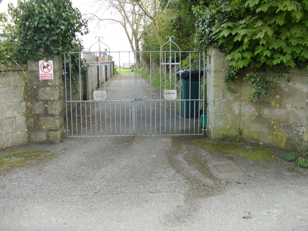
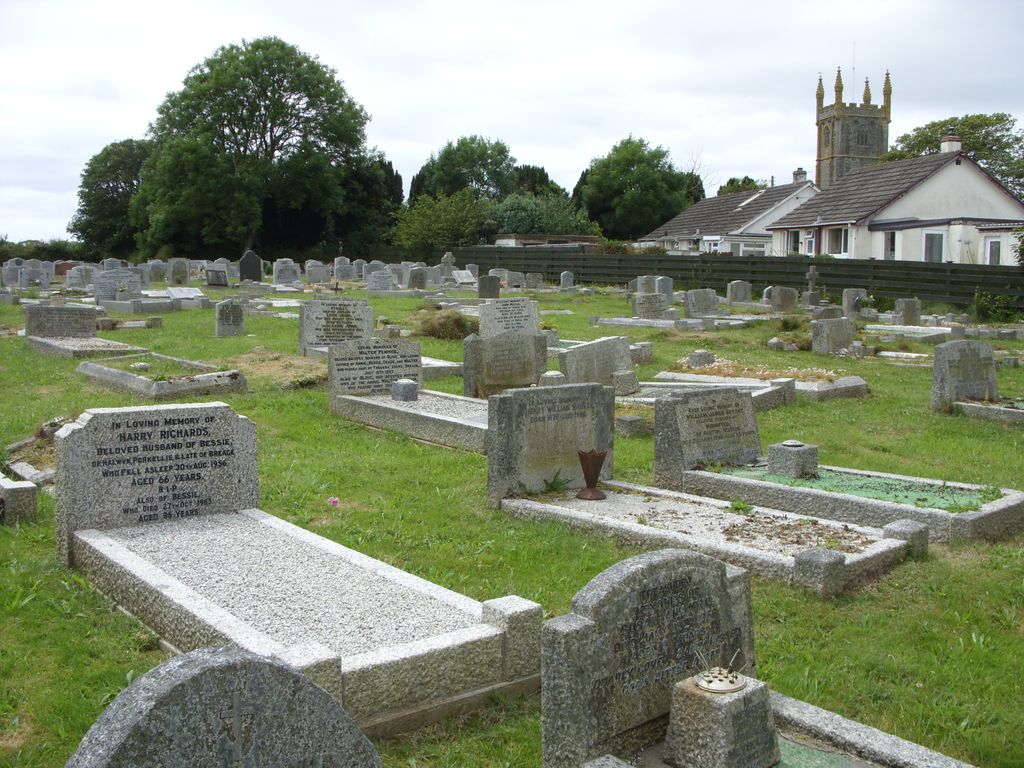
| Description | : | This is the latest of the cemetery sites in Breage and is the one in current use. This is a public cemetery which opened in 1955 and is managed by the Breage Parish Council. It has recently been extended to the field behind the Memorial Cemetery which belongs to the St Breaca Church. It is not to be confused with the cemetery across the road from St Breaca Church also on Sethnoe Way. This cemetery belongs to the church and is known as the St Breaca North Cemetery. |
frequently asked questions (FAQ):
-
Where is Breage Parish Council Cemetery?
Breage Parish Council Cemetery is located at Sethnoe Way Breage, Cornwall Unitary Authority ,Cornwall , TR13 9PDEngland.
-
Breage Parish Council Cemetery cemetery's updated grave count on graveviews.com?
0 memorials
-
Where are the coordinates of the Breage Parish Council Cemetery?
Latitude: 50.1080600
Longitude: -5.3306300
Nearby Cemetories:
1. Breage War Memorial Cemetery
Breage, Cornwall Unitary Authority, England
Coordinate: 50.1080100, -5.3314400
2. St. Breaca Churchyard
Breage, Cornwall Unitary Authority, England
Coordinate: 50.1083210, -5.3321080
3. St. Breaca New Church Cemetery
Breage, Cornwall Unitary Authority, England
Coordinate: 50.1088900, -5.3316800
4. Balwest Chapel Cemetery
Germoe, Cornwall Unitary Authority, England
Coordinate: 50.1213610, -5.3644730
5. St John the Baptist Churchyard
Godolphin Cross, Cornwall Unitary Authority, England
Coordinate: 50.1333830, -5.3470240
6. St Michael Churchyard
Helston, Cornwall Unitary Authority, England
Coordinate: 50.1033570, -5.2765600
7. Helston Cemetery
Helston, Cornwall Unitary Authority, England
Coordinate: 50.0956590, -5.2690150
8. Crowan Anglican Churchyard
Crowan, Cornwall Unitary Authority, England
Coordinate: 50.1637320, -5.2976630
9. St. Winwaloe Churchyard
Gunwalloe, Cornwall Unitary Authority, England
Coordinate: 50.0389880, -5.2690600
10. Cury Cemetery
Helston, Cornwall Unitary Authority, England
Coordinate: 50.0471500, -5.2462600
11. St Corentine Churchyard
Cury, Cornwall Unitary Authority, England
Coordinate: 50.0461920, -5.2452850
12. St. Gwinear Churchyard
Gwinear, Cornwall Unitary Authority, England
Coordinate: 50.1874090, -5.3706170
13. Gwinear Parish Church Cemetery
Gwinear, Cornwall Unitary Authority, England
Coordinate: 50.1879940, -5.3714960
14. St. John the Evangelist Churchyard
Camborne, Cornwall Unitary Authority, England
Coordinate: 50.1935761, -5.2931032
15. Killivose Cemetery
Camborne, Cornwall Unitary Authority, England
Coordinate: 50.2027700, -5.3036500
16. Rescorla Monument
Hayle, Cornwall Unitary Authority, England
Coordinate: 50.1857330, -5.4215940
17. St Constantine Churchyard
Constantine, Cornwall Unitary Authority, England
Coordinate: 50.1181980, -5.1748880
18. St Felicitas and St Piala Churchyard
Hayle, Cornwall Unitary Authority, England
Coordinate: 50.1961600, -5.4124860
19. Southern Anglican Cemetery
Lelant, Cornwall Unitary Authority, England
Coordinate: 50.1879380, -5.4361620
20. St. Uny Churchyard Old
Lelant, Cornwall Unitary Authority, England
Coordinate: 50.1887240, -5.4362110
21. Eastern Anglican Cemetery
Lelant, Cornwall Unitary Authority, England
Coordinate: 50.1885730, -5.4367950
22. Western Non-Anglican Cemetery
Lelant, Cornwall Unitary Authority, England
Coordinate: 50.1887070, -5.4373470
23. St. Martin and St. Meriadoc Churchyard
Camborne, Cornwall Unitary Authority, England
Coordinate: 50.2134190, -5.3020460
24. Camborne Cemetery
Camborne, Cornwall Unitary Authority, England
Coordinate: 50.2157510, -5.3098940