
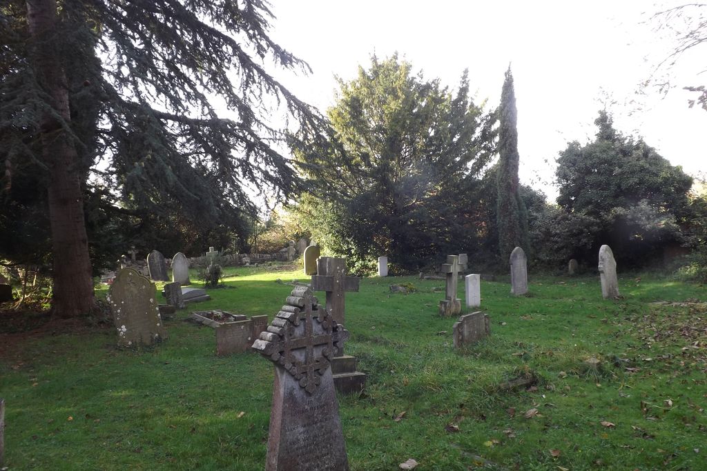
| Memorials | : | 7 |
| Location | : | Wolvercote, City of Oxford, England |
| Coordinate | : | 51.7848300, -1.2811100 |
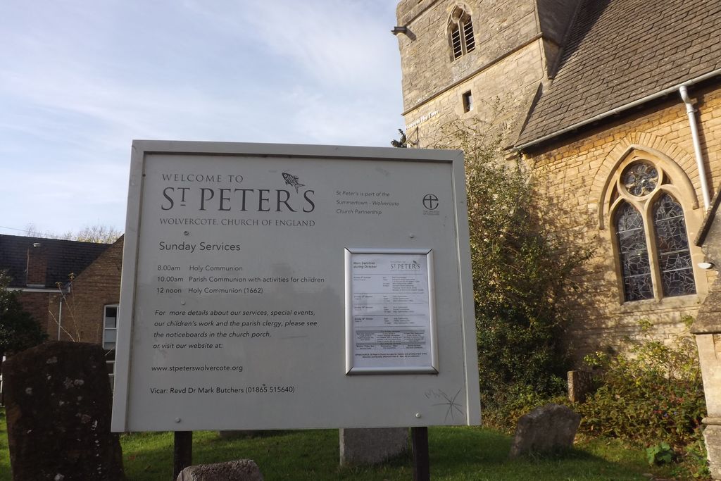
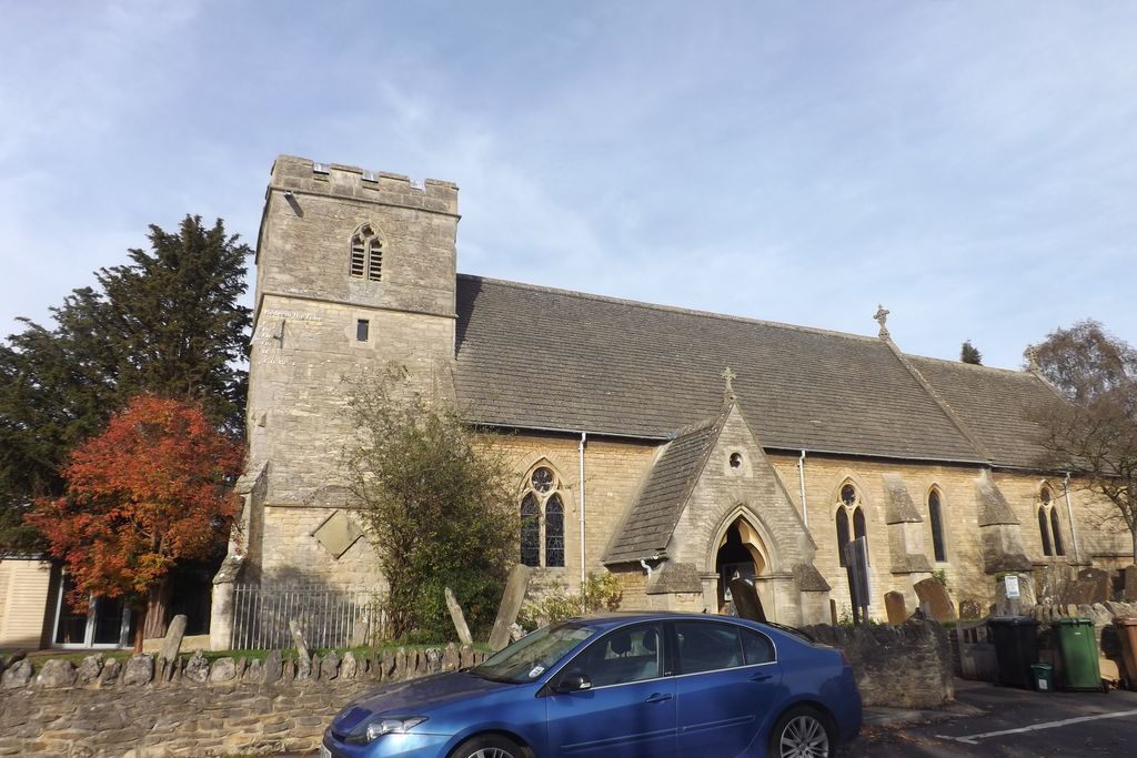
| Description | : | Wolvercote is a village which is part of the City of Oxford, though still retaining its own identity. It is about 3 miles northwest of the centre of Oxford, on the northern edge of Wolvercote Common, which is itself north of Port Meadow and adjoins the Thames. The village is listed in the Domesday Book of 1086 as Ulfgarcote (Cottage of Woolgar; or Woolgar's place); the name had mutated to Wolvercote by 1185. The Church of England parish church of St. Peter is in Upper Wolvercote. It has a fourteenth-century west tower and fifteenth-century window and doorway. It was rebuilt in 1860 in... Read More |
frequently asked questions (FAQ):
-
Where is St. Peter Churchyard?
St. Peter Churchyard is located at First Turn Wolvercote, City of Oxford ,Oxfordshire , OX2 8ASEngland.
-
St. Peter Churchyard cemetery's updated grave count on graveviews.com?
5 memorials
-
Where are the coordinates of the St. Peter Churchyard?
Latitude: 51.7848300
Longitude: -1.2811100
Nearby Cemetories:
1. Wolvercote Cemetery
Oxford, City of Oxford, England
Coordinate: 51.7913666, -1.2721500
2. St Michael and All Angels Summertown
Oxford, City of Oxford, England
Coordinate: 51.7796280, -1.2643940
3. Godstow Abbey Ruins
Oxford, City of Oxford, England
Coordinate: 51.7784060, -1.2998170
4. Saint Margaret of Antioch
City of Oxford, England
Coordinate: 51.7690340, -1.2975900
5. Wytham Churchyard
Wytham, Vale of White Horse District, England
Coordinate: 51.7736230, -1.3131610
6. Yarnton Cemetery
Yarnton, Cherwell District, England
Coordinate: 51.8004080, -1.3103260
7. St. Bartholomew's Churchyard
Yarnton, Cherwell District, England
Coordinate: 51.8016610, -1.3087620
8. St. Sepulchres Cemetery
Oxford, City of Oxford, England
Coordinate: 51.7611110, -1.2694440
9. St Paul's Oxford Cemetery
Oxford, City of Oxford, England
Coordinate: 51.7594590, -1.2648470
10. Saint Barnabas Church
Oxford, City of Oxford, England
Coordinate: 51.7579620, -1.2697600
11. St. Nicholas Churchyard
Old Marston, City of Oxford, England
Coordinate: 51.7761340, -1.2373130
12. St Giles Churchyard
Oxford, City of Oxford, England
Coordinate: 51.7591660, -1.2605170
13. Elsfield Road Cemetery
Old Marston, City of Oxford, England
Coordinate: 51.7752940, -1.2332640
14. Blackfriars
Oxford, City of Oxford, England
Coordinate: 51.7561210, -1.2602060
15. Rewley Abbey
Oxford, City of Oxford, England
Coordinate: 51.7543810, -1.2675170
16. St Johns College
Oxford, City of Oxford, England
Coordinate: 51.7560820, -1.2589910
17. Mansfield College Chapel
Oxford, City of Oxford, England
Coordinate: 51.7576410, -1.2523340
18. Martyrs' Memorial
Oxford, City of Oxford, England
Coordinate: 51.7550900, -1.2590100
19. St Frideswide Churchyard
Oxford, City of Oxford, England
Coordinate: 51.7521560, -1.2748350
20. Trinity College Chapel
Oxford, City of Oxford, England
Coordinate: 51.7552360, -1.2569620
21. St. Mary Magdalene's Churchyard
Oxford, City of Oxford, England
Coordinate: 51.7546250, -1.2588340
22. Wadham College Chapel
Oxford, City of Oxford, England
Coordinate: 51.7560700, -1.2540350
23. Balliol College Chapel
Oxford, City of Oxford, England
Coordinate: 51.7547800, -1.2572240
24. Botley Cemetery
Botley, Vale of White Horse District, England
Coordinate: 51.7518050, -1.2930000