
| Memorials | : | 8 |
| Location | : | Robin Hoods Bay, Scarborough Borough, England |
| Coordinate | : | 54.4341460, -0.5394280 |
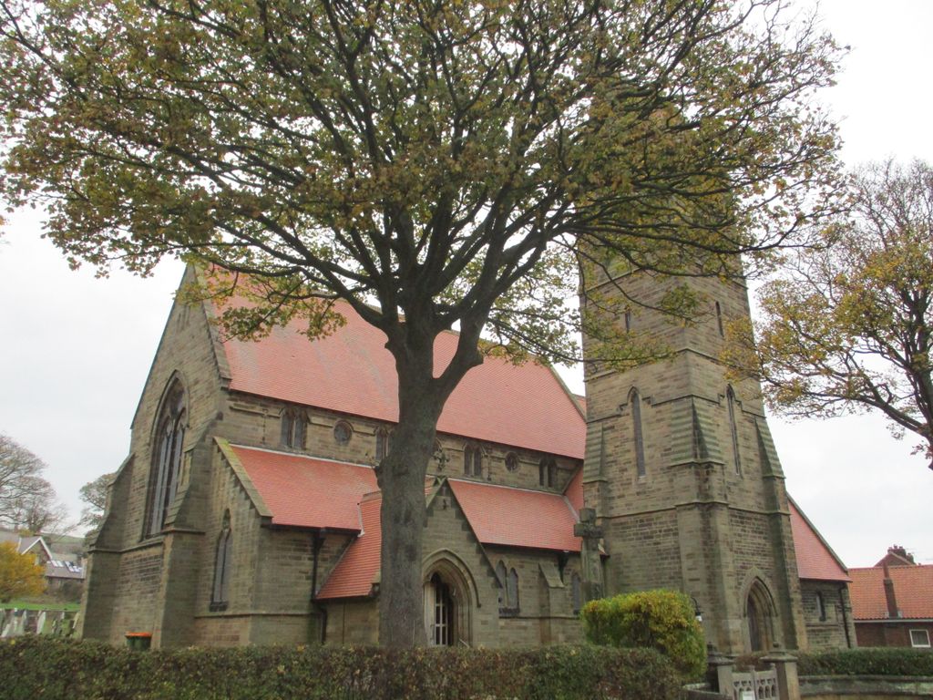
| Description | : | The church building at this site still referred to as St Stephen New Church even though it opened in 1870. It serves as the the parish church for Robin Hood's Bay and Fylingthorpe. It superseded St Stephen Old Church. Extensive churchyards are found at both locations. There are eight armed services personnel who died during their service in First or Second World Wars buried in St Stephen New Churchyard. Also buried is an unknown sailor of the Mercantile Marine who died during the First World War. |
frequently asked questions (FAQ):
-
Where is St. Stephen's New Churchyard?
St. Stephen's New Churchyard is located at 6 Thorpe Lane Robin Hoods Bay, Scarborough Borough ,North Yorkshire , YO22 4RNEngland.
-
St. Stephen's New Churchyard cemetery's updated grave count on graveviews.com?
5 memorials
-
Where are the coordinates of the St. Stephen's New Churchyard?
Latitude: 54.4341460
Longitude: -0.5394280


Nearby Cemetories:
1. St. Stephen Old Churchyard
Fylingdales, Scarborough Borough, England
Coordinate: 54.4400890, -0.5496350
2. All Saints Churchyard
High Hawsker, Scarborough Borough, England
Coordinate: 54.4624580, -0.5785000
3. St Hilda Churchyard
Ravenscar, Scarborough Borough, England
Coordinate: 54.3973500, -0.4925300
4. St. Hilda's Churchyard
Sneaton, Scarborough Borough, England
Coordinate: 54.4579490, -0.6226930
5. Whitby Cemetery
Whitby, Scarborough Borough, England
Coordinate: 54.4755000, -0.6106500
6. All Saints Churchyard
Ugglebarnby, Scarborough Borough, England
Coordinate: 54.4522340, -0.6446610
7. Whitby Abbey
Whitby, Scarborough Borough, England
Coordinate: 54.4883230, -0.6073850
8. St. Mary the Virgin Churchyard
Whitby, Scarborough Borough, England
Coordinate: 54.4888400, -0.6093420
9. Staintondale Churchyard
Staintondale, Scarborough Borough, England
Coordinate: 54.3752645, -0.4795295
10. Quaker Burial Ground
Whitby, Scarborough Borough, England
Coordinate: 54.4847790, -0.6194700
11. St John the Evangelist Churchyard
Sleights, Scarborough Borough, England
Coordinate: 54.4503500, -0.6651200
12. St Hilda Priory Cemetery
Whitby, Scarborough Borough, England
Coordinate: 54.4823300, -0.6431400
13. St Margaret Churchyard (Ruins)
Harwood Dale, Scarborough Borough, England
Coordinate: 54.3558170, -0.5365790
14. St. Margaret's Churchyard
Aislaby, Scarborough Borough, England
Coordinate: 54.4653900, -0.6792400
15. St Margaret Churchyard
Harwood Dale, Scarborough Borough, England
Coordinate: 54.3470030, -0.5238540
16. Ebenezers Baptist Church
Scarborough Borough, England
Coordinate: 54.3744655, -0.6557164
17. St Matthew Churchyard
Grosmont, Scarborough Borough, England
Coordinate: 54.4348410, -0.7243950
18. St Oswald Churchyard
Lythe, Scarborough Borough, England
Coordinate: 54.5065120, -0.6885870
19. Cloughton Church Cemetery
Cloughton, Scarborough Borough, England
Coordinate: 54.3322500, -0.4511900
20. St Mary Churchyard
Goathland, Scarborough Borough, England
Coordinate: 54.3950300, -0.7266400
21. St Hilda Churchyard
Egton, Scarborough Borough, England
Coordinate: 54.4414240, -0.7535720
22. St Peter Churchyard
Langdale End, Scarborough Borough, England
Coordinate: 54.3065050, -0.5557030
23. St Peter Churchyard
Hackness, Scarborough Borough, England
Coordinate: 54.3012880, -0.5127850
24. Egton Cemetery
Egton, Scarborough Borough, England
Coordinate: 54.4482300, -0.7690700