
| Memorials | : | 12 |
| Location | : | Scarborough Borough, England |
| Coordinate | : | 54.3744655, -0.6557164 |
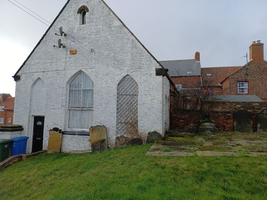
| Description | : | Chapel burned down in 1952, graves were removed and grave stones put to the perimeter of the plot. The plot was built on with social housing |
frequently asked questions (FAQ):
-
Where is Ebenezers Baptist Church?
Ebenezers Baptist Church is located at Longwestgate Scarborough Scarborough Borough ,North Yorkshire ,England.
-
Ebenezers Baptist Church cemetery's updated grave count on graveviews.com?
12 memorials
-
Where are the coordinates of the Ebenezers Baptist Church?
Latitude: 54.3744655
Longitude: -0.6557164


Nearby Cemetories:
1. St Mary Churchyard
Goathland, Scarborough Borough, England
Coordinate: 54.3950300, -0.7266400
2. St Margaret Churchyard (Ruins)
Harwood Dale, Scarborough Borough, England
Coordinate: 54.3558170, -0.5365790
3. St Matthew Churchyard
Grosmont, Scarborough Borough, England
Coordinate: 54.4348410, -0.7243950
4. St John the Evangelist Churchyard
Sleights, Scarborough Borough, England
Coordinate: 54.4503500, -0.6651200
5. All Saints Churchyard
Ugglebarnby, Scarborough Borough, England
Coordinate: 54.4522340, -0.6446610
6. Lockton Cemetery
Lockton, Ryedale District, England
Coordinate: 54.2977400, -0.7003200
7. St Giles Churchyard
Lockton, Ryedale District, England
Coordinate: 54.2987100, -0.7057700
8. St Margaret Churchyard
Harwood Dale, Scarborough Borough, England
Coordinate: 54.3470030, -0.5238540
9. St Mary the Virgin Churchyard
Levisham, Ryedale District, England
Coordinate: 54.2992000, -0.7223000
10. St. Hilda's Churchyard
Sneaton, Scarborough Borough, England
Coordinate: 54.4579490, -0.6226930
11. St Hilda Churchyard
Egton, Scarborough Borough, England
Coordinate: 54.4414240, -0.7535720
12. St Peter Churchyard
Langdale End, Scarborough Borough, England
Coordinate: 54.3065050, -0.5557030
13. St. Stephen Old Churchyard
Fylingdales, Scarborough Borough, England
Coordinate: 54.4400890, -0.5496350
14. St. Stephen's New Churchyard
Robin Hoods Bay, Scarborough Borough, England
Coordinate: 54.4341460, -0.5394280
15. St. John’s Churchyard
Newton-on-Rawcliffe, Ryedale District, England
Coordinate: 54.3022700, -0.7520000
16. St. Margaret's Churchyard
Aislaby, Scarborough Borough, England
Coordinate: 54.4653900, -0.6792400
17. Newton upon Rawcliffe Cemetery
Newton-on-Rawcliffe, Ryedale District, England
Coordinate: 54.2998382, -0.7503566
18. St Hilda Churchyard
Ravenscar, Scarborough Borough, England
Coordinate: 54.3973500, -0.4925300
19. All Saints Churchyard
High Hawsker, Scarborough Borough, England
Coordinate: 54.4624580, -0.5785000
20. Egton Cemetery
Egton, Scarborough Borough, England
Coordinate: 54.4482300, -0.7690700
21. Staintondale Churchyard
Staintondale, Scarborough Borough, England
Coordinate: 54.3752645, -0.4795295
22. Whitby Cemetery
Whitby, Scarborough Borough, England
Coordinate: 54.4755000, -0.6106500
23. St Hilda Priory Cemetery
Whitby, Scarborough Borough, England
Coordinate: 54.4823300, -0.6431400
24. St Thomas Churchyard
Glaisdale, Scarborough Borough, England
Coordinate: 54.4373700, -0.8083400