
| Memorials | : | 0 |
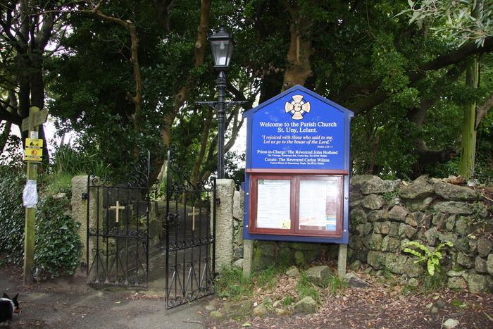
| Location | : | Lelant, Cornwall Unitary Authority, England |
| Coordinate | : | 50.1887240, -5.4362110 |
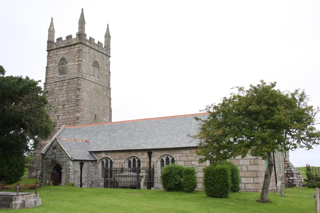
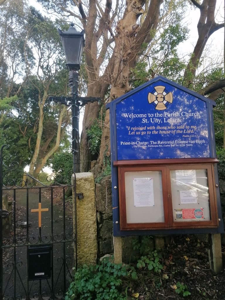
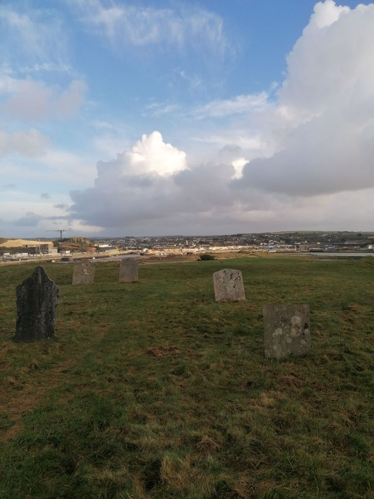
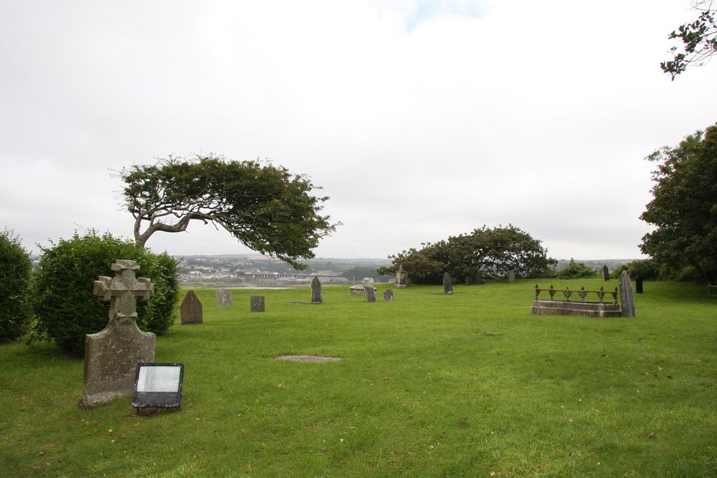
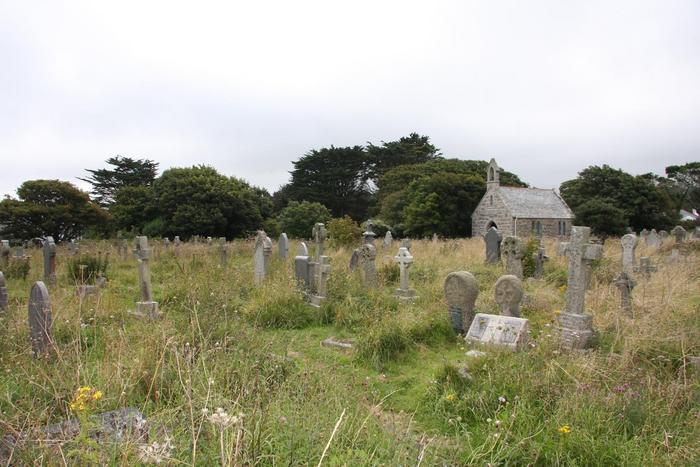
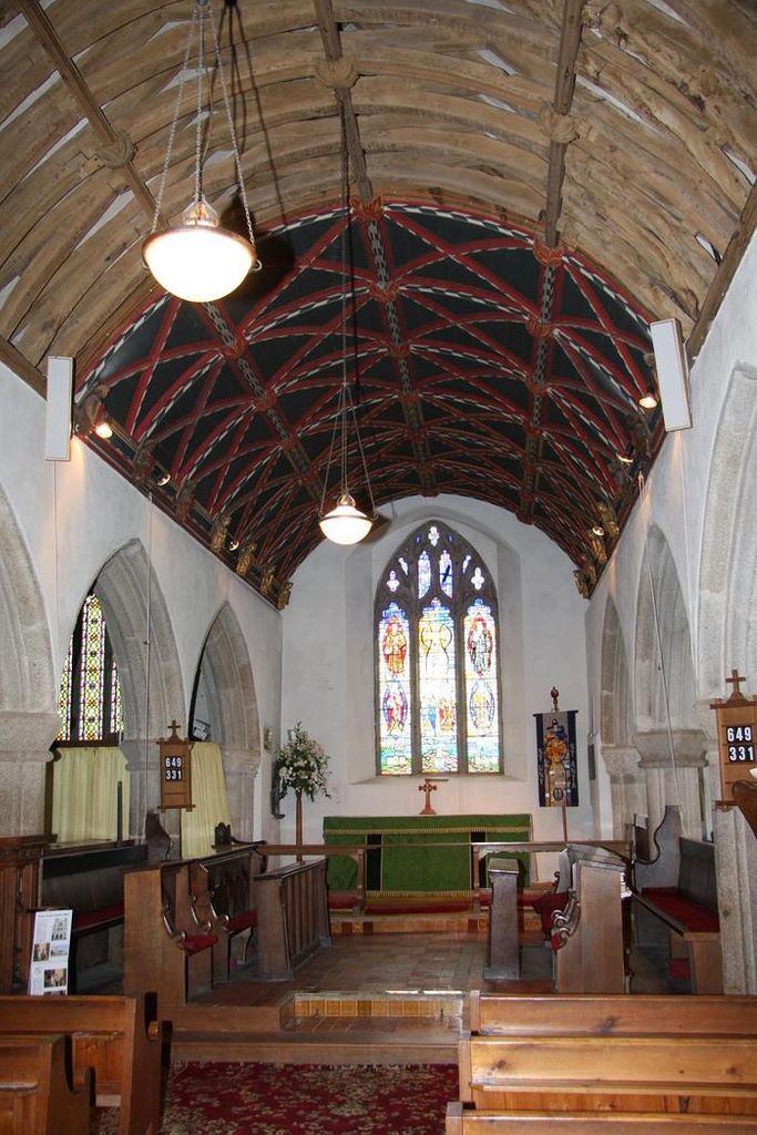
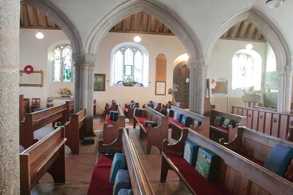
| Description | : | There is no record of the date of first consecration of the original Norman Church, now incorporated into the North Aisle. The earliest reference being in 1170 when Thomas Beckett, Archbishop of Canerbury, referred to 'Church of St Euni'. The building, which replaced an earlier wooden structure, was extended during the 14th century by aqddition of the present nave and south aisle. Original burial ground for the parish church at Lelant. This churchyard was closed on 30 June 1877 and burials then commenced in the adjoining Eastern (Anglican) and Western (non-Anglican) cemeteries. Another Anglican cemetery, the Southern Cemetery was added... Read More |
frequently asked questions (FAQ):
-
Where is St. Uny Churchyard Old?
St. Uny Churchyard Old is located at Church Rd Lelant, Cornwall Unitary Authority ,Cornwall , TR26 3DYEngland.
-
St. Uny Churchyard Old cemetery's updated grave count on graveviews.com?
0 memorials
-
Where are the coordinates of the St. Uny Churchyard Old?
Latitude: 50.1887240
Longitude: -5.4362110
Nearby Cemetories:
1. Eastern Anglican Cemetery
Lelant, Cornwall Unitary Authority, England
Coordinate: 50.1885730, -5.4367950
2. Western Non-Anglican Cemetery
Lelant, Cornwall Unitary Authority, England
Coordinate: 50.1887070, -5.4373470
3. Southern Anglican Cemetery
Lelant, Cornwall Unitary Authority, England
Coordinate: 50.1879380, -5.4361620
4. Rescorla Monument
Hayle, Cornwall Unitary Authority, England
Coordinate: 50.1857330, -5.4215940
5. Longstone Cemetery
Carbis Bay, Cornwall Unitary Authority, England
Coordinate: 50.1918260, -5.4605190
6. St Felicitas and St Piala Churchyard
Hayle, Cornwall Unitary Authority, England
Coordinate: 50.1961600, -5.4124860
7. Gwinear Parish Church Cemetery
Gwinear, Cornwall Unitary Authority, England
Coordinate: 50.1879940, -5.3714960
8. St. Gwinear Churchyard
Gwinear, Cornwall Unitary Authority, England
Coordinate: 50.1874090, -5.3706170
9. St. Gothians Churchyard
Gwithian, Cornwall Unitary Authority, England
Coordinate: 50.2221222, -5.3850918
10. St Ludgvan and St Paul Churchyard
Ludgvan, Cornwall Unitary Authority, England
Coordinate: 50.1447940, -5.4932190
11. St John the Baptist Churchyard
Godolphin Cross, Cornwall Unitary Authority, England
Coordinate: 50.1333830, -5.3470240
12. Balwest Chapel Cemetery
Germoe, Cornwall Unitary Authority, England
Coordinate: 50.1213610, -5.3644730
13. Camborne Cemetery
Camborne, Cornwall Unitary Authority, England
Coordinate: 50.2157510, -5.3098940
14. Killivose Cemetery
Camborne, Cornwall Unitary Authority, England
Coordinate: 50.2027700, -5.3036500
15. St. Martin and St. Meriadoc Churchyard
Camborne, Cornwall Unitary Authority, England
Coordinate: 50.2134190, -5.3020460
16. St. John the Evangelist Churchyard
Camborne, Cornwall Unitary Authority, England
Coordinate: 50.1935761, -5.2931032
17. Crowan Anglican Churchyard
Crowan, Cornwall Unitary Authority, England
Coordinate: 50.1637320, -5.2976630
18. Wesley Rock Cemetery
Heamoor, Cornwall Unitary Authority, England
Coordinate: 50.1284900, -5.5507200
19. Centenary Methodist Chapel & Cemetery
Camborne, Cornwall Unitary Authority, England
Coordinate: 50.2147340, -5.2928470
20. Madron Parish Churchyard
Madron, Cornwall Unitary Authority, England
Coordinate: 50.1317547, -5.5647815
21. All Saints Churchyard
Camborne, Cornwall Unitary Authority, England
Coordinate: 50.2201180, -5.2858190
22. Madron Cemetery
Madron, Cornwall Unitary Authority, England
Coordinate: 50.1327760, -5.5684290
23. St. Breaca New Church Cemetery
Breage, Cornwall Unitary Authority, England
Coordinate: 50.1088900, -5.3316800
24. St. Breaca Churchyard
Breage, Cornwall Unitary Authority, England
Coordinate: 50.1083210, -5.3321080