
| Memorials | : | 0 |
| Location | : | Leicester, Leicester Unitary Authority, England |
| Phone | : | +4401162707305 |
| Website | : | www.sjbchurch.co.uk/ |
| Coordinate | : | 52.6181730, -1.1118790 |
frequently asked questions (FAQ):
-
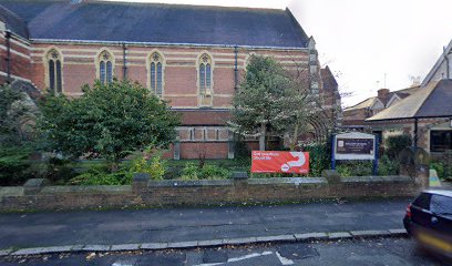
Where is St. john the Baptist?
St. john the Baptist is located at 4a Clarendon Park Road Leicester, Leicester Unitary Authority ,Leicestershire , LE2 3ADEngland.
-
St. john the Baptist cemetery's updated grave count on graveviews.com?
0 memorials
-
Where are the coordinates of the St. john the Baptist?
Latitude: 52.6181730
Longitude: -1.1118790
Nearby Cemetories:
1. Welford Road Cemetery
Leicester, Leicester Unitary Authority, England
Coordinate: 52.6200104, -1.1295080
2. St Peter's Church (Defunct)
Leicester, Leicester Unitary Authority, England
Coordinate: 52.6300260, -1.1164980
3. Saint Mary Magdalene Churchyard
Knighton, Leicester Unitary Authority, England
Coordinate: 52.6054170, -1.1163730
4. St George's Church
Leicester, Leicester Unitary Authority, England
Coordinate: 52.6344300, -1.1267420
5. Church of the Annunciation of St. Mary
Leicester, Leicester Unitary Authority, England
Coordinate: 52.6308229, -1.1417201
6. St. Mary de Castro Churchyard
Leicester, Leicester Unitary Authority, England
Coordinate: 52.6322610, -1.1404000
7. Leicester Cathedral
Leicester, Leicester Unitary Authority, England
Coordinate: 52.6347430, -1.1370210
8. St. Denys' Churchyard
Evington, Leicester Unitary Authority, England
Coordinate: 52.6193210, -1.0743860
9. St. Nicholas Church
Leicester, Leicester Unitary Authority, England
Coordinate: 52.6351400, -1.1408940
10. Great Meeting Unitarian Chapel
Leicester, Leicester Unitary Authority, England
Coordinate: 52.6379400, -1.1360390
11. All Saints Church
Leicester, Leicester Unitary Authority, England
Coordinate: 52.6381940, -1.1403170
12. St Margaret Churchyard
Leicester, Leicester Unitary Authority, England
Coordinate: 52.6403430, -1.1363440
13. Saffron Hill Cemetery
Leicester, Leicester Unitary Authority, England
Coordinate: 52.5934120, -1.1310010
14. St. Peter Churchyard
Oadby, Oadby and Wigston Borough, England
Coordinate: 52.5973900, -1.0805100
15. Oadby Cemetery
Oadby, Oadby and Wigston Borough, England
Coordinate: 52.5961580, -1.0826170
16. St Andrew Churchyard
Aylestone, Leicester Unitary Authority, England
Coordinate: 52.6038420, -1.1568900
17. St Wistan's Churchyard
Wigston, Oadby and Wigston Borough, England
Coordinate: 52.5866580, -1.1024700
18. Wigston United Reformed Church
Wigston, Oadby and Wigston Borough, England
Coordinate: 52.5840900, -1.1071200
19. Leicester Abbey
Leicester, Leicester Unitary Authority, England
Coordinate: 52.6489600, -1.1369470
20. Church of St. Mary and All Saints
Stoughton, Harborough District, England
Coordinate: 52.6129090, -1.0552350
21. All Saints Churchyard
Wigston, Oadby and Wigston Borough, England
Coordinate: 52.5823880, -1.1096900
22. St. Mary's Churchyard
Humberstone, Leicester Unitary Authority, England
Coordinate: 52.6479200, -1.0760100
23. Saint Luke Churchyard
Thurnby, Harborough District, England
Coordinate: 52.6291480, -1.0457760
24. St. Peter's Churchyard
Belgrave, Leicester Unitary Authority, England
Coordinate: 52.6594208, -1.1255690