
| Memorials | : | 8 |
| Location | : | Saint Joseph, Buchanan County, USA |
| Coordinate | : | 39.7717209, -94.8067780 |
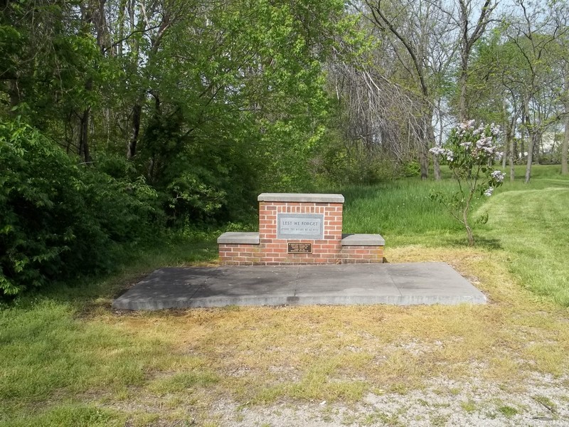
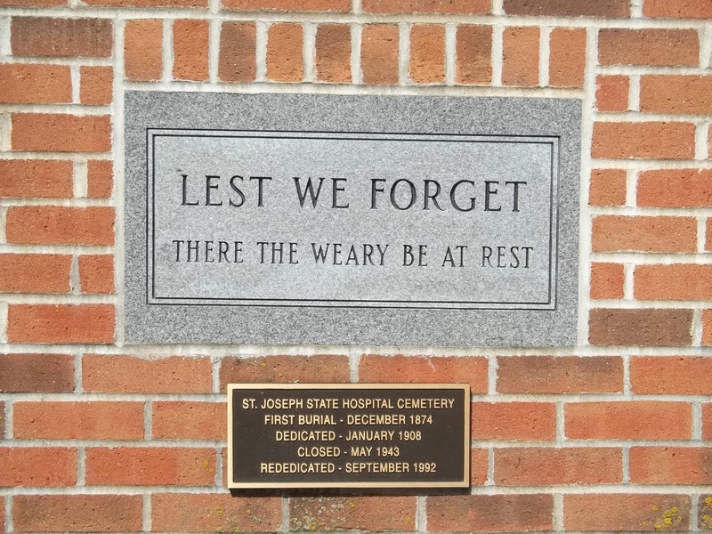
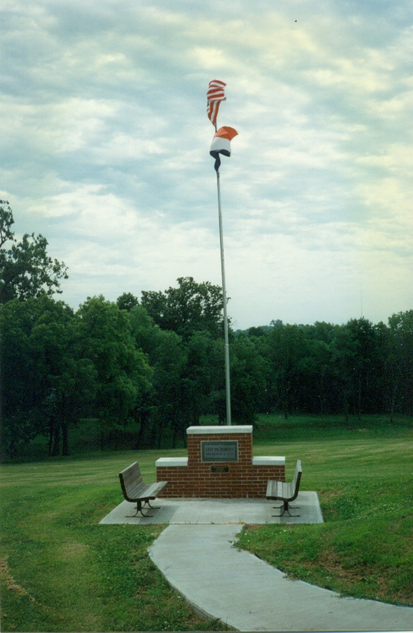
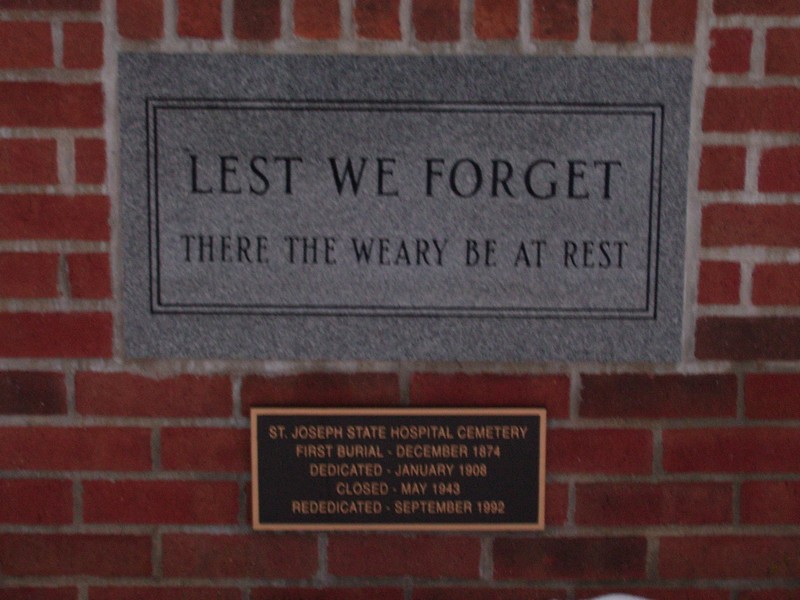
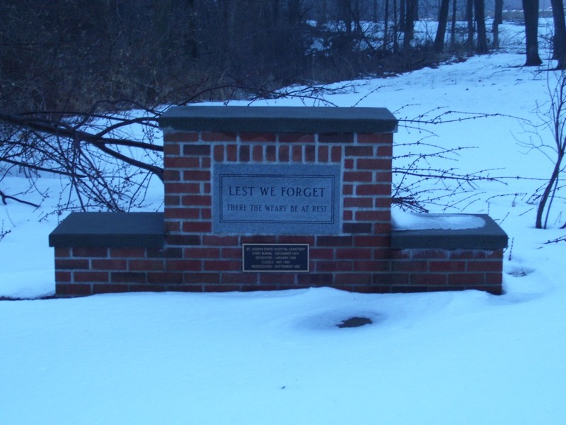
| Description | : | The cemetery is no longer maintained nor are there any markers visible. The memorial marker shown is the only sign of this cemetery having been here. Status of the burials is unknown (it is not known at this time whether they were moved or still exist at this site). The State Hospital is now a state prison, and access to any area other than the place of the marker is forbidden (and there is a No Trespassing sign there also). |
frequently asked questions (FAQ):
-
Where is State Hospital Cemetery?
State Hospital Cemetery is located at Saint Joseph, Buchanan County ,Missouri ,USA.
-
State Hospital Cemetery cemetery's updated grave count on graveviews.com?
7 memorials
-
Where are the coordinates of the State Hospital Cemetery?
Latitude: 39.7717209
Longitude: -94.8067780
Nearby Cemetories:
1. Mount Auburn Cemetery
Saint Joseph, Buchanan County, USA
Coordinate: 39.7859497, -94.8156281
2. Adath Joseph Cemetery
Saint Joseph, Buchanan County, USA
Coordinate: 39.7860718, -94.8164215
3. Ashland Cemetery
Saint Joseph, Buchanan County, USA
Coordinate: 39.7881813, -94.8218002
4. Saint Joseph Memorial Park
Saint Joseph, Buchanan County, USA
Coordinate: 39.7796249, -94.7824707
5. Shaare Sholem Cemetery
Saint Joseph, Buchanan County, USA
Coordinate: 39.7889404, -94.8234482
6. Mount Mora Cemetery
Saint Joseph, Buchanan County, USA
Coordinate: 39.7743225, -94.8418808
7. Mount Olivet Cemetery
Saint Joseph, Buchanan County, USA
Coordinate: 39.7953262, -94.8294296
8. Leanord Cemetery
Buchanan County, USA
Coordinate: 39.7459989, -94.7832187
9. Buchanan County Poor Farm Cemetery
Saint Joseph, Buchanan County, USA
Coordinate: 39.8170160, -94.8113140
10. Maxwell Cemetery
Saint Joseph, Buchanan County, USA
Coordinate: 39.8065948, -94.8490295
11. Bnai Sholem Cemetery
Buchanan County, USA
Coordinate: 39.8191986, -94.7988968
12. Sunbridge Cemetery
Saint Joseph, Buchanan County, USA
Coordinate: 39.8053818, -94.8513336
13. Nelson Cemetery
Buchanan County, USA
Coordinate: 39.7201614, -94.8059692
14. Elwood Cemetery
Elwood, Doniphan County, USA
Coordinate: 39.7652300, -94.8760500
15. Ozenberger Cemetery
Buchanan County, USA
Coordinate: 39.8050003, -94.7461014
16. Green Valley Cemetery
Andrew County, USA
Coordinate: 39.8211594, -94.8477020
17. Fairview Cumberland Presbyterian Cemetery
Country Club Village, Andrew County, USA
Coordinate: 39.8283005, -94.7857971
18. Felix Cemetery
Saint Joseph, Buchanan County, USA
Coordinate: 39.8090330, -94.8673600
19. Samuel Ball Green Cemetery
Andrew County, USA
Coordinate: 39.8264400, -94.8586500
20. Todd Cemetery
Country Club Village, Andrew County, USA
Coordinate: 39.8342018, -94.8424988
21. Walnut Grove Cemetery
Washington Township, Buchanan County, USA
Coordinate: 39.7048800, -94.7750400
22. Odd Fellows Public Cemetery
Saint Joseph, Buchanan County, USA
Coordinate: 39.7031593, -94.8320999
23. Courtney Cemetery
Buchanan County, USA
Coordinate: 39.7722015, -94.7136002
24. Bagby Family Cemetery
Agency, Buchanan County, USA
Coordinate: 39.7041618, -94.7755183