
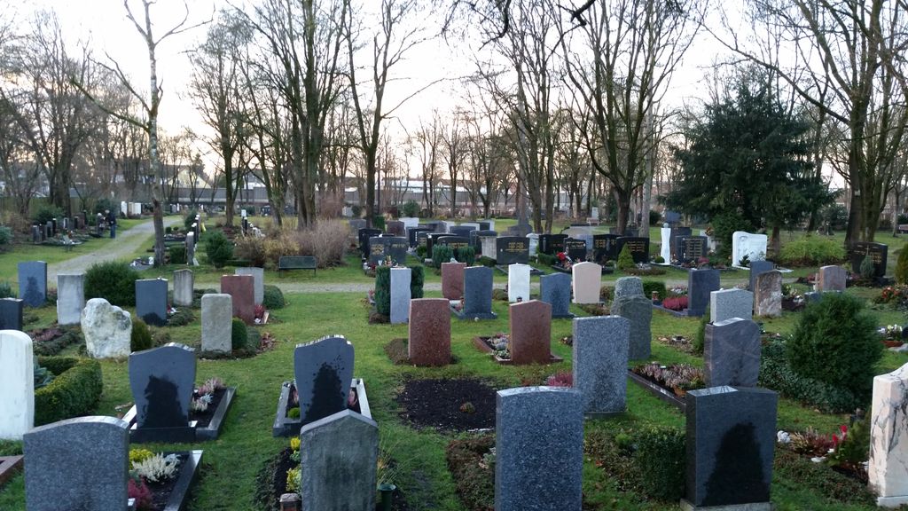
| Memorials | : | 0 |
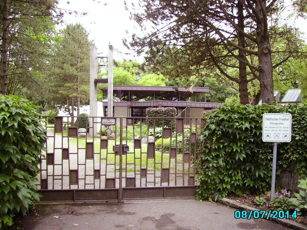
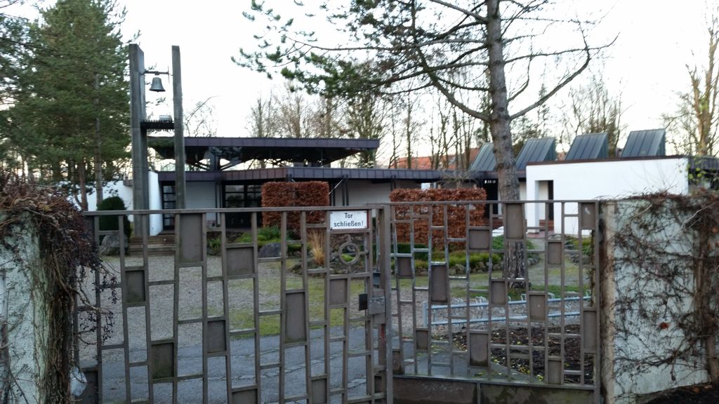
| Location | : | Garching bei München, Landkreis München, Germany |
| Coordinate | : | 48.2551400, 11.6549700 |
| Description | : | other cemeteries in the Country County of Munich (Landkreis München CScnty=4878): ► Cemeteries in the Munich Country County |
frequently asked questions (FAQ):
-
Where is Städtlicher Friedhof von Garching bei München?
Städtlicher Friedhof von Garching bei München is located at Römerhofweg Garching bei München, Landkreis München ,Bavaria (Bayern) , 85478Germany.
-
Städtlicher Friedhof von Garching bei München cemetery's updated grave count on graveviews.com?
0 memorials
-
Where are the coordinates of the Städtlicher Friedhof von Garching bei München?
Latitude: 48.2551400
Longitude: 11.6549700
Nearby Cemetories:
1. Friedhof St.-Katharina in Garching bei München
Garching bei München, Landkreis München, Germany
Coordinate: 48.2486400, 11.6517700
2. Kirchfriedhof St. Johannes
Eching, Landkreis Freising, Germany
Coordinate: 48.2808500, 11.6723300
3. Alter Friedhof Ismaning
Ismaning, Landkreis München, Germany
Coordinate: 48.2272500, 11.6792400
4. Friedhof Fröttmaning
Frottmaning, Stadtkreis München, Germany
Coordinate: 48.2177970, 11.6304040
5. Südfriedhof Eching
Eching, Landkreis Freising, Germany
Coordinate: 48.2906300, 11.6205500
6. Pfarrfriedhof St. Andreas
Eching, Landkreis Freising, Germany
Coordinate: 48.2976300, 11.6233300
7. Friedhof Eching
Eching, Landkreis Freising, Germany
Coordinate: 48.2998000, 11.6216600
8. Waldfriedhof Unterschleissheim
Unterschleissheim, Landkreis München, Germany
Coordinate: 48.2695880, 11.5761690
9. Parkfriedhof Unterföhring
Unterfohring, Landkreis München, Germany
Coordinate: 48.1996757, 11.6499731
10. Städtischer Friedhof an der Nelkenstraße
Unterschleissheim, Landkreis München, Germany
Coordinate: 48.2780200, 11.5776600
11. Gemeindefriedhof Neufahrn
Neufahrn bei Freising, Landkreis Freising, Germany
Coordinate: 48.3108300, 11.6696300
12. Oberschleissheim Churchyard
Oberschleissheim, Landkreis München, Germany
Coordinate: 48.2327500, 11.5768400
13. Kirchenfriedhof St. Wilgefortis
Neufahrn bei Freising, Landkreis Freising, Germany
Coordinate: 48.3115000, 11.6644800
14. Neufahrn Gemeindefriedhof
Neufahrn bei Freising, Landkreis Freising, Germany
Coordinate: 48.3111713, 11.6718575
15. Friedhof Oberschleißheim
Oberschleissheim, Landkreis München, Germany
Coordinate: 48.2326900, 11.5752000
16. Kirchlicher Friedhof der Pfarrei St. Ulrich
Unterschleissheim, Landkreis München, Germany
Coordinate: 48.2770100, 11.5678000
17. Kirchhof Sankt Valentin
Unterfohring, Landkreis München, Germany
Coordinate: 48.1925701, 11.6382245
18. Kirchhof Freimann
Freimann, Stadtkreis München, Germany
Coordinate: 48.1927360, 11.6162980
19. Kirchenfriedhof Mintraching
Mintraching, Landkreis Freising, Germany
Coordinate: 48.3196500, 11.6873200
20. Friedhof Mintraching
Mintraching, Landkreis Freising, Germany
Coordinate: 48.3220500, 11.6892600
21. Günzenhausener Friedhof
Gunzenhausen (Eching), Landkreis Freising, Germany
Coordinate: 48.3231100, 11.5995600
22. Inhausen Friedhof
Inhausen, Landkreis Dachau, Germany
Coordinate: 48.3035600, 11.5635000
23. Neuer Israelitischer Friedhof
Munich (München), Stadtkreis München, Germany
Coordinate: 48.1824270, 11.6025580
24. Kirchenfriedhof St. Stephanus
Fürholzen, Landkreis Freising, Germany
Coordinate: 48.3324100, 11.6165800