
| Memorials | : | 0 |
| Location | : | Hartlepool, Hartlepool Unitary Authority, England |
| Coordinate | : | 54.6761760, -1.2212850 |
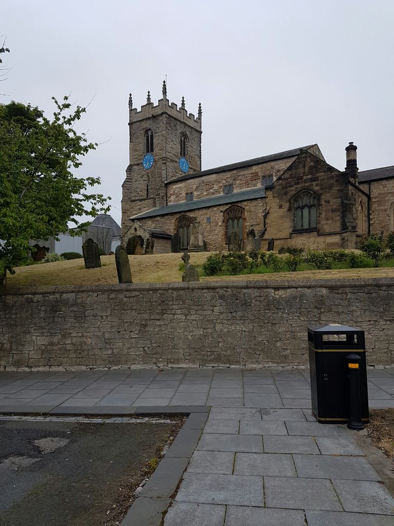
| Description | : | All Saints Cemetery is no longer acccepting burials. It was for the Old Parish Church for Stranton which in 1860 became West Hartlepool. Later in the 1970's, West Hartlepool was merged with Old Hartlepool and became Hartlepool. |
frequently asked questions (FAQ):
-
Where is Stranton All Saints Churchyard?
Stranton All Saints Churchyard is located at 34 Westbourne Road, Stranton Hartlepool, Hartlepool Unitary Authority ,County Durham , TS25 5REEngland.
-
Stranton All Saints Churchyard cemetery's updated grave count on graveviews.com?
0 memorials
-
Where are the coordinates of the Stranton All Saints Churchyard?
Latitude: 54.6761760
Longitude: -1.2212850
Nearby Cemetories:
1. Stranton Grange Cemetery and Crematorium
Hartlepool, Hartlepool Unitary Authority, England
Coordinate: 54.6679220, -1.2217610
2. North Cemetery
Hartlepool, Hartlepool Unitary Authority, England
Coordinate: 54.6916990, -1.2228890
3. Holy Trinity Churchyard
Seaton Carew, Hartlepool Unitary Authority, England
Coordinate: 54.6587490, -1.1888580
4. St Hilda Churchyard
Hartlepool, Hartlepool Unitary Authority, England
Coordinate: 54.6953770, -1.1818450
5. Spion Kop Municipal Cemetery
Hartlepool, Hartlepool Unitary Authority, England
Coordinate: 54.7068710, -1.2092690
6. Hartlepool Jewish Cemetery
Hartlepool, Hartlepool Unitary Authority, England
Coordinate: 54.7075320, -1.2116410
7. West View Cemetery
Hartlepool, Hartlepool Unitary Authority, England
Coordinate: 54.7082400, -1.2329800
8. Saint John the Baptist Churchyard
Greatham, Hartlepool Unitary Authority, England
Coordinate: 54.6402000, -1.2387000
9. Greatham Cemetery
Greatham, Hartlepool Unitary Authority, England
Coordinate: 54.6385300, -1.2351570
10. St Mary Magdalene Churchyard
Hart, Hartlepool Unitary Authority, England
Coordinate: 54.7087680, -1.2713930
11. St Peter's Churchyard
Elwick, Hartlepool Unitary Authority, England
Coordinate: 54.6813620, -1.2982740
12. Billingham Cemetery
Billingham, Stockton-on-Tees Unitary Authority, England
Coordinate: 54.6177010, -1.2650780
13. St. Peter's Churchyard
Wolviston, Stockton-on-Tees Unitary Authority, England
Coordinate: 54.6250820, -1.2977740
14. Blackhall Cemetery
Blackhall, Durham Unitary Authority, England
Coordinate: 54.7435640, -1.2841120
15. Hutton House Roman Catholic Burial Ground
Hutton Henry, Durham Unitary Authority, England
Coordinate: 54.7217300, -1.3337000
16. St Mary's Church
Monk Hesledon, Durham Unitary Authority, England
Coordinate: 54.7367130, -1.3154060
17. Monk Hesleden Cemetery
Monk Hesledon, Durham Unitary Authority, England
Coordinate: 54.7367750, -1.3156100
18. St John Haverton Hill Churchyard
Haverton Hill, Stockton-on-Tees Unitary Authority, England
Coordinate: 54.5961580, -1.2516480
19. Hutton Henry Cemetery
Hutton Henry, Durham Unitary Authority, England
Coordinate: 54.7171700, -1.3607100
20. St James Churchyard
Castle Eden, Durham Unitary Authority, England
Coordinate: 54.7392370, -1.3367390
21. St Cuthbert Churchyard
Billingham, Stockton-on-Tees Unitary Authority, England
Coordinate: 54.5941830, -1.2931180
22. St Hilda's Churchyard
Middlesbrough, Middlesbrough Unitary Authority, England
Coordinate: 54.5825036, -1.2335990
23. St. Mary the Virgin Churchyard
Norton, Stockton-on-Tees Unitary Authority, England
Coordinate: 54.5924790, -1.3163220
24. Christ Church Churchyard
Coatham, Redcar and Cleveland Unitary Authority, England
Coordinate: 54.6170000, -1.0806600