
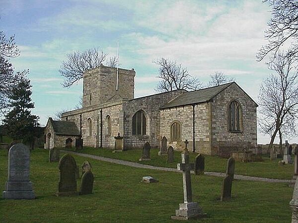
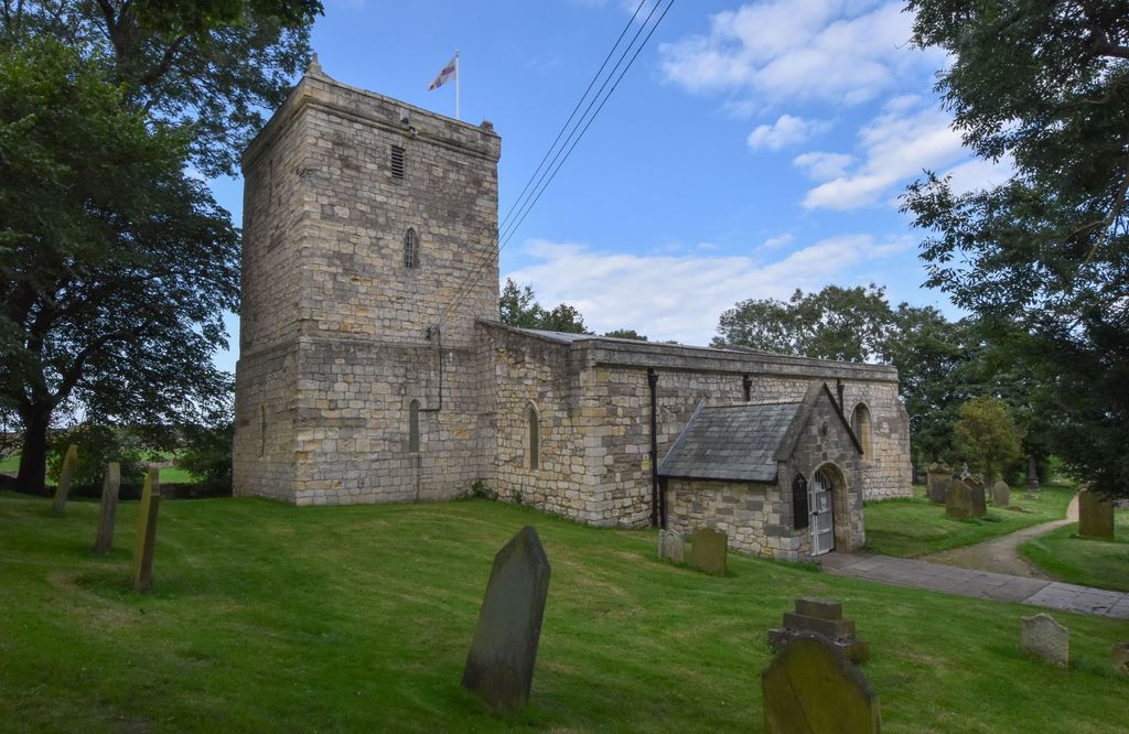
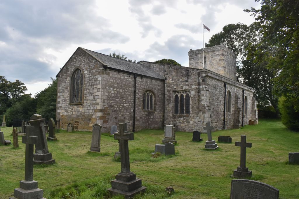
| Memorials | : | 0 |
| Location | : | Hart, Hartlepool Unitary Authority, England |
| Coordinate | : | 54.7087680, -1.2713930 |
frequently asked questions (FAQ):
-
Where is St Mary Magdalene Churchyard?
St Mary Magdalene Churchyard is located at Hart, Hartlepool Unitary Authority ,County Durham ,England.
-
St Mary Magdalene Churchyard cemetery's updated grave count on graveviews.com?
0 memorials
-
Where are the coordinates of the St Mary Magdalene Churchyard?
Latitude: 54.7087680
Longitude: -1.2713930
Nearby Cemetories:
1. West View Cemetery
Hartlepool, Hartlepool Unitary Authority, England
Coordinate: 54.7082400, -1.2329800
2. St Peter's Churchyard
Elwick, Hartlepool Unitary Authority, England
Coordinate: 54.6813620, -1.2982740
3. North Cemetery
Hartlepool, Hartlepool Unitary Authority, England
Coordinate: 54.6916990, -1.2228890
4. Hartlepool Jewish Cemetery
Hartlepool, Hartlepool Unitary Authority, England
Coordinate: 54.7075320, -1.2116410
5. Blackhall Cemetery
Blackhall, Durham Unitary Authority, England
Coordinate: 54.7435640, -1.2841120
6. Spion Kop Municipal Cemetery
Hartlepool, Hartlepool Unitary Authority, England
Coordinate: 54.7068710, -1.2092690
7. St Mary's Church
Monk Hesledon, Durham Unitary Authority, England
Coordinate: 54.7367130, -1.3154060
8. Monk Hesleden Cemetery
Monk Hesledon, Durham Unitary Authority, England
Coordinate: 54.7367750, -1.3156100
9. Hutton House Roman Catholic Burial Ground
Hutton Henry, Durham Unitary Authority, England
Coordinate: 54.7217300, -1.3337000
10. Stranton All Saints Churchyard
Hartlepool, Hartlepool Unitary Authority, England
Coordinate: 54.6761760, -1.2212850
11. St James Churchyard
Castle Eden, Durham Unitary Authority, England
Coordinate: 54.7392370, -1.3367390
12. Stranton Grange Cemetery and Crematorium
Hartlepool, Hartlepool Unitary Authority, England
Coordinate: 54.6679220, -1.2217610
13. Hutton Henry Cemetery
Hutton Henry, Durham Unitary Authority, England
Coordinate: 54.7171700, -1.3607100
14. St Hilda Churchyard
Hartlepool, Hartlepool Unitary Authority, England
Coordinate: 54.6953770, -1.1818450
15. St Mary's Churchyard
Horden, Durham Unitary Authority, England
Coordinate: 54.7629930, -1.3144310
16. Holy Trinity Churchyard
Seaton Carew, Hartlepool Unitary Authority, England
Coordinate: 54.6587490, -1.1888580
17. Saint John the Baptist Churchyard
Greatham, Hartlepool Unitary Authority, England
Coordinate: 54.6402000, -1.2387000
18. Greatham Cemetery
Greatham, Hartlepool Unitary Authority, England
Coordinate: 54.6385300, -1.2351570
19. Horden Cemetery
Horden, Durham Unitary Authority, England
Coordinate: 54.7735900, -1.3374800
20. St. Peter's Churchyard
Wolviston, Stockton-on-Tees Unitary Authority, England
Coordinate: 54.6250820, -1.2977740
21. Easington Colliery Cemetery
Easington Colliery, Durham Unitary Authority, England
Coordinate: 54.7892830, -1.3300550
22. St Saviour Churchyard
Shotton Colliery, Durham Unitary Authority, England
Coordinate: 54.7638950, -1.3891300
23. Easington Durham Lane Cemetery
Easington Village, Durham Unitary Authority, England
Coordinate: 54.7823800, -1.3601500
24. St Mary's Churchyard
Easington Village, Durham Unitary Authority, England
Coordinate: 54.7842000, -1.3573000