
| Memorials | : | 2 |
| Location | : | Selmer, McNairy County, USA |
| Coordinate | : | 35.1337900, -88.6791110 |
| Description | : | From the intersection of Sulphur Springs Rd. & US-64 E., west of Selmer, travel south on Sulphur Springs Rd. for 4.8 mi.; turning east (left) into the entrance driveway of the cemetery & the Sulphur Springs U.M. Church. |
frequently asked questions (FAQ):
-
Where is Sulphur Springs United Methodist Church Cemetery?
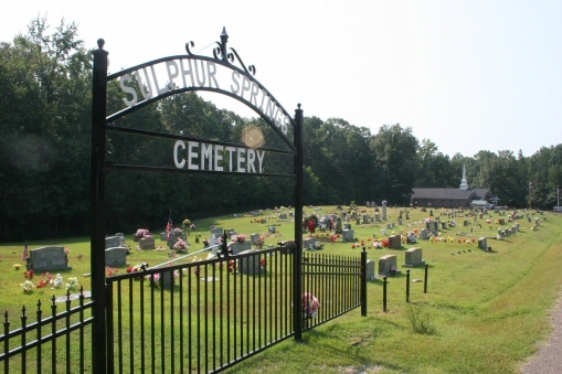
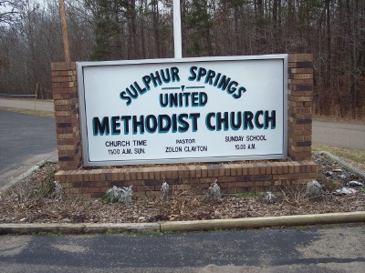
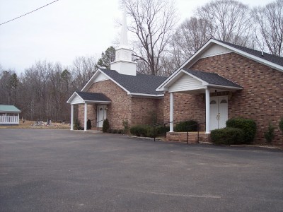
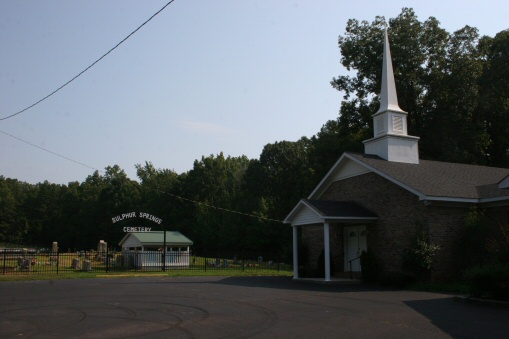
Sulphur Springs United Methodist Church Cemetery is located at 4879 Sulphur Springs Road Selmer, McNairy County ,Tennessee , 38375USA.
-
Sulphur Springs United Methodist Church Cemetery cemetery's updated grave count on graveviews.com?
2 memorials
-
Where are the coordinates of the Sulphur Springs United Methodist Church Cemetery?
Latitude: 35.1337900
Longitude: -88.6791110
Nearby Cemetories:
1. Dillon Family Cemetery
Selmer, McNairy County, USA
Coordinate: 35.1184060, -88.6844460
2. Lock Family Cemetery
Selmer, McNairy County, USA
Coordinate: 35.1313100, -88.7128930
3. Wallace Cemetery
Selmer, McNairy County, USA
Coordinate: 35.1663889, -88.6836111
4. Nethery Cemetery
Ramer, McNairy County, USA
Coordinate: 35.0978012, -88.6964035
5. Carr Family Cemetery
Ramer, McNairy County, USA
Coordinate: 35.0963230, -88.6921770
6. Hunters Chapel Cemetery
Selmer, McNairy County, USA
Coordinate: 35.1633060, -88.7110830
7. Coleman Cemetery
Ramer, McNairy County, USA
Coordinate: 35.0943370, -88.6874210
8. Rose Creek Village Cemetery
Selmer, McNairy County, USA
Coordinate: 35.1804070, -88.7074970
9. Friendship Church Cemetery
Ramer, McNairy County, USA
Coordinate: 35.0994500, -88.6299730
10. Simpson-Wolfe Cemetery
Selmer, McNairy County, USA
Coordinate: 35.1644420, -88.6240660
11. McAlpin Cemetery
Ramer, McNairy County, USA
Coordinate: 35.0813330, -88.6455110
12. Antioch Cemetery
Ramer, McNairy County, USA
Coordinate: 35.0693180, -88.6705420
13. Mount Pleasant Church Cemetery
Rose Creek, McNairy County, USA
Coordinate: 35.1839790, -88.7295350
14. Chapel Hill Baptist Church Cemetery
McNairy County, USA
Coordinate: 35.1456090, -88.7599310
15. McCalips Chapel Cemetery
McNairy County, USA
Coordinate: 35.1586510, -88.7573380
16. Union Soldiers Grave
McNairy County, USA
Coordinate: 35.0752240, -88.7241290
17. Gooch Cemetery
McNairy County, USA
Coordinate: 35.1086006, -88.7585983
18. Lowrance Cemetery
Rose Creek, McNairy County, USA
Coordinate: 35.1832930, -88.7439180
19. Falcon Cemetery
Selmer, McNairy County, USA
Coordinate: 35.1420180, -88.5904980
20. Head Family Cemetery
McNairy County, USA
Coordinate: 35.0741640, -88.7324250
21. Moores Schoolhouse Church Cemetery
Bethel Springs, McNairy County, USA
Coordinate: 35.2078018, -88.6766968
22. Ramer Cemetery
Ramer, McNairy County, USA
Coordinate: 35.0772870, -88.6183260
23. White Oak Cemetery
Ramer, McNairy County, USA
Coordinate: 35.0562340, -88.6859940
24. Oak Hill Cemetery
Selmer, McNairy County, USA
Coordinate: 35.1785650, -88.6008290