
| Memorials | : | 1 |
| Location | : | Taylortown, Moore County, USA |
| Coordinate | : | 35.2119444, -79.4872222 |
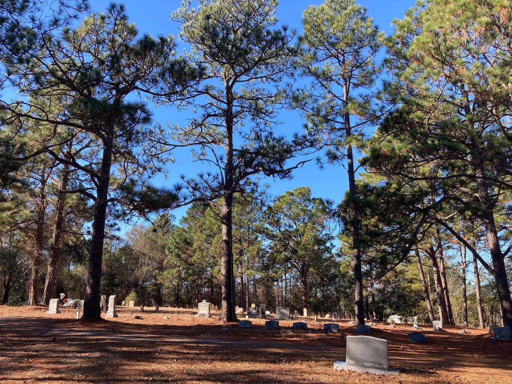
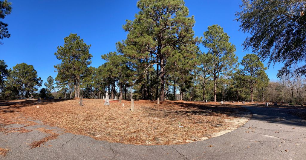
| Description | : | Taylortown Cemetery was also known as New Settlement in the early days. The Taylortown area of Pinehurst was also called Jimtown in the early years of the 20th century. Taylortown was incorporated as a town in 1987. There is no entrance sign for the African-American cemetery and is not visible from the street. It is located on Main St. in Taylortown across the street from the Gallilee Baptist Church. Its maintenance is fair, and about half of the markers are small metal markers where the names have eroded away. |
frequently asked questions (FAQ):
-
Where is Taylortown Community Cemetery?
Taylortown Community Cemetery is located at 192 Alston Drive Taylortown, Moore County ,North Carolina ,USA.
-
Taylortown Community Cemetery cemetery's updated grave count on graveviews.com?
1 memorials
-
Where are the coordinates of the Taylortown Community Cemetery?
Latitude: 35.2119444
Longitude: -79.4872222
Nearby Cemetories:
1. Galilee Missionary Baptist Church Cemetery
West End, Moore County, USA
Coordinate: 35.2122997, -79.4861824
2. Patterson Family Cemetery
Moore County, USA
Coordinate: 35.2083540, -79.4856550
3. Pinewild Cemetery
Pinehurst, Moore County, USA
Coordinate: 35.1993400, -79.4963500
4. Old Beulah Hill Church Cemetery
West End, Moore County, USA
Coordinate: 35.2227290, -79.5008470
5. Beulah Hill Baptist Church Cemetery
West End, Moore County, USA
Coordinate: 35.2222290, -79.5015564
6. Eastwood Community Cemetery
West End, Moore County, USA
Coordinate: 35.2412120, -79.4527430
7. Culdee Presbyterian Church Cemetery
West End, Moore County, USA
Coordinate: 35.2506660, -79.4689180
8. Saint Matthews Chapel Church Cemetery
Eastwood, Moore County, USA
Coordinate: 35.2451440, -79.4477820
9. Deep Creek Baptist Church Cemetery
Pinehurst, Moore County, USA
Coordinate: 35.1674850, -79.5037710
10. Cemetery No. 196: Willard Family Cemetery
Pinehurst, Moore County, USA
Coordinate: 35.1652832, -79.5007128
11. McDonalds Chapel Presbyterian Church Cemetery
Aberdeen, Moore County, USA
Coordinate: 35.1816940, -79.5461590
12. Pinelawn Memorial Park
Southern Pines, Moore County, USA
Coordinate: 35.1768300, -79.4251200
13. Kenneth Black Family Cemetery
Moore County, USA
Coordinate: 35.1684330, -79.4197490
14. Doubs Chapel United Methodist Church Cemetery
West End, Moore County, USA
Coordinate: 35.2835840, -79.4743410
15. West End Presbyterian Church Columbarium
West End, Moore County, USA
Coordinate: 35.2414110, -79.5701800
16. Faith Baptist Church Cemetery
West End, Moore County, USA
Coordinate: 35.2841492, -79.5079956
17. Mount Hope Cemetery
Southern Pines, Moore County, USA
Coordinate: 35.1697006, -79.4083023
18. West End Cemetery
West End, Moore County, USA
Coordinate: 35.2457700, -79.5723700
19. Fairview Baptist Church Cemetery
West End, Moore County, USA
Coordinate: 35.2903633, -79.4917068
20. Ingram Branch Presbyterian Church Cemetery
West End, Moore County, USA
Coordinate: 35.2900570, -79.4727800
21. West End Community Cemetery
West End, Moore County, USA
Coordinate: 35.2602780, -79.5652780
22. Victory Community Baptist Church Cemetery
Carthage, Moore County, USA
Coordinate: 35.2877820, -79.4522750
23. Bible Tabernacle Church Cemetery
Southern Pines, Moore County, USA
Coordinate: 35.2514610, -79.3984920
24. Woodlawn Cemetery
Southern Pines, Moore County, USA
Coordinate: 35.1845873, -79.3896530