
| Memorials | : | 0 |
| Location | : | Hertford, East Hertfordshire District, England |
| Phone | : | 01992 582109 |
| Website | : | parish.rcdow.org.uk/hertford/ |
| Coordinate | : | 51.7988966, -0.0745293 |
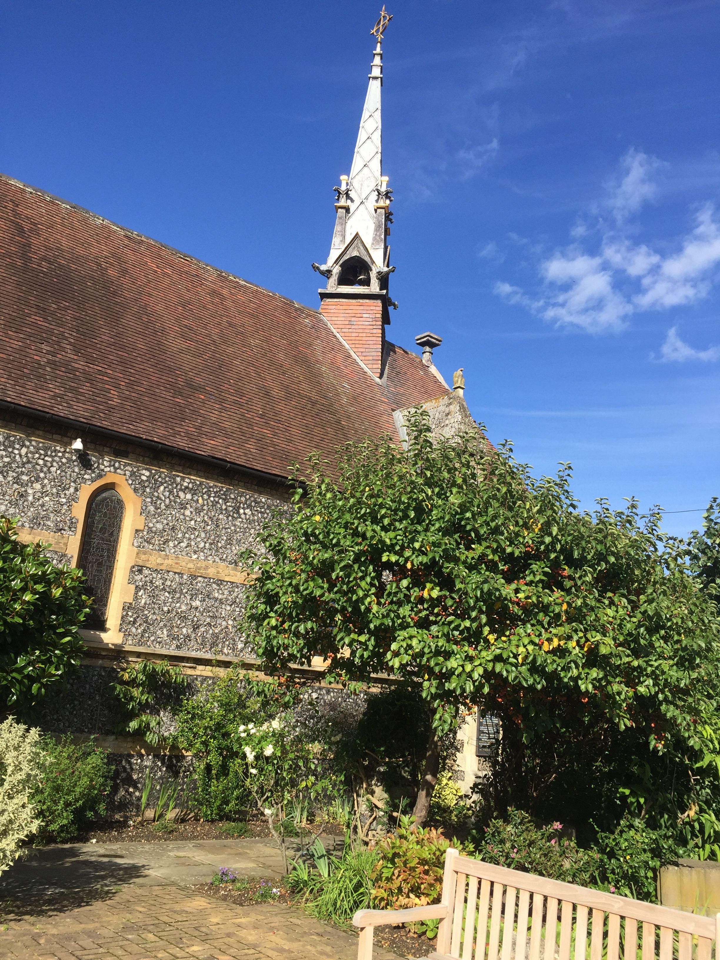
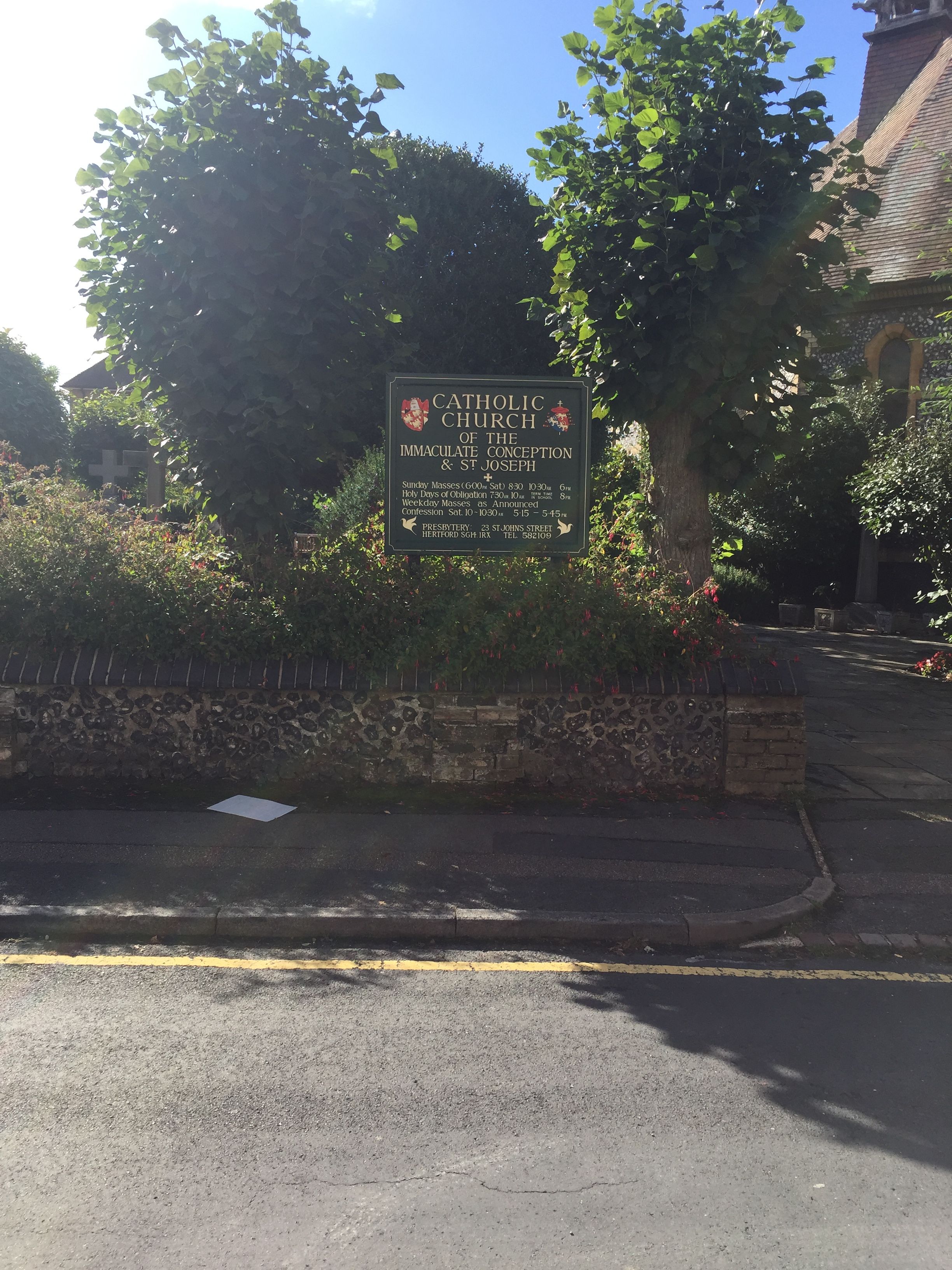
| Description | : | The present church of Our Lady and St Joseph was built in 1858 by Herbert later Cardinal Vaughan and consecrated on 16th October 1866 by Henry Cardinal Manning. It sits on the site of the much earlier Benedictine Priory of the Blessed Virgin Mary, founded in 1087 by Sir Ralph de Limesi, a nephew of William the Conqueror. It was destroyed on 9th February 1539 by King Henry VIII during the Reformation. |
frequently asked questions (FAQ):
-
Where is The Immaculate Conception and St Joseph?
The Immaculate Conception and St Joseph is located at 23 St John's Street, Hertford, Herts. Hertford, East Hertfordshire District ,Hertfordshire , SG14 1RXEngland.
-
The Immaculate Conception and St Joseph cemetery's updated grave count on graveviews.com?
0 memorials
-
Where are the coordinates of the The Immaculate Conception and St Joseph?
Latitude: 51.7988966
Longitude: -0.0745293
Nearby Cemetories:
1. All Saints with Saint John Churchyard
Hertford, East Hertfordshire District, England
Coordinate: 51.7950040, -0.0757330
2. Saint Andrew Churchyard
Hertford, East Hertfordshire District, England
Coordinate: 51.7960550, -0.0823520
3. St. Leonard's Churchyard
Bengeo, East Hertfordshire District, England
Coordinate: 51.8055165, -0.0722084
4. Holy Trinity Churchyard
Bengeo, East Hertfordshire District, England
Coordinate: 51.8053500, -0.0798610
5. St Andrews Cemetery
Hertford, East Hertfordshire District, England
Coordinate: 51.8026720, -0.0951500
6. Hertford Cemetery
Hertford, East Hertfordshire District, England
Coordinate: 51.8033280, -0.0979060
7. St Mary Churchyard
Hertingfordbury, East Hertfordshire District, England
Coordinate: 51.7919480, -0.1043700
8. St Michael and All Angels Churchyard
Waterford, East Hertfordshire District, England
Coordinate: 51.8152260, -0.0971940
9. Holy Trinity Churchyard
Hertford Heath, East Hertfordshire District, England
Coordinate: 51.7865300, -0.0433980
10. Ware Cemetery Old
Ware, East Hertfordshire District, England
Coordinate: 51.8170650, -0.0433230
11. Ware Cemetery New
Ware, East Hertfordshire District, England
Coordinate: 51.8181400, -0.0438590
12. Saint Mary's Churchyard
Ware, East Hertfordshire District, England
Coordinate: 51.8120500, -0.0331800
13. St John the Baptist Churchyard
Great Amwell, East Hertfordshire District, England
Coordinate: 51.7944320, -0.0123740
14. St Mary the Virgin Churchyard
Stapleford, East Hertfordshire District, England
Coordinate: 51.8349710, -0.0973140
15. Saint Mary
Bayford, East Hertfordshire District, England
Coordinate: 51.7629540, -0.1035070
16. St Andrew Church
Bramfield, East Hertfordshire District, England
Coordinate: 51.8241000, -0.1266000
17. Woollensbrook Crematorium
Hoddesdon, Broxbourne Borough, England
Coordinate: 51.7681805, -0.0280669
18. Hoddesdon Cemetery
Hoddesdon, Broxbourne Borough, England
Coordinate: 51.7711490, -0.0156822
19. St. Mary Parish Churchyard
Thundridge, East Hertfordshire District, England
Coordinate: 51.8366590, -0.0291820
20. St. Margaret's Parish Churchyard
Stanstead St Margarets, East Hertfordshire District, England
Coordinate: 51.7857570, -0.0002631
21. St Catherine and St Paul's Churchyard
Hoddesdon, Broxbourne Borough, England
Coordinate: 51.7625830, -0.0120670
22. Quaker Burial Ground, Hoddesdon, Hertfordshire
Hoddesdon, Broxbourne Borough, England
Coordinate: 51.7610213, -0.0139560
23. Thundridge Old Churchyard
Thundridge, East Hertfordshire District, England
Coordinate: 51.8378330, -0.0156530
24. St. Andrew's Churchyard
Little Berkhamsted, East Hertfordshire District, England
Coordinate: 51.7547390, -0.1295270