| Memorials | : | 5 |
| Location | : | Timblin, Jefferson County, USA |
| Coordinate | : | 40.9665620, -79.2057910 |
| Description | : | The land for this cemetery was donated in 1894 by Freeman Snyder for a church and cemetery for the use of the congregation of the Timblin Evangelical United Brethren Church. Source: Patricia M. Steele, October 2000, "Tombstones, Burials and Cemetery Histories of Jefferson County, PA", (Closson Press, Apollo, PA), pp. 164-165. Note: The Borough of Timblin was once known as New Petersburg. Old obituaries and death certificates will sometimes refer to the local cemetery as the "New Petersburg Cemetery". |
frequently asked questions (FAQ):
-
Where is Timblin United Methodist Cemetery?
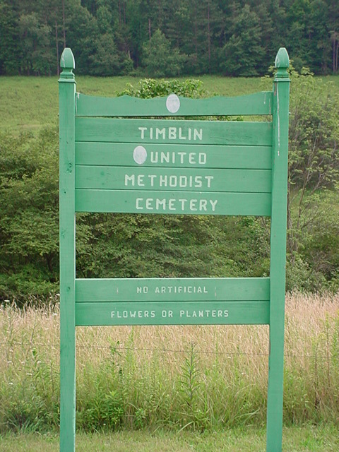
Timblin United Methodist Cemetery is located at Market Street Timblin, Jefferson County ,Pennsylvania , 15778USA.
-
Timblin United Methodist Cemetery cemetery's updated grave count on graveviews.com?
3 memorials
-
Where are the coordinates of the Timblin United Methodist Cemetery?
Latitude: 40.9665620
Longitude: -79.2057910
Nearby Cemetories:
1. Mount Tabor Cemetery
Mount Tabor, Armstrong County, USA
Coordinate: 40.9866390, -79.2178760
2. Saint James Lutheran Church Cemetery
Ringgold, Jefferson County, USA
Coordinate: 40.9864655, -79.1800613
3. Copenhaver Crossroads Cemetery
Mc Gregor, Armstrong County, USA
Coordinate: 40.9379463, -79.2207184
4. Dora Evangelical Cemetery
Dora, Jefferson County, USA
Coordinate: 40.9663887, -79.1618576
5. New Salem Cemetery
Armstrong County, USA
Coordinate: 40.9887733, -79.2424927
6. Ringgold United Methodist Church Cemetery
Ringgold, Jefferson County, USA
Coordinate: 40.9932137, -79.1680603
7. Fairview Cemetery
Porter, Jefferson County, USA
Coordinate: 40.9260941, -79.1888504
8. Shoffner Family Cemetery
Ringgold, Jefferson County, USA
Coordinate: 40.9785050, -79.1498420
9. Zion Cemetery
Porter, Jefferson County, USA
Coordinate: 40.9472000, -79.1424800
10. Mudlic Cemetery
Charlestown, Armstrong County, USA
Coordinate: 40.9798490, -79.2758420
11. Trinity Reformed Cemetery
Redbank Township, Armstrong County, USA
Coordinate: 41.0224700, -79.2152300
12. North Freedom United Methodist Church Cemetery
North Freedom, Jefferson County, USA
Coordinate: 41.0229073, -79.2080383
13. Milton Cemetery
Milton, Armstrong County, USA
Coordinate: 40.9086720, -79.2170050
14. Saint Mark's Lutheran Church Cemetery
Eddyville, Armstrong County, USA
Coordinate: 40.9414139, -79.2808609
15. Old Ebenezer Cemetery
Jefferson County, USA
Coordinate: 40.9846000, -79.1208600
16. Saint Johns Reformed UCC Cemetery
Jefferson County, USA
Coordinate: 40.9810000, -79.1180000
17. Emmanuel Evangelical Lutheran Cemetery
Redbank Township, Armstrong County, USA
Coordinate: 41.0177850, -79.2715500
18. Worthville Cemetery
Worthville, Jefferson County, USA
Coordinate: 41.0207062, -79.1404419
19. Langville United Methodist Cemetery
Jefferson County, USA
Coordinate: 41.0373000, -79.1763000
20. Minteer-McClatchy Burial Site
Worthville, Jefferson County, USA
Coordinate: 41.0291250, -79.1503140
21. Hawthorn Cemetery
Hawthorn, Clarion County, USA
Coordinate: 41.0225868, -79.2781982
22. Coleman Cemetery
Smicksburg, Indiana County, USA
Coordinate: 40.8890800, -79.1881600
23. McCreas Furnace Cemetery
McCrea Furnace, Armstrong County, USA
Coordinate: 40.9242060, -79.2952070
24. Mount Zion Cemetery
Oak Ridge, Armstrong County, USA
Coordinate: 40.9951553, -79.3060226


